Featured

Wood Buffalo National Park- Part I

A landscape awash in color and shaped by ancient waters, designated a World Heritage site for three important features.

A wood bison bull walks away from the camera, with yellow-leaved aspen and poplar trees lining the forest along which the large, dark brown animal walks.
The beleaguered wood bison was the initial trigger for planning a trip to Wood Buffalo National Park. But there is much, much more to see here! Photo ©Van der Vieren

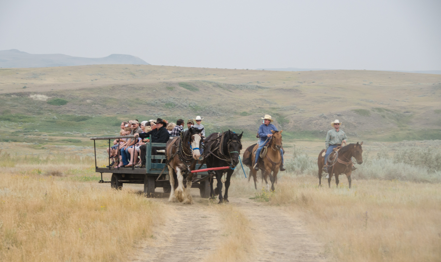
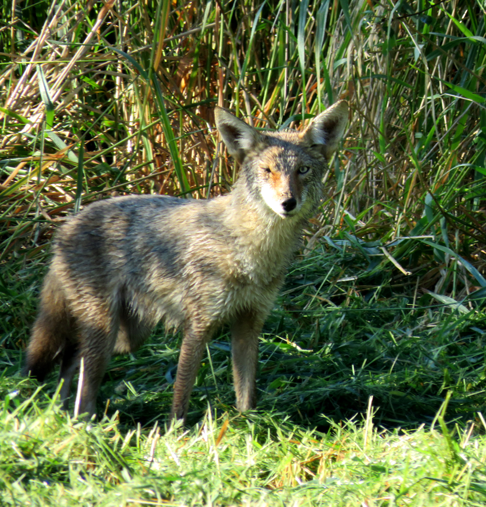
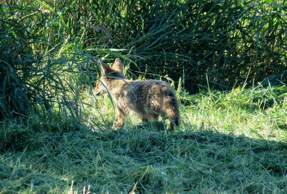
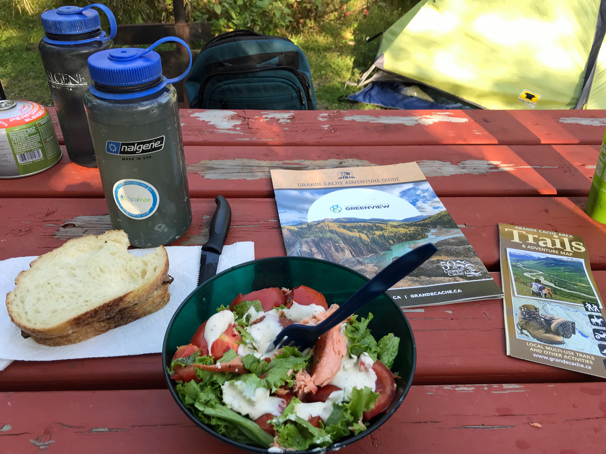
The world is made up of people who live to plan trips, and those who do not. I belong to the planners. I spend off-seasons charting routes on maps, researching places to stay, unearthing unique experiences, reading about wildlife and landscapes. There really is not an off-season, just in-between.

But the best part of travel is what we never plan. Surprises. Changes in perspective. Little gifts wrapped up with big bows.

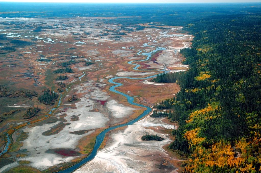
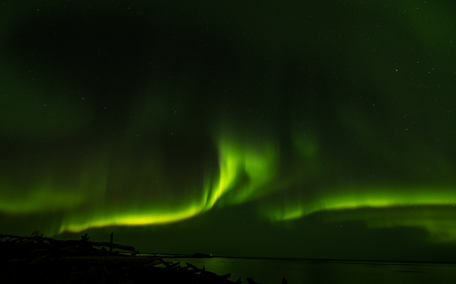
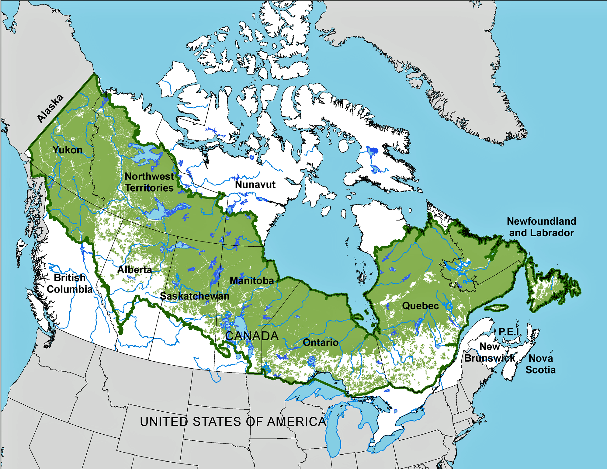
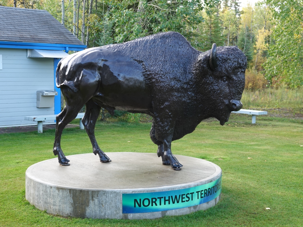
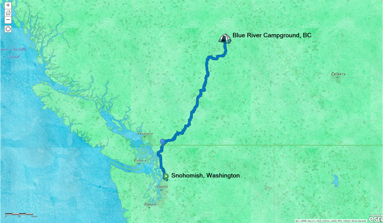
I reached Wood Buffalo National Park, the second largest national park in the world, only a week after I left home. This was the “trigger destination”- the reason for charting a road trip in the first place. By the time I reached it, I had so many unanticipated moments I might as well have been an astronaut wandering the moon. All those moments were created by water, some that flowed in ancient times, some flowing today.

Watercolor basemap, bright green and blue for water, showing a route from Hay River, NWT, to the Entrance of Wood Buffalo National Park, just north of the Alberta border.
The drive from Hay River to Fort Smith and the entrance to Wood Buffalo National Park. The drive winds in and out of the park on the way. The Parks Canada headquarters are in Forth Smith, NWT.

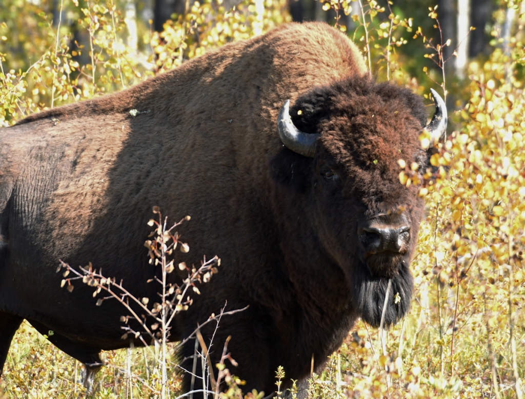
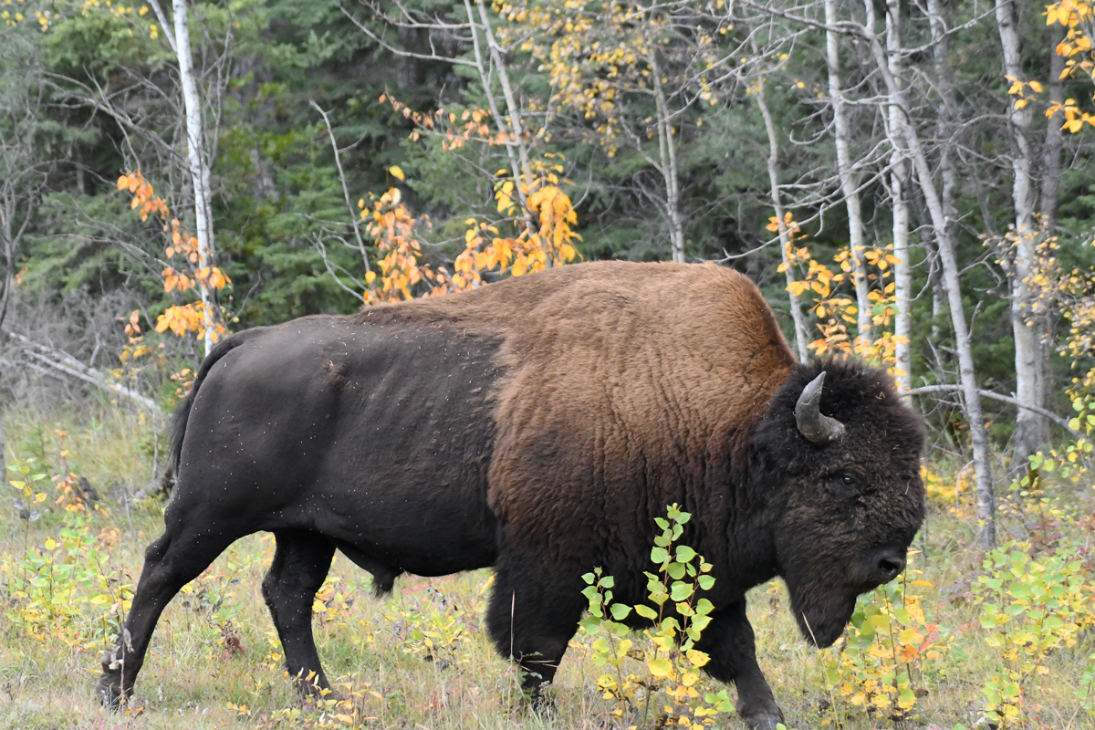
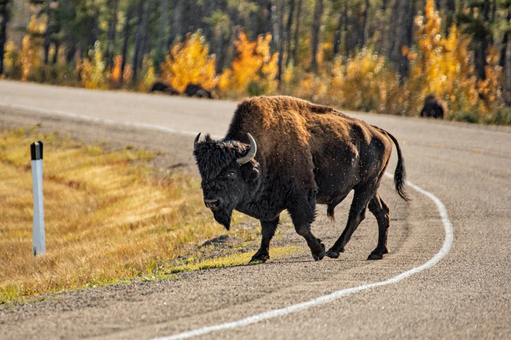
I traveled to the second largest national park in the world to see its namesake, the wood bison. This park is a World Heritage site for those bison, a dramatic landscape, and the last stand of an endangered species. Water is the creator and the life of this place.

Lands shaped by water

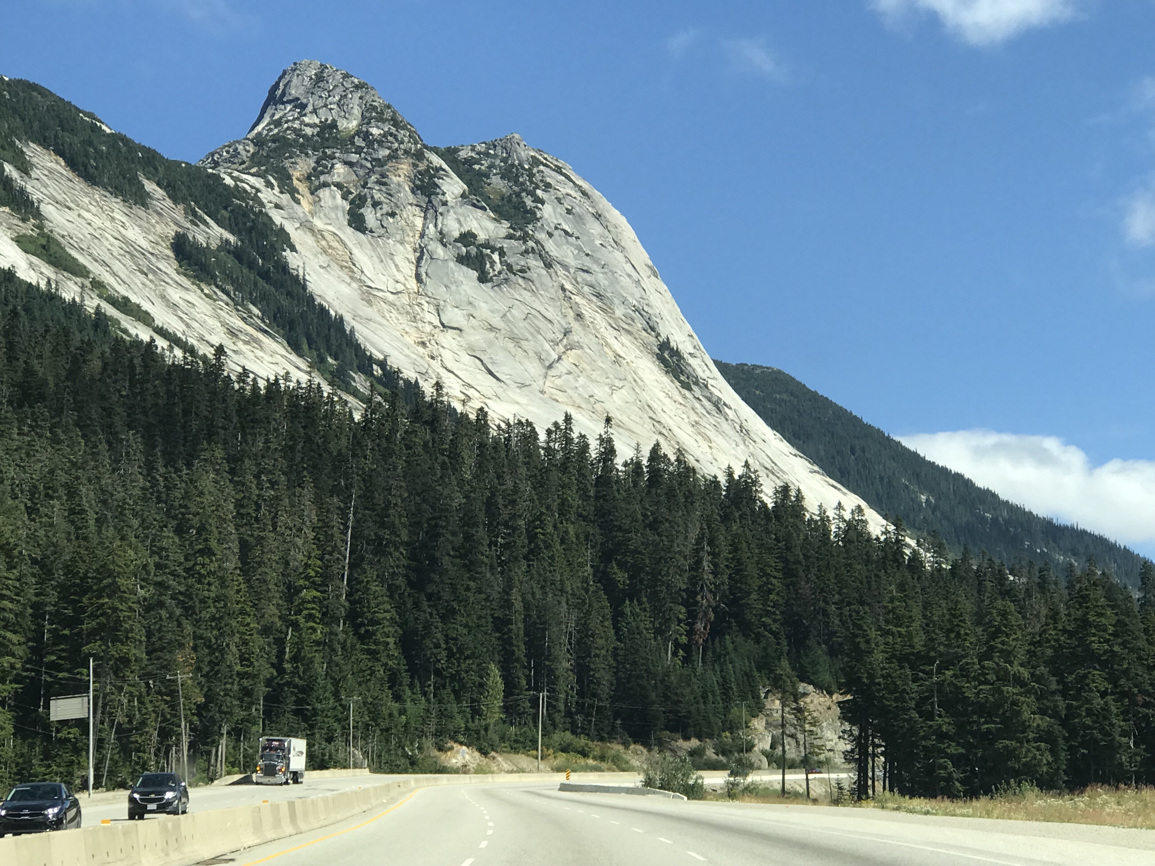
Water shaped much of North America for hundreds of millions of years. Whether liquid or ice, water left traces you can find across many different landscapes today. Beneath the surface, water still shapes some lands with unexpected and sometimes sudden results.

Laurentia, or the North American Craton, is a chunk of earth’s crust that has been around in one form or another for billions of years. As it crashed into other chunks of crust traveling from South Pole toward the north, Laurentia was pushed downward and covered with ancient seas. Seaways alternated with ice sheets to cover the land with water in one form or another.

A colored map of North America, with the North American Craton on roughly east of the Rockies and south into the coastal plain.
The North American Craton -a chunk of crust that has been moving around the planet hobnobbing with other chunks of crust for billions of years. United States Geological Survey, public domain.

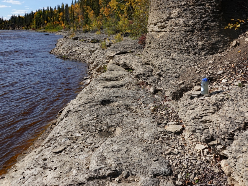
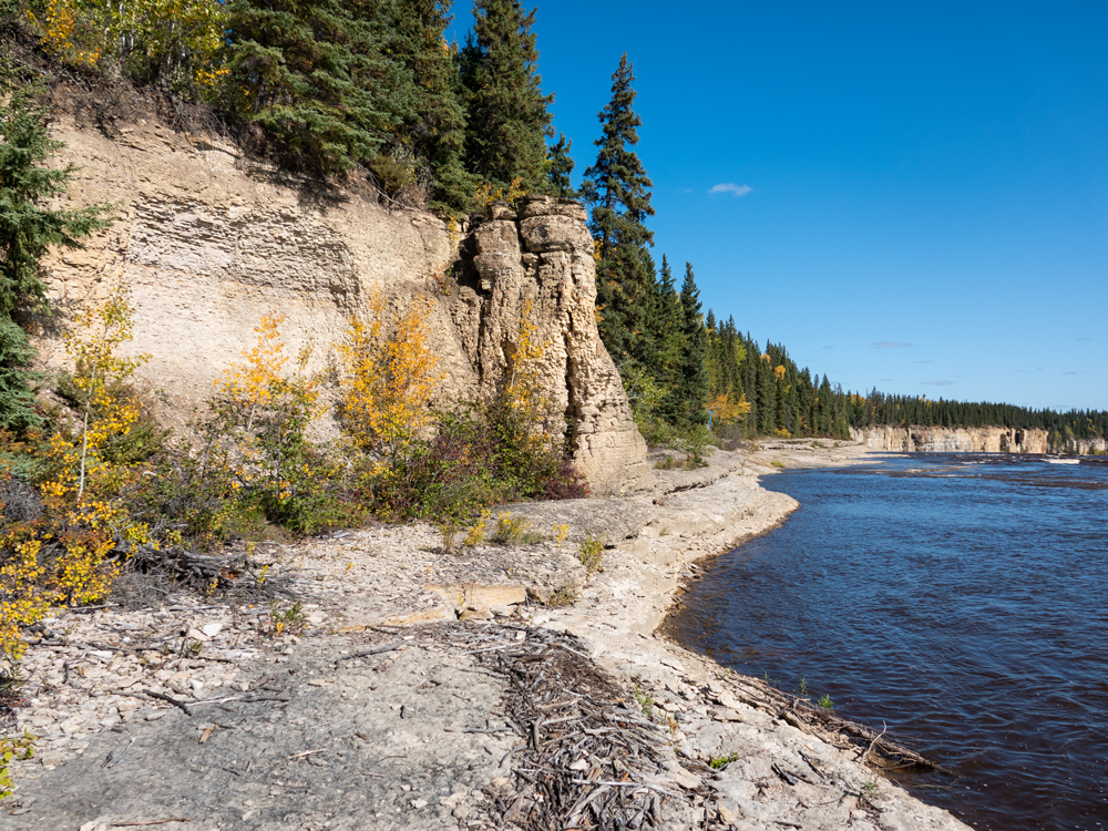
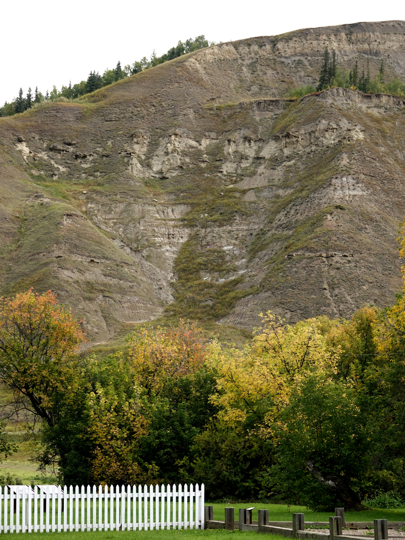
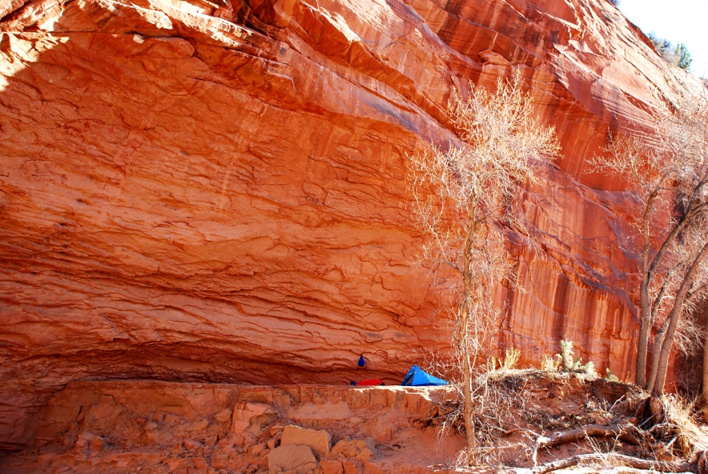
This watery history left its mark. Wood Buffalo National Park features karst topography, composed of gypsum, limestone, and dolomite: soft rock dissolved by water and sculpted into sinkholes, caves, hidden holes waiting to swallow the living.

Visual poetry describes karst landscapes. Cave flowers are not plants. There are cave blisters, hanging blades, half-blind valleys. Karst window, karst valley, cockpit karst, cone karst, syngenetic karst. This three-dimensional mosaic requires a montage of visual terms.

A circular water basin sits at the bottom of a deep funnel. The upper walls are tan with block lines running horizontally. Rocks and gravel cover the lower part, with some red, yellow, and green plants.
You can visit this massive sinkhole by the Angus Fire Tower pulloff. It is a collapse sinkhole, which occurs when water has been dissolving layer upon layer underneath and an unsupported ceiling finally falls in.

Karst landscapes hold that most precious resource for life: water. About 25% of the United States is karst landscape, and 20% of groundwater comes from karst reserves. People around the world depend on the fresh water running through undergound seams and pockets.

A map of the US and territories, showing karst formations that hold water. Florida is almost completely blue with karst formations.
From the Karst Waters Institute, whose mission is to “improve the fundamental understanding of karst water systems for professionals and the public”.

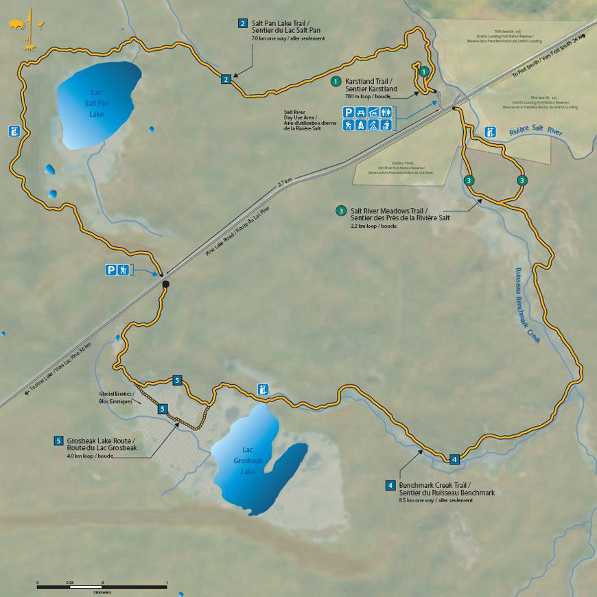
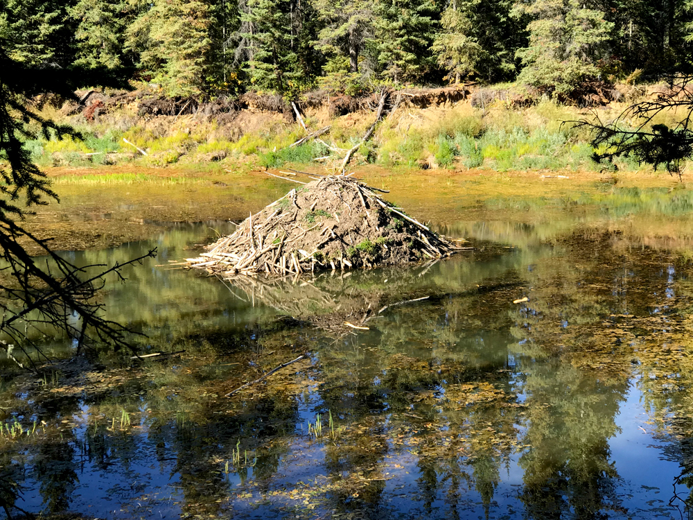
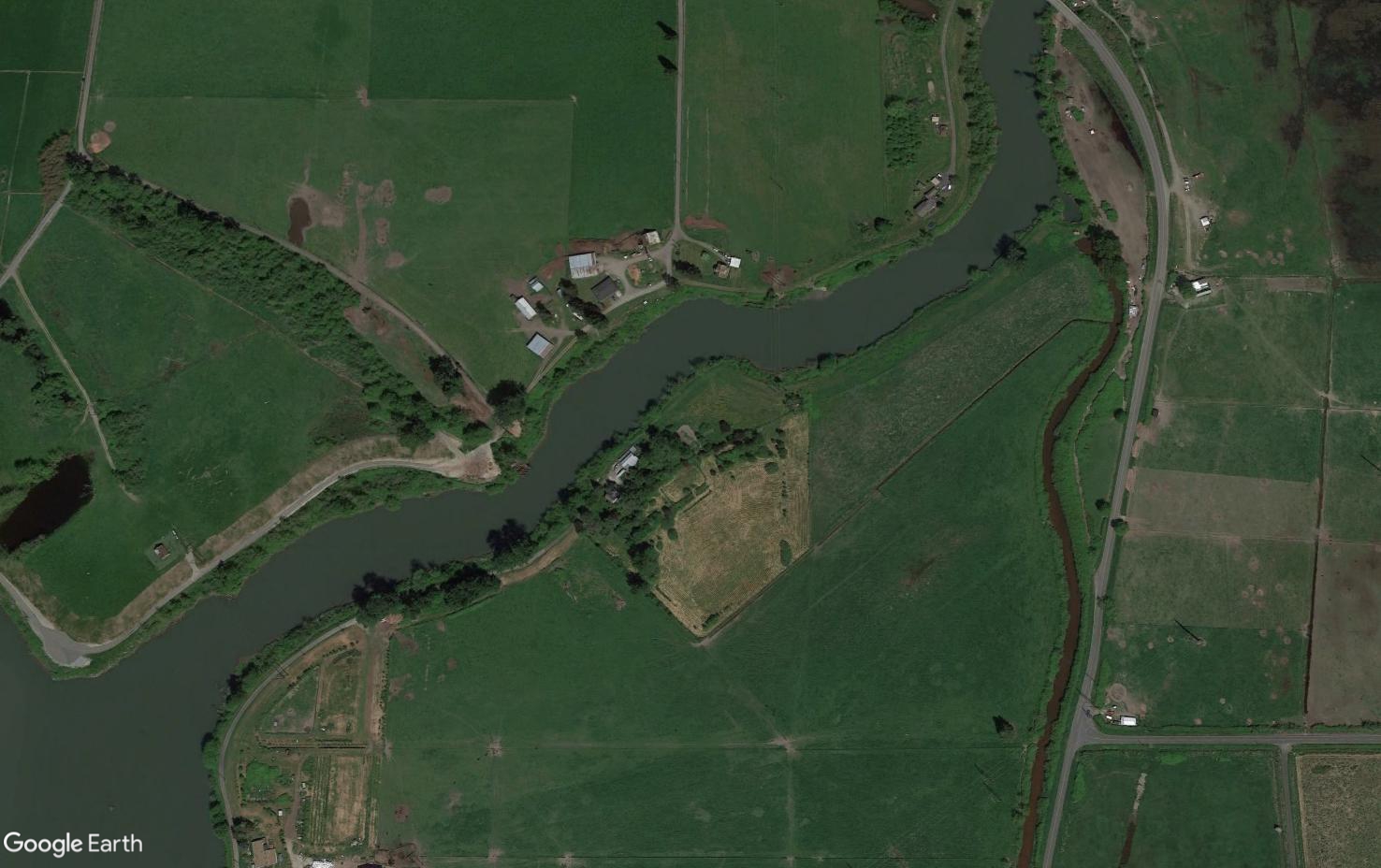
A karst landscape is dotted with water features. Pine Lake, where I stayed in Wood Buffalo National Park, is a uvula lake, comprised of multiple sinkholes that converged.

A view of a picnic table, firepit, and long Pine Lake over the grassy knoll outside my cabin. A bison bull grazes the knoll by a line of trees fringing the lake.
This view of Pine Lake is from the screened porch where I was eating dinner when a herd of bison ambled by to snack on the lawn. A bull is grazing in front of the yellow-leaved tree to the right in the background.

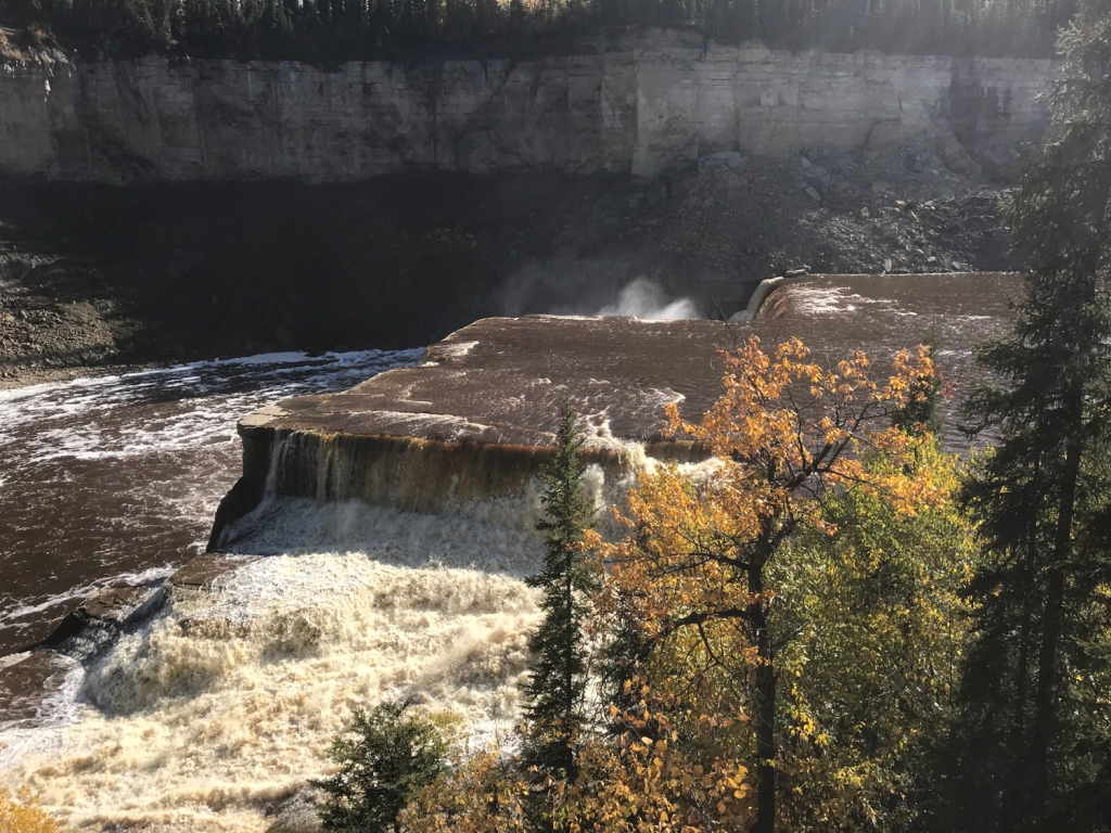
Karst landscapes are continually being reshaped. Surface and groundwater dissolves soluble rocks- limestone, gypsum, dolomite. The ground doesn’t dissolve in a planar fashion and just shrink like a collapsed souffle. Water worms its way through cracks underground, forming complex water systems. The Maligne River flows underground for 16 kilometers before it resurfaces in a canyon of the same name in Jasper National Park.

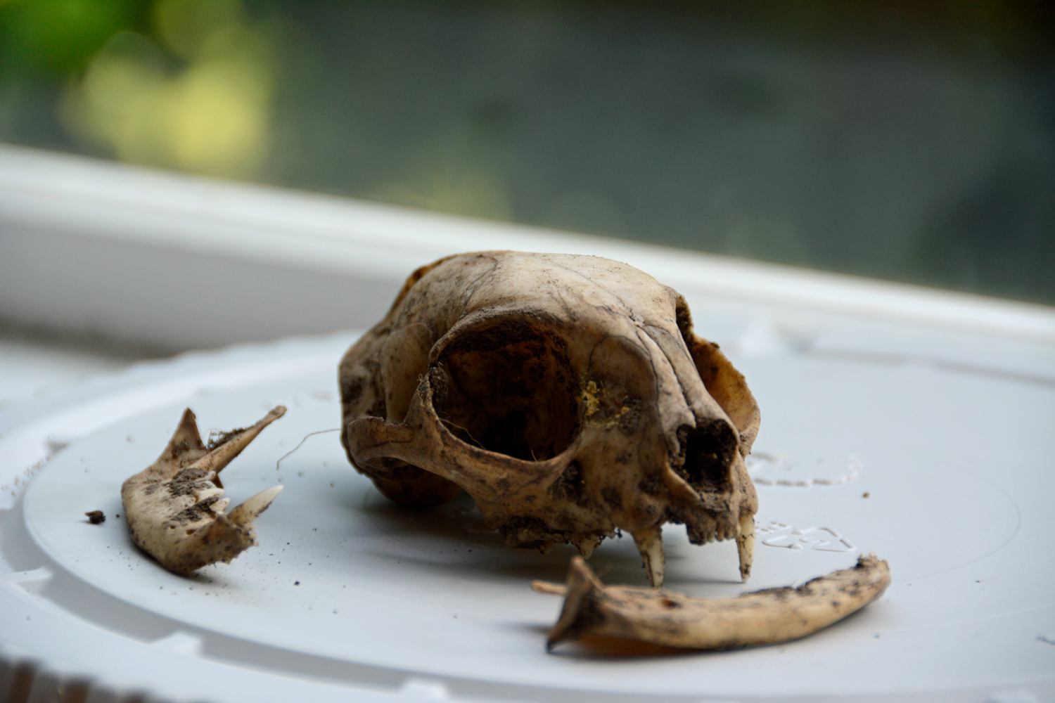
Karst features can form suddenly- and catastrophically. Collapse sinkholes can do just that, as the unsupported roof of an underground cave falls in. A sinkhole swallowed part of a house and sleeping resident in Florida. Libby Gunn, author of Thebacha Trails, describes the saga of a local resident whose dog suddenly disappeared into a 45-foot deep hole hidden under moss on the Rainbow Lakes trail in Wood Buffalo.

Fireweed and shrubs hang over a sinkhole where the trunks of fallen trees lay.
This sinkhole on the Karst Trail is one step off-trail- you can see the brown trail surface at the base of the red-leaved plant in the lower left. There was even a hole in the middle of trail here, and a sinkhole to the left!

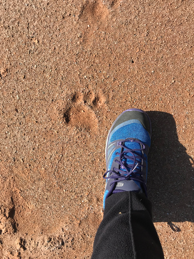
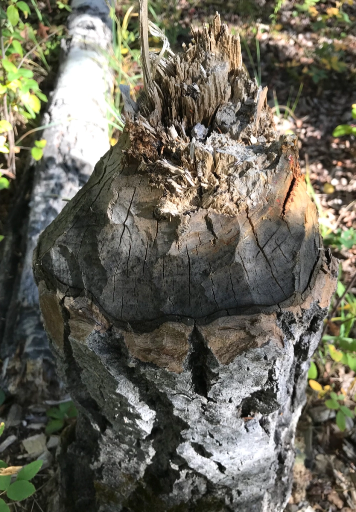
Hiking the trails in Wood Buffalo NP, I quickly found myself more afraid of the landscape than any animal. While the lure of caves may attract some, they are largely uncharted and very dangerous, according to Parks Canada cave expert Greg Horne.

A light colored wooden stairway with railing winds around a tree, letting the visitor walk to a river overlook from the top of a steep ledge.
Best to follow paths set by Parks Canada when traveling through karst country. This stairway helps you navigate the rolling landscape. In other places, you may see tape or arrows. Follow them!

I found that good ankle support was important hiking the Karstland Trail, and wished I had taken my heavier boots when I got inspired to hike the whole Salt Pan Lake/Meadows loop in one day. My ankles are pretty flexible after years of heavy use and injuries, but they were frankly sore in low hiking shoes that are usually just fine.

Parks Canada map showing the Salt Plains in tan, with Salt Pan Lake and Grosbeak Lake shown as blue circular forms.
This map can be found on Parks Canada’s Web and in hard copy from their office in Fort Smith- you can also get a more detailed topo map from GoTrekkers.

Salt Plains

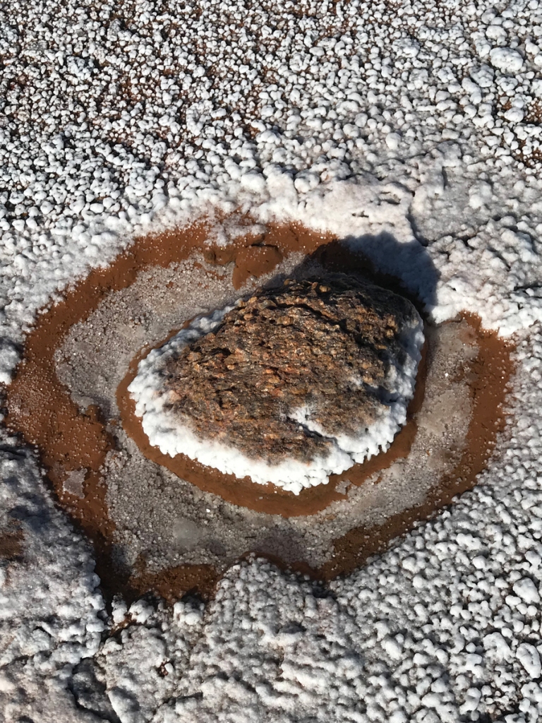
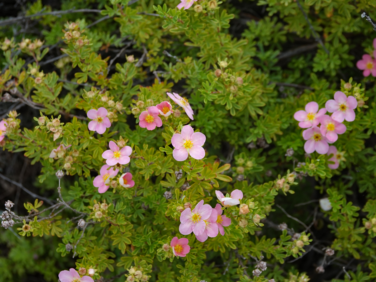
Ancient waters left life today a gift when they vanished about 270 million years ago. A vast North American seaway slowly evaporated, concentrating saline water in pools as it disappeared. Specialized plants live in the salt plains, painting them with color.

View of the Salt Plains, with a stream winding through flats that have white splotches, red blooms of salt plants, and a dark green and gold forest lining the right side.
Salt Plains Lookout Wood Buffalo National Park © J. McKinnon , Creative Commons 2.0 , link to photo in credits.

The salt from this ancient sea attracts life today- including people. The first peoples to live in North America harvested this salt. Commercial interests took over during the fur trade era. Today, the Salt Plains now attract wildlife and travelers who readily remove their shoes to roam barefoot across the surface.

Geometric salt blooms decorate clay red colored surface on the salt plains.
Salt creates art in blooms on the Salt Plains at Wood Buffalo National Park. Photo Monica Van der Vieren

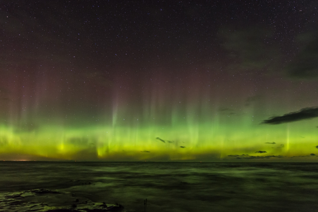
The area looks almost moon-like in places, with rocks covering the white surface. The salt eats at them, pitting some in almost coral patterns.

Dark rocks are randomly strewn across the whitish salt plain.
Rocks stranded on the Salt Plain give the area a moon-like appearance. Photo Monica Van der Vieren

Walking across the Salt Plains, you will wonder how things came to be what they are- was that hole once a cloven hoofprint? Or did a rock dissolve away? Or spirit away? This is a magical place to let your imagination wander.
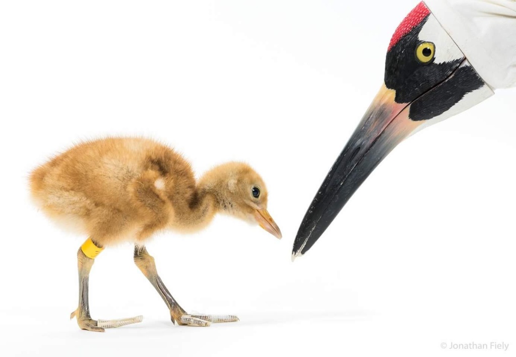
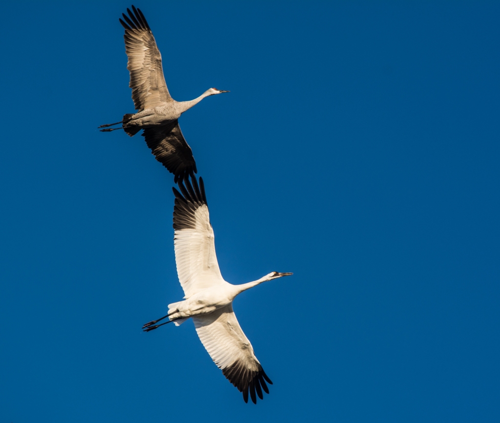
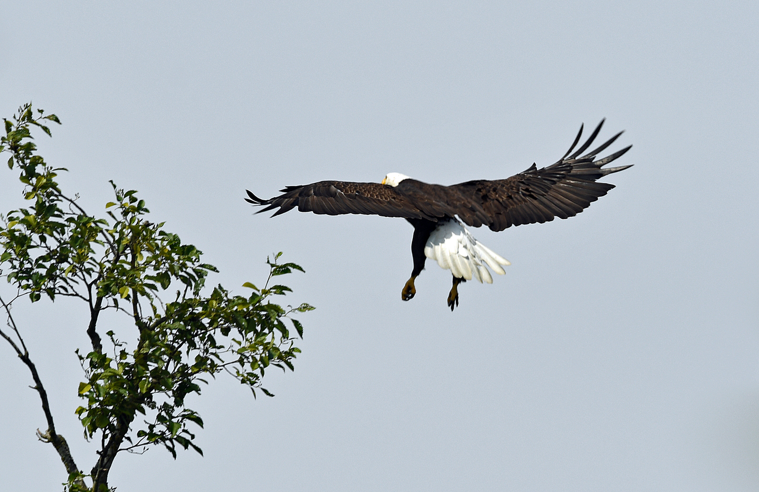
Whooping Cranes

Large white bird with red-capped head and black mask and wingtips, flying with wings outstretched and neck stooped for balance.
Whooping Crane in flight, John Noll, United States Department of Agriculture, Texas, U.S.A.

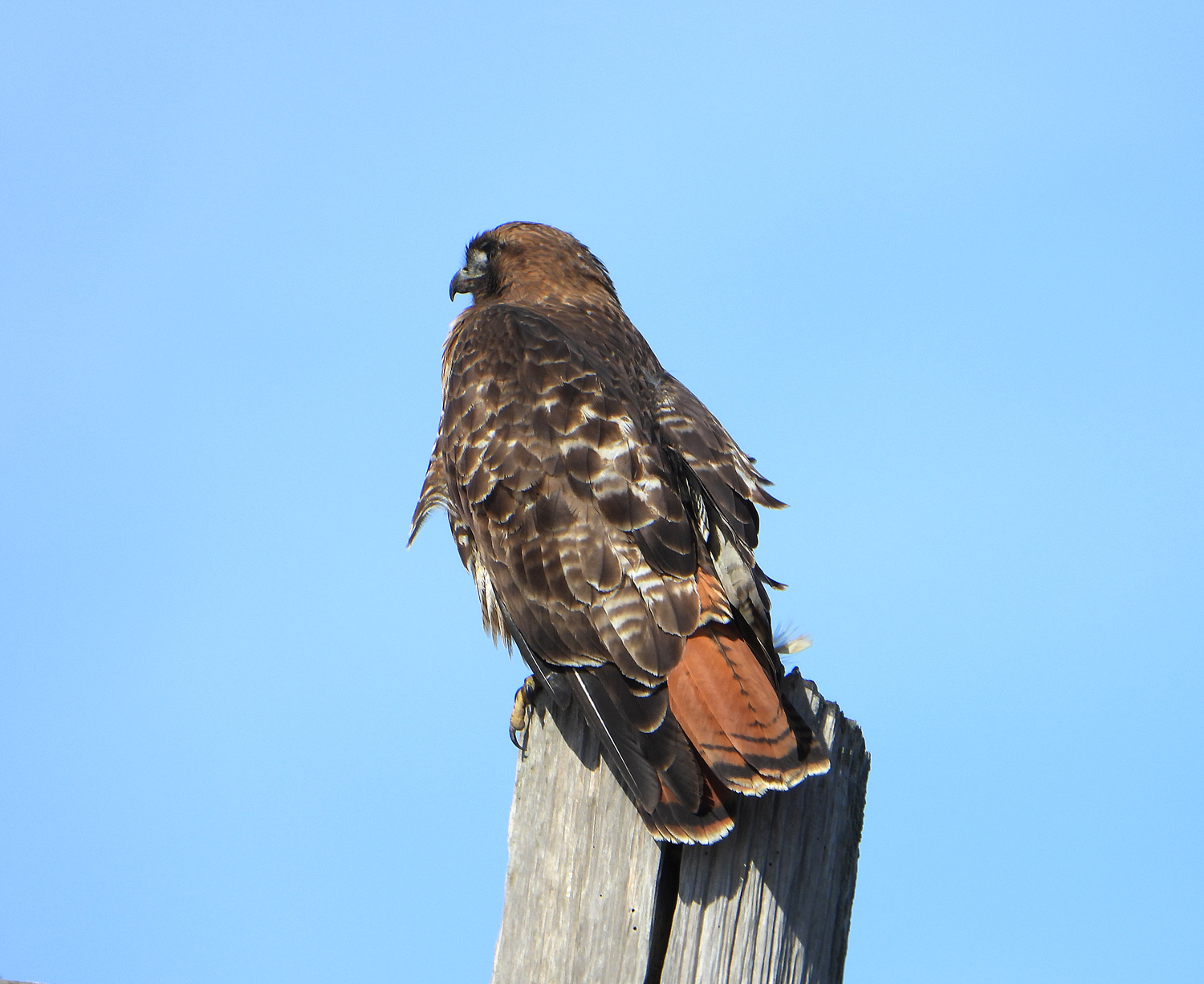
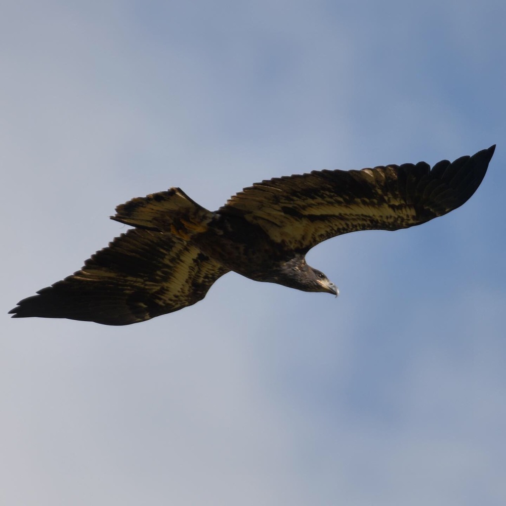
Whooping cranes contribute another element of World Heritage designation for Wood Buffalo National Park. The complex of wetlands provide the last natural nesting site for wild whooping cranes. These majestic cranes, which stand 4-5 feet tall, migrate from Aransas, Texas to wetlands in the Wood Buffalo area, where they can safely raise their young before flying south for the winter.

Map showing whopping crane migration route as a line extending from coastal Texas in the US to Wood Buffalo National Park.
Whooping crane migration route (map: Leandra N. Taylor) from Counting the Wild Whoopers, USFWS

The whooping crane remains critically endangered, and could easily disappear forever. Never a huge population, there were an estimated 10,000 whooping cranes flying over North America when European settlers arrived. Hunting, agriculture, and other human activities reduced the population to 60 by 1976.

Old postage stamp in "woven" style showing two whooping crane adults taking care of two chicks.
Charles R. Chickering (1891–1970) [Public domain]

At that time, ornithologist George Archibald took a fresh and innovative approach to captive breeding of endangered cranes: he became a crane “husband”. Challenges didn’t end there: saving the first viable egg and resulting chick, named Gee Whiz, took heroic effort. Watch George talk about the pioneering work that changed whooping crane conservation efforts, courtesy of the International Crane Foundation:

In partnership with the U.S. government, ICF’s work has helped the whooping crane recover to about 826 birds today. The future of these birds is not guaranteed: they are threatened by impacts to their breeding grounds from hydroelectric projects in the Peace-Athabasca delta, illegal shootings, sea level rise, and predation from bobcats flourishing after humans decimated the Florida panther and red wolf.

Photo of a whooping crane puppet head feeding a little orange-brown chick wearing a leg band.
Whooping crane hand puppet feeding a chick. Credit: Jonathan Fiely, USGS Patuxent Wildlife Research Center. Public domain.

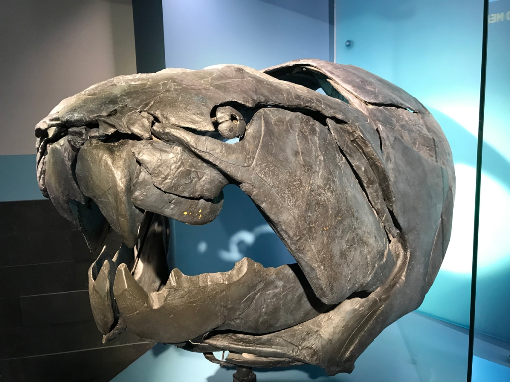
When you drive through Fort Smith, do visit the Northern Life Museum. Never a weeper, I teared up when I entered, only to be greeted by Canus, an iconic whooping crane survivor. Canus was rescued in an unprecedented international effort in 1964.

Photo of a whooping crane mount (stuffed bird) standing in a glass case and looking out at the viewer, head facing left.
Canus, an iconic whooping crane, has returned home to greet visitors at the Northern Life Museum in Fort Smith, NWT.

Canus was sighted during aerial surveys at Wood Buffalo with an injured wing and embedded piece of charred wood, likely the result of hitting a burnt tree during flight practice. He was captured and brought to Patuxent Wildlife Research Center. Despite a few more rounds of bad luck, Canus lived to 39 and became the sire/grandsire of 186 chicks.

After Canus’ passing, his stuffed body was returned to his birthplace. He now greets visitors in a whooping crane display at the Northern Life Museum and Cultural Centre in Fort Smith. Where he brings tears to the eyes of people like me, who never want to see our natural heritage disappear.
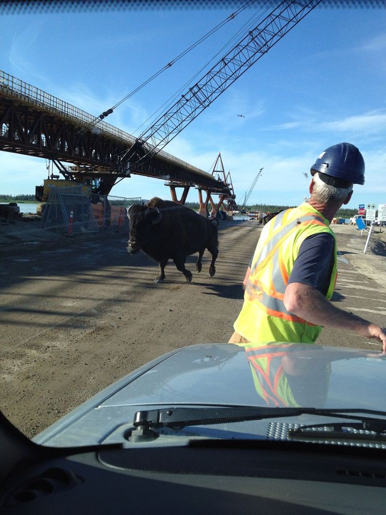
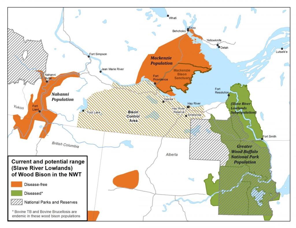
Photo of a whooping crane and sandhill crane from underneath, flying wingtip to wingtip with a deep blue sky in the background.
A whooping crane and smaller sandhill crane fly together over the Platte River in Nebraska, U.S. Photo Van der Vieren.

Wood Buffalo

I will talk more about the beleaguered Wood Buffalo in other posts, and I’ve added their history to this Story Map. This iconic animal, the namesake of the National Park and World Heritage site, was the reason for my travel and will be the reason I return again (pandemic allowing).

Photo of a wood bison bull walking right through grass with aspen starts.
Photo ©Van der Vieren.

I’ll close this chapter with a video from Pierre-Emmanuel Chaillon, a brilliant photographer and videographer, and resident of Fort Smith. Mr. Chaillon notes that drone footage was acquired under a permit from Wood Buffalo National Park. More of Chaillon’s superb work can be found at http://www.pierreemmanuelchaillon.com/ .

References

A Glossary of Karst Terminology, compiled by Watson H. Monroe for the United States Department of Interior, 1899. https://pubs.usgs.gov/wsp/1899k/report.pdf

What is karst? And why is it important? https://karstwaters.org/educational-resources/what-is-karst-and-why-is-it-important/

A ‘Honking Big Cave in Canada’ Lures Geologist to its Mouth- New York Times https://www.nytimes.com/2018/12/08/science/canada-cave-british-columbia.html

Cave explorer takes stock of hidden holes in Wood Buffalo National Park, Northern Journal, March 31, 2014.

End of an Era-Our Deepest Gratitude to the Patuxent Wildlife Research Center, International Crane Foundation, March 2, 2018 https://www.savingcranes.org/end-of-an-era-our-deepest-gratitude-to-the-patuxent-wildlife-research-center/

Melinaguene [CC BY-SA 4.0 (https://creativecommons.org/licenses/by-sa/4.0)%5D

Ansgar Walk [CC BY-SA 2.5 (https://creativecommons.org/licenses/by-sa/2.5)%5D

Salt Plains Lookout, Wood Buffalo National Park, © J. McKinnon https://www.flickr.com/photos/iucnweb/9552353373/in/photostream/

Featured

An unexpected journey

It was supposed to be a straightforward adventure. And then my path turned to water and light, life and death, and deep time.

My best laid plans always leave room for surprise.

Bright green arms of the Aurora Borealis spread across the starry sky over Great Slave Lake.
The aurora borealis shimmering over Great Slave Lake, Northwest Territories.

It was supposed to be straightforward. I would take another road trip to a bison destination to gather blog and story map content. I would add to the project I sweated over for 18 months to publish– and then recovered from , letting it languish online for a year. My day job swelled with opportunity to innovate and lead. I suddenly found myself mentoring two college interns. I needed to divest myself of the whole Barbie Western Ranch kit after my last horse died. The country descended into surreal chaos. Too much going on to think, write, draw, communicate anything personal.

Cover image for a Story Map, with a title and buffalo staring out from the screen.
“On the Trail of the North American Buffalo” now lives on ArcGIS Living Atlas of the World.

This trip, I would take time to decompress. The interns would be back at school. I would spend more time traveling, four days driving to Northwest Territories and Wood Buffalo National Park and three weeks on the road. I meticulously penned the plan on a pre-flight wait in March. I scheduled the trip for September to avoid mosquitoes and crowds. I left an itinerary and emergency numbers with my sister, neighbors, coworkers, friends. I would check in regularly. All set.

But my journeys, no matter how strategically planned and defined in scope, always lead somewhere I don’t expect. This time, it was meant to be about wildlife, documenting travel tips, history, updating neglected blogs with new stories.

And then my path turned. The journey became all about water and light, the randomness of life and certainty of death, and deep time.

blue sky.
A golden eagle flies over the rich boreal forest of Northwest Territories.
A large wood buffalo bull walks among young aspen trees growing at the edge of the boreal forest.
A large wood buffalo bull walks among young aspens at the edge of the forest.

It will take me awhile and a few posts to unpack this journey. I packed not only my gear but also a strange and dangerous organism that dogged me all summer and almost won. I drove across a national border and turned off the news to ignore my country in historic chaos, anger, and agony. The unexpected changed my perspective at every stop.

I’m not superstitious, but I will always carry a small wooden square carved from an ancient tree, pressed into my hand by a Métis man who struck up a conversation with me. He insisted I take the square with me to ensure my survival and safe return to Canada in the future. He asked me to look up the real history of St Paul des Métis, where the tree once lived. He wanted me to share the story as far as I could. People needed to know the truth, he said.

At the time we spoke, I wasn’t sure I could do that. There might not be another trip. Ever. By that point in my travels, I felt overwhelmed, almost done in by a microscopic pathogen, and meaningless in the face of time. I wasn’t sure it mattered what happened to me. This was supposed to be a simple adventure and now I felt like a kayaker spilled into infinite rapids, grabbing a breath anytime I surfaced in the sunlight.

Then, after that conversation, the tide turned- suddenly, finally.

The sun rises over Great Slave Lake, on the shores of Hay River.

Here is the path I followed, a route that landed me in a place unimaginably old. Watch for updates as I set out on the road for my first destination: Blue River, British Columbia.

My journey from home to Wood Buffalo National Park, through the badlands of Alberta, and back home again.

Key:

  1. (A) Snohomish, Washington
  2. (B) Blue River, British Columbia
  3. (C) Saskatoon Island Provincial Park, Grande Prairie, Alberta
  4. (D) Sixtieth Parallel Territorial Park, Northwest Territories
  5. (E) Hay River, Northwest Territories
  6. (F) Peace Point, Wood Buffalo National Park, Alberta
  7. (G) High Level, Alberta
  8. (H) Elk Island National Park, Alberta
  9. (I) Drumheller, Alberta
  10. (J) Dinosaur Provincial Park, Alberta
  11. (K) Springy Point, Idaho
  12. (L) Home again!

Hay River Day 3: Exploring ancient waterways

Contemplating Deep Time and life as a chimera

Monday dawned clear, an invitation to explore. The sun rose on a chilly and serene morning as I walked the shores of Great Slave Lake. After a late night watching the aurora, rolling out of a warm sleeping bag to catch the sunrise seemed like a stretch. But I had planned a day following water. Strolling the beach by the campground with a cup of coffee and a camera seemed like a good start.

You have to stand on the shores of the Great Slave to feel its draw. North America’s deepest lake stretches across the horizon like the ocean, and back in time to the last ice age.

The beach by Hay River Campground curves, leading to a spit where seagulls nest. Morning light turned the sands to bronze.

An arc of lakes from Great Bear Lake to the Great Lakes tells the story of the Ice Age that started about 2.5 million years ago and ended only recently. The Laurentide Ice Sheet covered northeastern North America, millions of square miles (or kms) shaping the landscape. The Laurentide butted up against the “smaller” Cordilleran Ice Sheet that covered almost a million square miles in the west.

In the last glacial maximum, from about 95,000-20,000 years ago, the Laurentide Ice Sheet scraped the basins of North America’s various Great Lakes, including the Slave.

Jacques Descloitres, MODIS Land Rapid Response Team, NASA/GSFC [Public domain]

The western boundary is marked by a change in geology even today. The Ice Sheet scraped away the surface to some of the oldest known rocks on the earth’s surface, shown in shades of orange and red below (along the line that cuts the Great Slave Lake in two, if you are color vision-impaired).

https://pubs.usgs.gov/imap/i2781/i2781_c_med.pdf

Those surfaces include stromatolites from about Precambrian times 2.5 billion years ago. Stromatolites are rare, appearing in Western Australia and as fossils in a few other places, including Northwest Territories. They are evidence of the beginnings of life, rock-like mounds built by lime-secreting cyanobacteria and trapped sediment. If you are not appropriately grateful, know that cyanobacteria were the first organisms to create an atmosphere rich enough in oxygen to support life as we know it.

Artist Tim Bertelink depicts a time long ago when stromatolites formed. You see the moon much closer to the earth than it is today, and flaming space debris plummeting through the Earth’s thin atmosphere. Stromatolits are layered in the foreground and mounded in the water. Tim Bertelink [CC BY-SA 4.0 (https://creativecommons.org/licenses/by-sa/4.0)%5D

The Hay River Visitor Centre has a display of stromatolites that I will examine more closely on my return visit next year. This time, I barely registered that I stood on the floor of ancient tropical seas, transported back to Deep Time.

Lands west of Great Slave Lake feature relatively younger rock than Archean lands to the east. In exposed areas, the western surface is a modest 358-419 million years-ish, the remains of the Devonian period. This area is shown in blue on the geologic map above.

We call the Devonian period the Age of Fishes, when water covered the planet and complex reefs hosted diverse and sometimes monstrous-looking leviathans.

Dunkleosteus is renowned as the most fearsome of fishes, with armored plates and bone-mashing teeth. This fossil reconstruction shows the massive plates on its head and teeth.
Dunkleosteus is the most fearsome and legendary of Devonian fishes, armored and three times the size of a modern Great White Shark, with bone-crushing teeth. Photo from Royal Tyrell Museum, Van der Vieren.

I would discover evidence of other ancient fish at the Hay River Visitor Centre. The Visitor Centre is open during the week in off-season, so I had to skip it when I arrived on a Saturday. I’m going to tell you to plan your trip to arrive there first. You need to get local travel tips, history, and environmental issues from Peter Magill. You should peruse the exhibits and local artisan work for sale.

When a large family from Yellowknife came in to the Centre, I turned away from brochures and gifts to investigate exhibits. I discovered that the waterfall route I had visited on my Sunday drive held a giant secret.

Full disclosure: I stopped at the waterfalls on the route to Mackenzie Bison Sanctuary because they are a tourist attraction. I am not one of those people who finds spiritual serenity in falling water. Instead, I sit at waterfalls contemplating natural history, geological forces and hydraulics. I find them fascinating as a force of nature, not of spirit. I know that peoples from time immemorial see and hear more than I can. I’ve given up on the divine where waterfalls are concerned.

The waterfalls are well worth your visit no matter what you see in them. In mid-September, I had them to myself. Perhaps because I wasn’t feeling well, I enjoyed just sitting in the warm sun and watching water flow over rock shelves sculpted by ancient ice. Lady Evelyn Falls was perhaps the loveliest of the three with a gentle arc sweeping from bank to bank. Alexandra was the most dramatic. Louise Falls featured the most interesting formation, a shelf of blocks.

What I missed during my Sunday waterfall drop-ins were fossilized trackways from Sarcopterygians, the first fish to set lobed fin on land.

This exhibit in the Hay River Visitor Centre shows a fossil trackway upstream from Alexandra Falls.

Casts of individual tracks sit on the floor. I knelt down and felt them with my fingertips. I imagined a massive lobe-finned fish, the first tetrapod, hauling its huge body from a drying pool and moving slowly across the land to find more water.

Of course, I had to go and see the trackway. I now felt well enough to make the hike between Alexandra and Louise Falls. I could make it a day. I had food for lunch in the car. After talking with Peter awhile and buying local gifts for friends, I headed out.

Alexandra Falls is easy to reach from the road. There is a parking lot I walked the trail to the river, but instead of turning downstream to the falls, I walked upstream. The bank and trackways erode every spring with battering by the Hay River. But the tracks from the display are still there. Further upstream I found more tracks, and fossil shells embedded in limestone.

I brushed fine debris from the depressions as I sat by the finprints drinking water-primordial, life-giving water. Water that beckoned fish to grow primordial hands and crawl onto the land.

I sat in the sun struggling to comprehend time. I always think of North America’s West Coast as young compared to the East, where old homes are a century older than my area. This all looks adolescent compared to parts of Europe, where crumbling stone tells of life a thousand years back. But this is age as measured by human occupation, not real time.

The Hay River cuts into rock laid down in Deep Time. View from river bank at Alexandra Falls, looking downstream.

The rock I sat on bore traces of fish that lived almost 400 million years ago. I felt like dust- or the dust mites that appear only under electron microscope. We are really nothing in the face of Deep Time. A throwaway moment in the history of life. We seem so large and loud and destructive- but we are meaningless and small on a geologic scale.

We are, in fact, a chimera of ancient life. I sat there with my mess of flawed DNA that includes junk sequences from earlier beings and ghosts left behind by viruses. My body hosts microscopic flora, early life forms. Friendly flora help me digest my food and protect me from pathogens. Animal studies say that I would die in a sterile environment.

I sat in the thin fall sunlight with my hands resting in those fossil tracks and simply dissolved. What it meant to be human, to be me, vanished in colored droplets rising with the mist from the falls.

This realization might frighten or depress some people. I was glad I didn’t have a travel companion at that point.

Personally, I found this liberating. Soothing. All those to-dos and must-dos, the fears and hurt and failures. All the small successes that seemed so hard won. The looming questions about becoming an old person with an irritable immune system in a country threatening to cancel health care.

Nothing mattered, not really. Not in Earth’s impassive regard. The sheer act of being alive and touching deep time at that moment was more than a miracle. I could live in this precious moment experiencing dissolution and absolution. I could relax.


There are living Sarcopterygians, remnants of Deep Time still swimming in today’s oceans. The coelacanth, a Lazarus fish thought to be extinct 66 million years ago, was rediscovered off the east coast of South Africa in 1938. I learned about these ghosts of an unimaginable time in grade school. I loved that the world was so much larger and older than me, that there were mysteries to be discovered in my fleeting time on earth.

I love that feeling still. That is why I travel to places like this. That is also why I will return- to feel small and amazed once again. Next time, I will add a visit to Sambaa Deh Falls Territorial Park, where ancient coral tumbles down the river from the falls.

This reconstruction shows a sarcopterygian propelling itself on the surface as it leaves the water. The massive lobed fins brace the upper body of the fish.

I walked the trail between Alexandra and Louise Falls and back, reading every interpretive sign along the way. The signs tell the journey of young Dene people on a portage past the barriers of the Twin Falls.

When you reach Tucho, the elders of all clans in the region will gather to hold ceremonies, celebrate, and give thanks. Every elder there will be called upon to use special healing gifts. There will be many new stories to tell and legends to retell to educate the young.

Interpretive sign, Twin Falls Gorge trail.

The restored portage trail is well-maintained and used heavily by modern life, including beavers, black bears, and likely other furtive creatures. A sturdy spiral stairway safely transports hikers from the trail to an overlook at Louise Falls. I have no idea how First Peoples made this trek, but I do know they would be more fit, agile, and adept at cross-country navigation than most of us modern folk.

I had one last night to spend at Hay River Territorial Park. One late night to brave the sneaky foxes and creep down to the beach to try my hand at photographing the aurora. The Northern Lights were softer, greener, and the light show more brief. I was still entranced. I had spent the day becoming so small and insignificant. I could be one of those atoms in the sky, struck by charged particles from the sun, emitting light on humanity as I calmed.


For an easy, fun look at Deep Time, watch this PBS video.

References

Spectacular NWT- 19 reasons to see Great Slave Lake. https://spectacularnwt.com/story/19-reasons-to-see-great-slave-lake-now

What causes the aurora borealis, by EarthSky. https://earthsky.org/earth/what-causes-the-aurora-borealis-or-northern-lights

Twin Falls Gorge Territorial Park and Waterfall Routes. https://www.nwtparks.ca/explore/waterfalls-route

Hay River to Mackenzie Bison Sanctuary

A troubled day watching wildlife on land and lights in the night sky.

A watercolor map shows Great Slave Lake in Blue on the upper right, with a blue route line from Hay River, on the shore, northwest to cross the Mackenzie River, and then across to the Bison Sanctuary.
I took advantage of a sick day to travel to a protected area for wood buffalo.

When you are a 4 day drive from home, it’s not a wise idea to become ill. I knew it was a possibility, and had really worried about the potential for decent medical care in a remote area. When I woke up sick on a Sunday morning, I knew I would need to get help that day. The bacterial infection that started with a tick bite in June was back with a vengeance. I sat feverish and in pain in a dark tent Googling medical care services by the glaring light of my cell phone. On a Sunday, my only option was Hay River Emergency.

I lay back waiting for dawn and wondering what would happen if they could not help me. Would I need to leave my car behind and take an emergency flight home? I felt foolish- why hadn’t I ditched my plans? Why didn’t I just stay home and hunker down? I thought of the coworker who sustained a strained back muscle just as her husband and kids left for a 2 week vacation in Glacier National Park. She stayed home in a dark house, miserable, to recover.

I need not have worried. The hospital was bright, up to date, and the staff friendly and professional. The doctor was as befuddled by my own when I showed him the lab results on the bacterium. They had not posted the sensitivity, so he did some research and guessed. They gave me antibiotic in the hospital and a prescription for more.

This photo shows yellow chairs and a grey couch in front of a window in a hospital exam room.
It’s an odd trip that includes photos of the emergency rooms and urgent care facilities you visited. If i had family or friends with, they could have accompanied me to this spacious exam room.

The bill came to $275 USD, which I could easily pay out of pocket. Most copays in the U.S. would be higher. I felt guilty as I watched a dark-skinned woman strolling and smoking outside, a bag and dripline peeking from under her jacket. She would have health care, I thought, but any extra expense would be a burden.

I needed to take it easy while the antibiotic kicked in, so I decided to drive to Mackenzie Bison Sanctuary. The sanctuary is a few hours’ travel toward Yellowknife, but scenic and lonely. It is best to fuel before going. I filled after crossing the Mackenzie River and paid dearly for it, more than I would at Hay River.

The Deh Cho Bridge rises above the river, a gentle arc with two braces that anchor stay cables supporting the span.
The Deh Cho Bridge, designed by Infinity Engineers, features two support structures for stay cables that support the structure.

The day turned to sun as I drove. I crossed the Deh Cho Bridge, spanning 1.1 km across the Mackenzie River. The bridge is a technically challenging and expensive infrastructure solution. The bridge project struggled through redesign, a bankrupt contractor, cost overruns for materials, and weather. Finally it opened in 2012, replacing a summer ferry and winter ice roads as a way across the Deh Cho River.

The river is a natural barrier for bison, and must remain that way to protect them, as you will see. This was apparently an unappealing idea to the bison during the bridge construction project.

Photo by snowceltdog [CC BY 3.0 (https://creativecommons.org/licenses/by/3.0)%5D

Bison grates prevent the animals from walking onto the bridge on either side. They can’t be prevented from swimming, and bison managers have observed bison tip-toeing across grates in the past. If nature and man-made barriers fail, there is always the high powered rifle.

This sign in English and French lets you know that you are driving into the Mackenzie Bison Sanctuary.

After the last Ice Age ended, about 11,700 years ago, bison had spread across habitable parts of North America. Bison evolved rapidly along with a changing climate. Ancient steppe bison gave rise to our modern bison and ultimately faded away. Plains bison were far more numerous than wood bison, though accurate population numbers will never be known.

If you see wood buffalo today, you are seeing ghosts. While all bison were decimated by overhunting during the development of the railroad, wood bison may have been lost to interbreeding. A seminal decision by managers of long-gone Buffalo National Park resulted in the transport of 6,600 plains bison to Wood Buffalo National Park. The animals hybridized and the plains bison transferred diseases from cattle into the Wood Buffalo herds.

Here is author Jennifer Brower talking about the park in a 2008 trailer by Athabasca University Press. Her book, Lost Tracks: Buffalo National Park, 1909-1939, is available from AUP as a book and free PDF download.

An apparently miraculous discovery of 200 isolated animals in WBNP mid-century led wildlife managers to hope that “pure” wood bison could be saved. Of 200 animals, only 23 survived the trip out of WBNP to establish the Mackenzie herd. The travails of transport and an anthrax outbreak decimated the herd.

Map of BC, Alberta, and Northwest Territories, showing diseased and disease free populations, with national parks and reserves marked.
This map shows the 2014 range of bison in northern BC and Alberta and Northwest Territories.

While some populations appear to be disease-free today, it is not clear whether they are genetically distinct enough to call “pure”.

The two bison bulls below are from Northwest Territories: the bison in the upper photo is from Mackenzie herd and the photo below shows a bull from Wood Buffalo National Park. Both have a forward thrust shoulder, abbreviated hair on their heads, and other features of wood bison.

But the bull on the top has indistinct pelage on its abdomen while the bull on bottom has more of a woolly “vest” and bare thermal window like plains bison. Both these bison were photographed within days of each other, so changing seasons doesn’t explain the difference.

Later I learned that the MacKenzie Sanctuary bison herds were subject to anthrax outbreaks in the same season that Wood Buffalo deaths hit the news. The animals tend to use the road verges to get away from insect-thick forests in the summer, and stricken animals died there. Wildlife officers were forced to burn the carcasses in the ditch to contain the spread to other animals.

Historic management practices may have muddied the genetic lines between woods and plains bison, but each has adaptations for different environments.

Great video talking about wood and plains bison in Canada.


Biomechanics may explain differences between wood and plains bison better than DNA at this point. Both wood and plains bison have a pronounced hump that allows them to forage in snow for food. But wood bison may not reach the speeds that plains bison needed to achieve to outrun long-gone predators. A woollier abdomen may protect wood bison from scraping by twigs or bites in the insect-rich boreal forest, while the plains bison’s bare thermal window may be critical to managing body temperature during hot prairie summers.


I saw no sign of wood buffalo on the way north, but instead, vari-colored forest and muskeg spinning by beneath a bright sky. I turned around in late afternoon, and woodland ghosts appeared.

First a few bulls emerged from the trees, then cows and a calf or two. Looking across stunted trees, I saw animals resting away from the road. With no traffic, I could stop and examine them through binoculars. They looked different from plains bison, with more abbreviated bouffs and steeper humps set farther forward. Were they really different? Did it really matter?

A wood buffalo bull walks across a curving highway, with golden leaved fall trees bright in sunlight behind it.

North America’s First Peoples viewed family and community in a more fluid way than settlers. Family units were not identified only by father’s name. Family consisted of a long list of ancestors on both sides of the family presented with their unique stories as part of a person’s introduction. People could become part of a community if they contributed to that community.

This animal looks very distinct from plains bison, with short hair mostly piled behind its horns, a steep rise to the forward hump behind, and a different shaped face.

Perhaps biological necessity fostered a more tolerant culture, perhaps. As smaller populations, they would need to maintain a fluid culture, welcoming outsiders to avoid inter-family reproduction.

From an indigenous perspective, a buffalo with combination of wood and plains bison genes is a buffalo. Even if the wood buffalo is an ecotype instead of a subspecies, it is a buffalo. But our endangered species laws carry Western European bias toward genetic purity, and a hybrid isn’t necessarily valued or protected. The more refined genetic analysis becomes, the more hair-splitting about genetic purity occurs.

A group of bison approach the camera, with a dark faced bull in the front.

I watched the wood buffalo move in a stately parade just like buffalo do, in a vastly different environment from their prairie cousins. Poplar and birch, tamarack and spruce- there was nothing like  grassy plains here. Their massive brown bodies carried a heavy history slowly into the woods, disappearing like ghosts bearing infinite knowledge of earth and sorrow.

At Mackenzie, the raven lives with bison just as on the plains. These long-lived, intelligent birds have a place in story for peoples of the north. Their lustrous black color is a result of being tricked by either ducks or owls. They have medicine power and wisdom, but can get mad when fooled. I imagined they were looking at me quizzically, wondering why on earth I traveled this far with an uncertain health status. But really, they may have been sizing me up for handouts.

A shiny black raven glances at the camera with its head tilted as if listening.

Nightfall offered another opportunity to try my hand at photographing the Northern lights. I felt better after downing a gallon of water and a couple of light meals. I ate soup for dinner and sat with a cup of cocoa and marshmallows at the picnic table at my site.

In the falling light, shadows flitted through the woods. Suddenly, a fox appeared across from me, standing on its hind legs with front paws on the table. It looked at me with a Picasso face: a face made of two triangles joined at the base above its eyes, with triangular ears and eyes.

Still staring intently at me, it dipped its nose into the marshmallows floating on my cocoa. I exclaimed in surprise, causing it to spring away from the table. A dab of marshmallow whitened its nose. It stood and slowly licked off the marshamallow on its nose for a moment. I thought it looked resentfully at me, but maybe I imagined that. It disappeared into the forest.

A sketch of a fox propped by its front feet on a picnic table, over a mug of steaming cocoa with marshmallows.
The fox was too stealthy and quick for a photo, so here is a sketch reconstructing the culprit at the scene of the crime.

I crawled into the tent, leaving my shoes outside under the fly. I set my phone alarm for 11, then tried my best to sleep. I pondered just turning off the alarm and getting some rest, but I had come this far hoping to see the northern lights once again. I could sleep tomorrow if need be.

A lime green and blue tent is tied down on a wooden platform among a stand of trees with white bark.
This tent pad was apparently set up in the fox patrol zone.

A rustle behind my head caught my attention. Then, a swift, light pounce and two paws landed on the tent and my head. I hollered and hit the tent wall.

I got up before the alarm, not rested, and went to pull my shoes on. I couldn’t find one shoe, so I shone a light across the site. The shoe lay on its side in the middle of the site.

Darn foxes.

Bundled in fleece and a parka, I walked to the beach in the dark and set up my gear. A group of people say by a fire nearby, and I could see the shadows of lone photographers on the dark beach.

I wasn’t very good at this the first time as I hadn’t anticipated the difficulty of focusing on manual wearing glasses that wanted to fog up. But the aurora worked with me, shimmering in green and purple and red. I experimented with shutter times, not sure of exposure, counting “one-one-thousand, two-one-thousand” under my breath.

Soft waves washed the shore. Fire snapped and cracked and murmuring voices floated from the dark forms huddled around the embers. The crisp air cooled my cheeks, unnaturally warmed by my body’s attempts to burn out the infection.

In the firelight, foxes skirted by, half watching for opportunity, a gap in surveillance. I heard a French accent say, “See, the foxes. They are here.” The photographer was walking past me in the dark. He waved at the lights, which had softened. “It is over,” he said. “The light show is done.”

A Japanese photographer I recognized from camp had just set up his tripod. He paused and looked at the sky over the lake.

I shrugged. “It’s still good practice,” I said. “The stars are out here. We never see them at home because of city lights.”

The Frenchman shrugged back and walked away with his gear.

After he left, the lights arced across the sky, reflected in the waters of the Great Slave Lake. The Japanese photographer and I stayed awhile. My photos displayed marginal focus over time, possibly due to fumbling with gloved hands in the dark.

A green light curtain extends upward and to the right in the photo.
I lost focus fussing with my camera over time, but really, it was all about the experience.

Since the forecasts for weather and aurora were good for the next night, I pulled up stakes and walked back to my campsite, rewarded for having at least tried.

When I returned to my tent, I pulled my shoes off a noticed a wet spot on my sock. Puzzled, I shone a flashlight in my shoe. I found flattened fox poop in the heel. The fecal pancake left a brown stain on my shoe liner when I dumped it out away from the tent. I carefully removed my socks, turning the stained spot inside, cleaned my foot, and put on a fresh pair for the night.

A blue Keen trail running shoe with the sole out sits on the wooden tent platform. The sole has a brown stain on the heel from fox poop.

The furred sprites had wreaked revenge on me. I was mad at them, but intrigued. Little mischievous magicians of the forest, they were still wild spirits despite obvious handouts. As I dropped off to sleep, I saw that face of triangles and diamond-sharp eyes staring at me over a cup of cocoa.

Darn foxes.

A fox steps across a gravel path with trees running alongside it.
A fox checks me quickly in passing to see if I’m offering a handout.

References

Bison Bellows: Plains and Wood Bison: What’s the Difference? National Park Service. https://www.nps.gov/articles/bison-bellows-2-25-16.htm

Genetic analyses of wild bison in Canada: implications for recovery and disease management. 2016, Journal of Mammalogy, Oxford University Press. https://academic.oup.com/jmammal/article/97/6/1525/2628020

Northwest Territories Species at Risk (map of wood bison populations): https://www.nwtspeciesatrisk.ca/species/wood-bison

Lost Tracks, Bower, Jennifer. Athabasca University Press, 2008, available online.

Chapter 4: Hay River, NWT, Day 1

I arrived at Hay River only to find a connection to another northern destination I visited not too long ago.

The next leg of my journey unexpectedly closed a loop on a trip I took to Baffin Island in 2015. The 2-hour run from 60th Parallel Territorial Park to Hay River made for a short driving day and an opportunity to explore. At Hay River, I found a place connected by water to the remote lands I trekked not too long ago.

Watercolor map of the route from the 60th Parallel to Hay River. Background is bright green and waters are washes of blue.
The short run from the 60th Parallel to Hay River takes you past wetlands and forests.

I do appreciate journeys alone to explore and reflect. But when I spend too much time submerged in memories, I feel like an Inuit orhpan standing on cracked arctic ice above waters full of lurking beings with dubious intent. The Qalupalik might crawl out of the water, shove me into its amauti, and slip back under the ice. I might fall into the cold, dark sea and get tangled in Nuliajuk’s hair forever.

So it is nice to come up for air once in awhile. Mystified? Check videos at the end of this story.


I traveled to the 60th Parallel and Hay River via the MacKenzie Highway. Highway construction was started in the late 1930’s, delayed by World War II, and continued after the war ended. The road reached Hay River in 1949.

There are few roads in this area, but they are invaluable for residents and resource extraction. Road building is an adventure here: bridges must span wild rivers to replace ferries and ice roads, and fuel for construction equipment is expensive.

Along the roadside varicolored wetlands increased in forest breaks. Some areas looked like muskeg with scrawny aspens and stunted spruce leaning precariously over treacherously soggy ground. I saw tamarack turning yellow along the roadside. Beaver dams were large, and if this eagle is any clue, good hunting grounds.

A bald eagle sits on top of the dome of a beaver lodge, made of mud and sticks.
An eagle hunts atop a massive beaver dam in a flooded wetland.

At one point, I saw an animal walking the roadside, and as I came upon it, a person. A woman in full bush gear and mosquito netting was walking a cow. I thought I might have been on the road way too long for sanity, but I discovered the source of this apparent mirage later that day.


Hay River’s history is about resource extraction small and large. The first peoples to occupy the area after the last Ice Age would have come for fish, game, and birds, following the rivers and portaging around falls.

Today, the economy of the Northwest Territories is founded on mining. NWT is rich in diamonds and mineral resources. When I stop at the Hay River Visitor Center and buy gifts a few days later, my bounty is packed into a DeBeers Diamonds reusable bag.

A display of "Our Northern Mines", including a map and photos from each mine.
List of active mines NWT mines from NWT and Nunavut Mining Chamber of Commerce.

Hay River also sees the sealift set off with food and supplies- including furniture and cars- from the Mackenzie River to coastal villages.

I learned that the sealift that serves Baffin Island starts at Hay River. Sealift operations are a lifeline for remote communities, as I saw in 2015. When lingering pack ice prevented the ships from accessing these communities, the federal government set up an emergency ice-breaking operation. The villages were running out of rations and fuel and would have been in trouble if winter set in early.

  • View from a low-flying plane of a sea covered in a mosaic of ice fragments, with a large, rectangular iceberg floating on top.
  • A long, dark blue tanker puffs smoke, with ice chunks across the waterway in front. A mountain disappears into fog behind it.
  • Large white cylindrical tanks rise above the shore where boats are tied at a harbor.

The government of Northwest Territories took over an insolvent sealift operation in 2016, not without some controversy among private marine transport companies. But realiable service is critical since subsistence hunting and fishing is no longer an option for survival.

The NWT government has ambitious goals to increase tourism as an economic contributor. The “Tourism 2020” goal is to increase awareness of the area as a destination and raise tourism income to $207 million/year. The Northwest Territories has a more active tourism campaign with “Spectacular NWT” than my own state does!

Winter has been a big sell for Yellowknife as a destination to see the aurora borealis (northern lights). Locals tell me that plane loads of people arrive from Japan all winter, and hotels are full.

For people like me, wildlife and nature nuts, the ground and forest of NWT holds as many suprises as the night sky, and guess what? There is an autumn aurora season, when summer visitors are gone, and the winter tourists are still at home packing.


I arrived after my short drive on a Saturday, with time and options for activities. I checked in early to the wonderful Hay River Territorial Park campground. This campground had actual campers, many in RV’s. Some looked like seasonal residents. The campground is tidy, with a central, heated washroom/shower room and a laundry. There are more amenities, but the campground manager encouraged me to skip setting up my tent and take advantage of events in Hay River.

An elegant sign installation marks Great Slave Lake Beach at Hay River Territorial Park. A boardwalk runs past the blue sign mounts, leading to the water in the distance.
The Hay River Territorial Campground sits by the Great Slave Lake, with boardwalks, beach walks, and northern lights to be experienced.

First I stopped at the Fisherman’s Wharf for a plate of beer-battered whitefish and chips. It was the last day of the season for the Saturday market, which I had marked at home as a must-do. There were a few vendors for arts and goods, and several for fish and chips. I will bet the wharf is jammed during the summer.

A sign on the side of a metal shed advertises the Saturday Market at Fisherman's Wharf.

I ordered and chatted with the women cooking the fish. Whitefish were declining in the rivers and lakes, they said, and they were not sure about the effects of development and mining on water quality and fish. But fishing was their livelihood in season, and they would continue on until they couldn’t. I could go fishing with an outfitter if I had time, they told me. Maybe next time; this time I would just indulge in their catch.

On top of a table with paper taped on top sits a full plate of beer-battered fish and chips with a healthy dollop of tartar sauce.
Beer battered whitefish is a specialty at the seasonal Saturday market in Hay River. The tartar sauce is for the more mundane fries- the fish was delicious with batter and a light sprinkling of salt.

I ate my fish and chips at a table in the sun and watched a young girl chase seagulls. The day was cool and clear, with the thin fall sun lighting up the boat planters.

I reached Hay River Territorial Park and Fisherman’s Wharf across a bridge that connects New Town with Old Town (maps located here). Old Town, exposed to the surrounding waters, was submerged by the Great Flood of 1963. The entire population was evacuated as ice jams that had held back spring meltwater burst and crushed the town.

View of Old Town in the 1963 flood, from the NWT Archives.

NWT Archives/Bobby Porritt fonds/N-1987-016: 0007

The New Town area was built so that people could move back to safer ground. But some returned to Old Town and stayed on Vale Island, accessible only by boat and winter road. Driving through old town, you can reach the abrupt and unassuming end of the Mackenzie Highway in Hay River. Along the way there is unmarked access to a serene, driftwood-strewn beach where you can sit and gaze across the Great Slave Lake.

A black and white sign marks a graded brown dirt area. The sign says "Temporary Road: use at own risk".

After lunch, I stopped at the Hay River Museum, around the corner from the wharf. I am a huge fan of community museums, and this one did not disappoint. You will never see a place in three dimensions until you will view donated collections listening to stories told by a local volunteer docent.

Entrance to the Hay River Heritage Center, showing a white painted wood ramp for accessibility, white siding, and red lettering.

What popped out as I was coming in was a round wooden sign that said, “ZOO”. The gentleman behind the counter started to laugh when I pointed at it and raised my eyebrows.

“That sign has a story,” he said. It came from one of the oldest buildings in Hay River, a complex of restaurants, hotel, bar, general store, post office, and even pharmacy. The Zoo held a lot of memories but not much structure after 70 years of subarctic weather and heavy use. Apparently people were upset by the loss of the dilapidated complex and felt it should have historic designation. One man got drunk and stole the sign, convinced it would be destroyed. The next day, hung over and embarrassed, he gave it up and here it sits on the porch at the Heritage Center.

If things were different – say, if the buildings did not appear to have survived a riot and look like they could fall down in a stiff breeze – maybe an effort could be made to save them.

Paul Bickford, Hay River Hub, July 2, 2019
A round barrel with carved wooden letters in light grey fixed to the bottom. The letters spell out "zoo".
This sign once welcomed people to a tumble-down complex that still holds memories for people as a social and retail core.

My host was a retired tug captain who plied the Canadian Arctic his entire career. He thought it might be nice to live somewhere warm, so he bought a retirement home in Arizona in a development full of retirees. He hated it so much that he sold the house at a loss and came back to Hay River. “I liked the warm weather in winter,” he said, “but that was about it.”

The museum traced the town’s history from a Hudson’s Bay Company fur trading post to a hub of commercial fishing and finally, a center for shipping and second home to men working the mines. As always, there was a suitcase with gas mask from World War I. There is always a gas mask, a reminder of why international diplomacy is preferable to war.

Ancient fossils were the most surprising find to me. It was starting to dawn on me that I missed something very important when I researched this trip.

  • A booth wall and display case show gear and furs, along with photos, maps, and newspaper articles.
  • A grey/white skull sits atop a wooden display case. View is down on the skull.
  • A very large trout with its mouth agape is mounted on a wooden plaque.
  • A red suitcase contains a "chemox oxygen breathing apparatus" in case of mustard gas attack.
  • Wooden shelves hold minerals and fossils with little cards and sheets describing

The exhibits included a display about indigneous peoples of the area, along with various sashes of the Métis. I got one burning question answered: the origin of the lake’s name. Apparently the Dene people settled in this area were known as the “Slavey people” by the Cree. This is reported to be wishful thinking by the Cree, who enslaved their enemies. Great and Lesser Slave Lakes are named after the Dene.

A simple map of the Northwest Territories showing Dene territory, with divisions for each group of Dene.
Map of historic Dene Territory. These nomadic people harvested game and fish and traveled light.

The museum had clothing donations that likely will inspire some faux-outdoor collection on a runway at some point. If these models could move, they would take selfies and declare themselves Instagram influencers. Because… attitude. And style.

On the wall hung a ceremonial parka designed for the Hay River Centennial Choir. The Centennial Choir heralded 100 years since Queen Victoria ceded “Rupert’s Land” and the “North-West Territories” to Canada. The choir recorded an album, “North of Sixty”, to commemorate the centennial.

  • A white parka like jacket hangs on a wall. The jacket has a fur collar, three stripes across the bottom and lower sleeves, two whales swimming toward each other, and symbolic patches.
  • A simple map shows the land claims in Northern North America of 1867-70
  • A black and white image has information about the choir and recording at the right, and a collage of pictures of indigenous peoples and lands at the left.

My host gave me a collection of photos of the Inuit. “We ran out of the photo collections for the Dene and Cree,” he said. “I hope that’s okay.” I told him I had traveled to Nunavut and that was just fine. He talked of remote villages he visited there as a tug captain based in Hay River. “It was a good job,” he said.

I gather retirement still doesn’t sit well with him. I wonder if it will be the same for me, or maybe I’ll just wander small, remote towns and community museums until I pass on.


My last stop was the Hay River Trade Show, recommended by my new friend at the Museum. The trade show has two components, a community festival and a commercial hall. I paid $2 to visit and dropped into the community room first. There, awards for produce, arts, and crafts sat proudly on tables. Artists and crafts people sold their wares at other tables, and I found an interesting poster on the Northern Farm Training Institute– owner of that cow I saw walking on the roadside.

  • A poster display tells about the Northern Farm Training Institute.
  • A poster with information and pictures sits on a table, with a cucumber and peppers and handouts sitting on the table.
  • A dark green and purple cabbage sits on a plate with a red award ribbon below.
  • Two beaded earrings are pinned to a card with an award ribbon lying underneath.

In the commercial section, shiny trucks and fancy ATV’s were parked around the room. Outdoor clothing hung on racks. I found a wildlife photographer and bought some cards from him, then stopped at the NWT government table. The helpful NWT employee talked me through economy, fishing, and tourism, and gave me a coffee cup, lens cloth, and fish recipe book.

The NWT government does a stunning job promoting the region. My state is wishy washy about this as everything else. We just assume people will flock here. As our largest company stumbles on an oversized airplane that couldn’t, I wonder if we should take a cue from NWT.

A buff colored suede handbag features an intricate floral beadwork pattern on a red felt background.
The Northwest Territories promotes amazing arts and cultural events throughout the region.

Finally, I returned to camp and set up for the night. I was unusually tired, but determined to get up for the aurora, which would be visible after 11:00 p.m. I put my camera in the car, set up for the night sky, and turned in after a cup of cocoa.

On the way back from the bathhouse, I glanced at the mowed play area and saw a fox. It was jaunty and comfortable, play-pouncing and then rolling in the grass. I dashed back for my camera but it vanished into the forest before I returned.

A black-legged red fox heads across a gravel path winding past forest.
The campground foxes were to become part of my Hay River adventure over the next couple of days.

I needn’t have worried about setting an alarm to get up. I had seen a trendy young couple in chic outdoor wear head for the beach with a tripod, camera, and bottle wine before dark. About 11 pm, their car alarm started going off. They weren’t there to turn it off, and grumpy voices started drifting from sites near and far. Finally, a man arrived, did something magical, and the alarm made a sound like a dying duck before falling silent.

I ddin’t dare try to get my camera from my car. What if I set off the panic button on my fob? I walked to the beach in the dark and watched the aurora shimmer across the water. Headlamps on the beach marked photographers. I wondered if I should chance getting my camera and tripod out. But it was cold and I felt heavy and tired. I headed back to camp.

Near the tent, two foxes darted by me, then paused and looked at me. Lithe and curious, they looped around my legs. One sat down, facing me. I faltered, puzzled and unsure what exactly to do, if anything. I wondered if people feeding them. They must have decided I wasn’t worthy, and skimmed across the road into the next camp.

I turned in with the grim feeling that I might be falling sick again.

Below you will find the Inuit stories I referenced above. Enjoy!

The story of Qalupalik, the sea being that kidnaps wayward children.
A beautiful spoken version of the legend of Nuliajuk (Sedna). Nuliajuk’s hair is visible waving in the undercurrent. When she becomes angry, she hides the sea mammals in her hair and roils the water. A shaman must go to visit her and comb out her hair, which she can’t do without fingers.

Chapter 3: Grand Prairie to the 60th Parallel

Finding myself back in a long-forgotten place I once knew

My third day included driving from the Grand Prairie area in Alberta into a new province: Northwest Territories.

As I continued north in Alberta, something felt hauntingly familiar. You worry about this feeling as you get older, wondering if some sort of neurological decline is setting in. It did not really gel for me until I reached the 60th Parallel that I had traveled to a place I already knew.

When I was 12, my mother decided abruptly- as, on a Tuesday- that we would leave the rat race of Chicago and move to northern Minnesota. By Thursday we were back at our apartment packing up. The move might have saved my brother who was going astray with too much opportunity for trouble in the city. It might save both my brothers in a neighborhood where boys were being stalked by a serial killer.

A few years before, my mother had purchased a small cabin at Hovland, Minnesota from some hippies. She had saved everything she could find to buy a tiny place with no running water or electricity. We had spent a few summers there, with family friends tagging along. My grandparents visited once, but stayed in a tourist cabin; our place was too basic. Now we would move for real, to a place that was no place for city folk to spend a winter.

  • Aerial view of rows upon rows of buildings on the left, with a green buffer and the shores of Lake Michigan on the right.
  • Aerial view of a forested area with some small roads and dispersed buildings, with Lake Superior in the right side of the photo.
  • Aerial view of farm area along a river. My property has a growing green buffer around it.

Our years in Minnesota were no Hallmark holiday special . My mother’s high-risk move didn’t resolve as pastoral bliss, with sunbeams radiating from parting clouds at the end of an hour minus commercials. I didn’t transform into a young Rachel Carson, an urban child suddenly enthralled with nature. I never even realized I was standing in the largest biome on the planet, the boreal forest.

Way back then, I didn’t know this forest is a huge carbon sink, home for significant wildlife– and being lost to products like toilet paper.

  • Map showing northern segment of North America and the southern tip of Greenland. The boreal forest is colored dark green and extends in a belt across Canada.
  • Map is the same as previous, with a belt of white creeping in at the south end of the belt, signifying loss of forest for farming and development.

Minnesota then was the place I just wanted to leave. In my own words from some years ago:

I sat on the shores of a frozen bay along massive Lake Superior, gazing at the Northern lights shimmering across the sky. I sat huddled in an oversized, ugly snowsuit, sorel boots, wool hat, and lined wool mittens.  I was as lonely and bent toward the future as any teenager stranded in a foreign and isolated place. I wanted to be far away from trailers, cabins and shacks. I wanted to breathe without the smell of propane heaters in ice fishing huts, and the choking fumes of diesel, gas and oil that ran buzzing chainsaws, growling logging skidders, and screaming snowmobiles. I wanted to run from a strange world of drunkenness and teen pregnancy and domestic violence punctuated seasonally by the puzzled eyes of well-appointed city tourists seeking natural beauty.

Aurora over Lake Superior, 2016. RomanKahler [CC BY-SA 4.0 (https://creativecommons.org/licenses/by-sa/4.0)%5D

If I could dissolve into light, I imagined, I could rise to the sky like the Northern lights and catch a ride on stratospheric winds to some faraway place where my mind’s eye could already see sunlight and hear laughing, chatter, music.


We lived in a land divided, with white folk living in Grand Marais at the foot of the Boundary Waters Canoe Area and the Grand Portage band of Chippewa Indians on remnants of their former lands by the Pigeon River. Well-intentioned city dwellers streamed in to escape their rat race, bringing their culture with: they started community theaters, reading groups, and artisan shops. Tourists flooded in during the summer to visit Isle Royale, and to cross-country ski in the winter.

The rest of the year, local people were left facing each other and facing off. Nurses from the Grand Marais hospital were caught gossiping about their patients at the Blue Water Cafe. People gossiped about my mother, a single white parent living on the rez with her kids. I learned about domestic violence, alcoholism, and suicide from my classmates. I learned about turning in and eating your young from adults.

The reservation kids were slowly banished from school in Grand Marais. They would slump in the back seats in class, then slowly disappear. It wasn’t their fault. Palpable disapproval washed over them as they sat there. I could feel it sweep past and watch them turn away. We got scorned as children of a single parent, but my skin color exempted me from the worst of it. Maybe they thought we could be saved.

I spent a lot of time outdoors when I wasn’t reading or teaching myself to draw. I spent a lot of time alone. I was miserable but determined to get by. I got treed by rutting bull moose before an elder helped me understand that where wolves follow the trail moose stay away. I figured out how to deliver trash to the dump without ending up with a black bear cub in the truck. I learned to ski and fish, to skin a deer. I planted trees and worked at the local resort for money. I watched northern lights.

Bull moose are nothing to mess with. Here is a fine bull looking for someone to beat up or mate with in Minnesota’s Superior National Forest. USDA Forest Service [Public domain], from Wikimedia Commons.

The natural experience shaped me into the person I am today while the human experience left me focused on one thing: getting an education and getting out. I finally did, returning once when my mother was killed by drunk-driving teenagers and then when my brothers threw their share of her ashes into Lake Superior from the Hovland Dock.

The noise, glare, and claustrophobia of city life never suited me after that. Decades later, I bought the only house I’ve owned in river flood plain, where only a few crazy folk like me would chance it. I have spent almost two decades planting a green barrier with only wildlife and few trusted people welcome.

  • A rusty yellow cedar waxwing with black mask and beak faces left. On its head feathers rests a fragment of plant fluff, sparkling against a blue sky.
  • An adult bald eagle is flying toward a small tree with its wings spread and talons dropped for landing.
  • A flicker with red streak below its cheek looks back over its shoulder. It is standing on a rough grey surface.
  • A dark garter snake is curled up with face pointed right, eye focused on the viewer.
  • A male duck with a striking square crown flaps its wings to stand up on the water.
  • A group of white swans are feeding among brown corn stubble while one spreads its wings over them.
  • A dark hawk with striking red tail looks into the distance from its perch on a grey post.

But even in a farm with no farm lights, I will never watch the northern lights dance. A dome of artificial light from exploding communities around me obscures the night sky. We can never escape the light or the noise here.

Now here I was driving north, not fully aware I was heading to a place I already knew, a place that shaped who I am. In northern Alberta, I traveled through boreal forest, complete with moose, wolves, and bears, and northern lights. The difference this time was a lifetime of experience and real longing to be there, eyes wide open and ears listening for the call of birds and animals moving through the woods.

View from below of a dark golden eagle flying toward the right of the viewer.
A golden eagle cruises over the boreal forest hunting prey along AB 35.

The drive from Saskatoon Island Provincial Park to the 60th Parallel made for a long but interesting day. I headed northeast from Grand Prairie toward Peace River and eventually, north on AB 35.

Alberta’s roads are generally like Roman Great Ways. Vital links to resource-rich areas, they are wide, paved, and easy to drive. Hundreds of kilometers are treeless and mowed on each side to keep wildfire from jumping the road. Later in the trip, I talked to an Alberta rancher who harvested hay from the right-of-way.

Besides conferring some wildfire deterrence, the mowed areas provide great sightlines for wildlife. Ravens look as large as calves. It seems like Montana might benefit from this approach to avoid the slaughter that occurs spring and fall on their highways.

The drive changed character as I approached Dunvegan, Alberta on Hwy 2. I started to descend to the Peace River, with some warning of unstable geology.

An orange and black striped barricade blocks people from a broken part of the road.
A barricade prevents people who pull over for photos from ending up in a sinkhole.

The road is crossing the Dunvegan Formation, ancient sea bed with rich gas reserves and notorious instability. A geotechnical report from 1959 warned about conditions as a bridge across the Peace River was considered to replace a ferry system.

Eventually that bridge was built. The Dunvegan bridge, constructed of steel, was completed in 1960 as the longest vehicle suspension bridge in Alberta at 274 m.

Aerial view of Dunvegan bridge, by awmcphee [CC BY-SA 4.0 (https://creativecommons.org/licenses/by-sa/4.0)%5D.

You can take a drive over the bridge and through the scenery in this YouTube video (pardon the puzzling dramatic music- and here I thought I was a little weird about road trips):

Or better yet, stop at Dunvegan Provincial Park for a visit or the night. The park is at the site of historic Fort Dunvegan, a fur trading post. While I’m no more a fan of the fur trade than I am of logging or war, I believe it is important for us to understand that history. The fur trade decimated wildlife and indigenous peoples coerced or forced to support it, and has had ramifications for the environment to today.

  • A grey sign with yellow text and graphic shows a Dunvegan Maple over three curving lines representing the Peace River.
  • An old maple with two main trunks and one broken trunk leaning to the left.
  • A cross and steeple rise above a wooden church building with fir trees as a backdrop.
  • A white statue of the Virgin Mary wearing a crown rises above a pedestal with sign, surrounded by wild rose shrubs.
  • Pink roses in bloom on a dense, yellow-green shrub.
  • A small white building with tidy picket fence stands before a sandy hill.
  • Interpretive signage and a plaque mark a view spot by the Peace River, with the yellow span of the Dunvegan suspension bridge overhead.

Historic Dunvegan District includes not just remnants of the fur trade, but also historic trees. You can touch the bark of Dunvegan Maples brought to the area from Manitoba in the late 1800’s. I wondered how many historic moments include these furrowed trees as silent witnesses in the backdrop.

I could easily spend a full day at Dunvegan, but I know there is one thing I won’t be doing: hiking the hills.


Turning onto Highway 35, I returned to parkway like-conditions alongside the road. I found that mowing is not a guarantee that epic wildfires won’t jump the highway. Increasing heat and drought create potentially explosive conditions for wildfire. All bets are off when a fire starts.

High Level looked like a good stopping point when I first put together my plan in March. But as I traveled through southern Alberta in May 2019, I heard reports that fire had engulfed the area. I decided not to risk it and set my eyes on 60th Parallel Territorial Park as my next stop.

Wildfire at high level.
This image from Wildfire Today, which I wish I had read before leaving.

What I didn’t realize is that the fire chased High Level residents out of town a couple of times, but what really burned was Paddle Prairie. As I drove through this Metis settlement, I saw people clearing burned debris and rebuilding houses. I wondered why Paddle Prairie burned while High Level was spared; some reports say that Paddle Prairie might have been more impacted by unequal distribution of firefighting resources.

Along this burned landscape, I saw people clearing charred remnants of their homes and rebuilding.

The settlers of North America were line drawers. When forced, they used natural features as boundaries. They preferred to slice and dice North America using squares, rectangles, polygons and placed abstract, sometimes arbitrary lines on paper and and on the ground.

The 60th Parallel is one of those lines. It divides the northern and southern provinces of Canada. “North of 60” is sometimes used to describe the provinces that lie closer to the pole, just as “Midwest” describes 12 states in the north-central U.S.

A simple map of Canada's provinces, with a red line marking the 60th parallel, marking a straight border between several provinces.
Bazonka [CC BY-SA 3.0 (https://creativecommons.org/licenses/by-sa/3.0)%5D

In addition to being an abitrary line, the 60th Parallel heralds your entry into a new province. This is marked with great fanfare as you enter Northwest Territories. Despite grey weather threatening rain and creeping tiredness, I felt welcome. I made it.

A large, colorful sign reads "60th Parallel- Welcome to the Northwest Territories". A compass pointing north is included at the right of the sign.

I stopped in the Visitor Center to check into my campsite. As usual, I looked a little silly, conditioned to reserve a spot even though I was traveling in off-season in a lightly traveled area. The woman behind the desk was friendly and funny, with great stories and good travel advice. I believe she was Metis from her stories, but I didn’t know if it was polite to ask.

The number of wildlife mounts increased at visitors centers as I moved northward. This may be due to the increased amount of wildlife you might encounter as a tourist, combined with the number of accidents and conflicts they have because of people. The nice employee gave me wildlife tips along with some tales of mistakes people made over the summer. There was the person who insisted on feeding the fox after she said it wasn’t allowed. And then a couple decided to camp in the backcountry with no preparation for bears. I would find signs of worse as I traveled.

There were few visitors. One couple making dinner in the day use area slept in their van. Another van drove up and stopped. The driver was a man who was all of 4 1/2 feet when I saw him on the ground. His van was modified to let him enjoy roadtripping like everyone else. He asked me if I knew how to pay for a site if the visitor’s center was closed. I told him I didn’t, but he could probably wait until morning. He said he had driven for eight hours and needed to turn in.

There was a potted cactus strapped into the passenger seat of his van.

A green-yellow tent with grey flaps is tied down on a light grey tent platform in a clearing with trees behind.. A matching grey picnic bench sits to the left of the tent along with a fire pit.
Tent platforms are a must in damp forested areas. I carry a ground cloth since most campgrounds don’t have them. 60th parallel was well set up for tent camping.

I set up camp on a chilly night, ate, and turned in after a walk to the river. Just as I snuggled in my bag, the raindrops started to tap on the tent fly, first a few, then rat-a-tat-a-tat. My sleeping bag was cozy and I dropped off to sleep.

Rain fell all night, then stopped at dawn. The sun was rising over the Hay River as I strolled to the lone outhouse, bundled up against the damp chill. The small man was walking with a camera to catch the sunrise. I came back with mine and we nodded hello in passing. We’re all a little different here, I thought. And that’s alright.

Sunrise illuminates the sky below a cloud layer. A wide, flat river winds among forested banks.

I walked down to the river and looked up to see a canoe on the bank. That’s when it hit me. I had come back willingly– even at risk– to a place I once refused to call home.

A deep yellow canoe lies hull upward among green, maroon, and yellow shrubs beneath an aspen forest.

Chapter 2: Blue River to Grand Prairie

Following the shore of an ancient seaway, I finally felt gone.

I no longer apologize for being a horse of a different color. You try to pass when you’re younger, but eventually, you have to come clean and just be yourself. One former friend hauled off on me in the fjordlands of New Zealand, demanding to know why I couldn’t just paddle a kayak like everyone else. Why did I have to ponder the history of boating and the physics of wind and waves meeting hull shape?

Even a few years ago, a project manager asked me in genuine curiosity, “Why don’t you just sit on a nice beach? Just relax? Why do you go to these places and do these things?”

A small blue tent sits on a ledge below a sweeping orange wall streaked with brown.
Here is why I go to these places. Camping in Harris Wash, Escalante National Monument.

I have realized road tripping is my beach time. It’s an old habit from the days I rode a school bus 35 miles from Grand Portage to Grand Marais along Lake Superior in northern Minnesota. We moved there from Chicago when I was too old to fit in. Reading and doing homework made me a target of ridicule, but tuning out and daydreaming did not. So I rode each way every day gazing out the window, faraway on an imagined adventure.

I road trip to relax today, stopping at places that help me piece together a picture of the world. I am not thinking about relationships or careers; I’m weaving a tapestry. I’ve road tripped mostly in the U.S., but also Mexico, Canada, Costa Rica, France, and New Zealand.

On the Osa Peninsula in Costa Rica, we ditched our rent-a -wreck and walked the beach to our destination, watching scarlet macaws on the way, while our packs took a more sustainable ride.

I won’t apologize for my personality anymore, but I am swallowing a heavy dose of catholic guilt as climate change gathers like thunderclouds. I drove a fossil fuel burning car thousands of miles, sailing past oil derricks and active gas pads, as Greta Thunberg sailed to the U.S. to share young people’s frustration with our inaction.

Abandoned oil derricks and wells are an increasing problem for landowners and the environment in Alberta. This derrick was fenced off with stark warnings about the potential for death due to hydrogen sulfide gas emissions.

The fact is, I would not be taking that trip in an electric vehicle without more infrastructure. There are charging stations in Alberta, including one in High Level. But there are none in Northwest Territories. And a bus to where I was going? Nope.

If a hybrid or EV broke down, I’m not sure if any of the few service stations along the way could fix it. Not going there is really the only carbon-saving option right now. Not traveling far may be our only option in the future, as it was in the past.

I carried tools, spare vehicle fluids, and gear to weather a break down in a place where help could be a long time coming.

On my second driving day, I needed to get from Blue River, BC to Saskatoon Island Provincial Park, west of Grand Prairie. I intended to be efficient driving so that I could visit the Philip J. Currie Dinosaur Museum before setting up camp. Fill up the tank, stop for lunch, stretch legs as needed, but keep moving.As usual, that was wishful thinking.

I drove across the outcome of the Laramide Orogeny- uplifted mountains- to reach the prairie. My goal was Wembley, Alberta, where the Philip Currie Dinosaur Museum sits, close to my camp.

I guess I would be more subject to highway hypnosis if I were less distracted along the way. Something catches my eye and I’m out of the car investigating. The dramatic uplift in Jasper National Park caught me first. I camped there a couple years ago and hiked the park, a geologic preview of my current trips.

If you stare hard enough at the rock faces in Jasper National Park, you can see them bend and move.

As you drive from West to east, you trace the fallout from subduction events that lifted the Rocky Mountains and drained an ancient tropical seaway. The warm, swampy wetlands and estuaries yield coal today; gas and oil come from ancient marine reefs.

Without polar ice caps, sea levels rose and and a seaway ebbed and flowed across North America for tens of millions of years. USGS, Public domain, from Wikipedia
The rise of the Rocky Mountains sent massive amounts of sediment flowing into the seaway and along with a cooling climate, helped drain the ancient waterway.

I stopped in Hinton, Alberta to fuel up and stop at Freson Bros. for groceries. On a trip to Jasper and other Alberta sites, I stayed at the Hinton KOA and found Freson, passing by the big chain stores. It is a great place to shop, featuring Alberta products throughout the store. Then there this great mascot outside to greet you. This time, I stocked up on salad fixings and even found smoked salmon, something I couldn’t make this year because our salmon run never happened.

Can’t miss him- the big grizz outside Freson Bros in Hinman, Alberta, standing on his hind legs and apparently waving hi.

After my grocery stop, I turned north on the scenic Alaska Highway, running somewhere along the shores of the ancient seaway. I didn’t do any better making up time because I started seeing wildlife signs- for caribou! I’ve never seen caribou before, and wasn’t super hopeful they would be wandering the road in the middle of a nice fall day.

Highway 40 is unfortunately the road with highest caribou mortality in Alberta.

I found information at a pullout by the Big Berland Provincial Recreation Area. This lovely area has camping among spruce and aspen along the Berland River, close to Willmore Wilderness Park. Anglers fish the Berland. This is definitely a place I want to go to in the future.

Caribou do migrate through this area, but in a different season. I caught up with more information when I reached the Grand Cache Tourism and Interpretive Centre. This is where I started to really get into the trip, greeted outside by a sculpture created by inmates at the Grand Cache Institution.

There was information about the Caribou Patrol, which is trying to reduce caribou deaths on Highway 40, and about caribou biology. I started thinking a stop at Big Berland would be good to add to a return visit to Blue River and Jasper; maybe I would see caribou for the first time.

The significance of the Grand Cache/Grand Prairie area in my journey is best summed up in this video about the area’s ancient secrets. It includes scenes from the Philip J. Currie Museum, where I was headed.

I made it to the Currie Museum in time to peruse the exhibits and pick up a few gifts (T. rex earrings for me) before it closed for the evening. The Currie Museum has great dioramas and even video (some of them a little gruesome, complete with screaming prey dying off screen). The museum is highly interactive, and staff are super friendly. The person who manned the reception desk and gift shop laughed when I told her the story of the Milk River dino that needed a hat to stop scaring kids.

As you walk through the Currie Dinosaur Museum, you can hear thunder warning of the catastrophic flood that washed a herd of Pachyrhinosaurus into an area that is now the Pipestone Canyon bonebed.

“Oh, we had that when we opened,” she said. “We used to have animatronic dinosaurs on each side of the door. You would enter, and one would turn its head to look at you. Then the other would scream. Yeah, that didn’t last.”

But the best part for me- well, I got to touch a real fossil. I have found the last couple of years that I can be totally happy just sitting in the presence of fossils, trying to grasp vast time and imagine bones articulated, covered in tissue, and moving a live animal through the landscape. I’m good with the screaming.

Then it was time to head to nearby Saskatoon Island Provincial Park to find a campsite.

Saskatoon Island has a walk-in tent camping area right by the lake. I felt like Goldilocks wandering through to find the best site. I was the only one in that section. I found a nice little private site, set up, and had a quick dinner before checking out the trails. I found waxwings, deer, a rabbit, ducks. I heard kingfishers somewhere. I did not find one of the moose they warn you about that evening. No, it wasn’t until I tried to sneak down to the water after dark to see if the aurora was out that I had stepped into the path of a moose. Fortunately, it let me scramble back up the path to my tent.

The trip was settling in now. Maybe setting up the tent made it real. Or the first museum visit. I had that “really away” feeling- finally.

  • A yellow tent is set up on the grass by a brick red picnic table with stuff on it.

Chapter 1: Snohomish to Blue River

Hitting the road with a little extra baggage and an unwanted passenger.

Important notes: This is installment #2 about a road trip to Wood Buffalo National Park and back. The straight up tourist info stuff will be posted here . This is the story stuff.

And some names are changed to protect the guilty.

Watercolor map showing Snohomish WA and Blue River Campground, with my driving route shown as a blue line.
The drive from my home to Blue River, BC is short enough to make it a destination for a long weekend trip.

It’s a short run to the Canadian border from my house if I head straight north. I avoid the Peace Arch crossing unless I am going bird watching in Delta. It’s too busy, with uncharacteristically unfriendly border guards. This time, I sailed through the border at Sumas.

Uncomplicated border crossings are one blessing of becoming a boring middle aged woman. I had far more trouble when I was younger and likely to be the target of drug dealers (“can you carry this bag over the border for me” is a real question I’ve heard). The younger guards make half-hearted attempts to snare you with questions about how a dinosaur dig is run or the actual location of Wood Buffalo National Park. When you blather on with happy paleontology chatter or your driving route to Northwest Territories, complete with scenic stops, they wave you through without examining your car full of gear. I won’t be abusing this privilege any time soon because I know they keep records.

You know you are in wild British Columbia when you reach overpasses like this one.

Blue River was the first stop on my drive to Northwest Territories. I selected it as a potential short trip destination. This small town is short day’s beautiful drive from my home, and definitely worthy of a longer return trip. While it was a stopover on this trip, it is an outdoor recreation destination. Summer offers hiking and paddling, river ecotours for wildlife viewing. Winter offers cross-country skiing and snow-sledding.

View of a smooth rock face sweeping above the
The drive to Blue River included sweeping mountain views along the way.

Blue River wasn’t a town when indigenous peoples would have cherished the area for the abundance of wildlife- and likely fish- at the confluence of the North Thompson and (of course) Blue Rivers. It became a hub for fur trading and later, the railroad. In the 1940’s, interred Japanese Canadians were put to work building the Yellowhead Highway that forms part of the Trans-Canada transportation system. Blue River is supported by logging, transportation, and tourism.

I didn’t have time to do much at Blue River besides survey the area for future trips. I drove and walked to chart out what I would do on a long weekend holiday sometime next year. Evening and rain were falling.

Right before turning in, I walked out of the campground to find an eerie protest scene. I know the story- indigenous peoples among others (including my state) are protesting an expensive boondogle of a project to parallel an existing crude-and refined-oil pipeline and extend it to the coast. Once a private project by Kinder-Morgan, the controversial project was taken over by the Canadian government to the tune of billions in taxpayer funds.

Image of a road blocked by an SUV and signs that say "unceded SECWEPEMC territory" and "man camps=violence against women".

The protest at Blue River focused on indigenous rights and man camps. Temporary concentrations of workers across oil country has resulted in short-lived population booms at dubious camps that attract a broad range of sins, just like early pioneer towns. Or some college fraternities. Bad things can happen, especially to indigenous women.

I photographed the red dresses hanging in the forest and the protest signs as the night fell. I heard voices but saw no one. I realized standing there in the rain that I couldn’t be too judgy about Kinder Morgan’s pipeline, having driven there in a fossil-fuel driven vehicle built of mined and manufactured materials. At what cost?

I had chosen family-friendly Blue River Campground as my stopover. It was casual and inexpensive, with a shower room for campers. I rented a small camping cabin instead of setting up my tent. Cheap and convenient.

And very necessary since I really was not well.

A driveway runs between cabin buildings, with a forest behind and a mountain towering over the scene.
Blue River Campground, in the valley below some beautiful British Columbia Mountain landscape, before the rain started falling.

I bought my house 19 years ago from a couple notorious for their drinking. She was a mean drunk; he was violent. They drank every day in the short time I knew them. Morning started with coffee, then beer. Mixed drinks appeared by midday, straight hard liquor by mid-afternoon. She lathered family and neighbors with insults and profanities. He muttered and swore, occasionally whirling red-faced on anyone he imagined might be Viet Cong.

I learned this only after signing the agreement to let them rent for thirty days. They said they needed time to pack up a quarter century of belongings and memories. She showed me a closet full of frothy finery and photographs from her days riding costume class in Arabian horse shows. The house was filled with hearts and flowers, the yard littered with garden gnomes and homey plaques, perhaps to counter her poisonous malice toward all of humanity.

Costume class: a modern rendition of a long tradition that requires a trained horse and skillful rider. From Wikimedia Commons, Montanabw [CC BY-SA 4.0 (https://creativecommons.org/licenses/by-sa/4.0)%5D

The barn was full of clutter except for a corner of the hay loft where armchairs and tables offered a place to watch the sun set over the river from an incongruous picture window. I cleaned out piles of cigarette butts and used hypodermic needles lining the rafters above. An addict’s man cave.

I moved two containers of debris and bad memories from the barn after the previous owners left.

I feared Kevin the most during the week before they threw a boozy moving party for friends and left early. In that time, I was caring for one of my horses and building paddocks for the rest of the herd to move in. If Kevin wandered by in the afternoon and sensed a threat, he would whirl on me, roaring incomprehensibly…then slur an apology and stumble away, eyelids sagging and red.

It was a good thing I did not know about the hot tub incident then. My now-beloved neighbor told me how Kevin shot a man in a drunken rage. He imagined the man was flirting with his mean wife at a liquor-fueled hot tub party. The man’s back took the bullet; the hot tub was intact. The victim was airlifted to our Harborview trauma center by helicopter from the back pasture. Kevin did 3 years in jail. The victim never walked again. Kevin was out now, and they were leaving the house and the memories behind.

My homestead is a more peaceful place now. And I have good reason to need that peace.

My immune system is Kevin. I live with a belligerent, paranoid, twitchy drunk within. My Kevin has a nemesis, too: not the Viet Cong, but Gram-positive bacteria that sneak in via skin wounds. When Kevin sees them he blows up, throwing glasses and tables and chairs. If it gets too bad, he whirls on me as the enemy and comes out swinging.

The only way to stop the chaos is to coldcock Kevin, dropping him flat until he sobers up. It’s only been once that Kevin really blew it, 13 years ago. This year, I blew it.

On a late-May trip to Alberta detoured by rain, wind, and snow, I didn’t think too much about bugs. I had only one nice weather day, during a visit to Writing-on-Stone Provincial Park. There were a few mosquitoes. Days later, when my shoulder stung on a hike in Waterton National Park, I assumed my camera and backpack straps were chafing. That raised bump I could feel? Probably a blood blister.

Horse petroglyph, Writing-on-Stone Provincial Park, a World Heritage site in Alberta.

It was only when I arrived back home a week later that I looked closer. The blood blister seemed to be moored only on one side, so I pulled- and pulled it off. In true horror movie style, the legs of a bloated, long-embedded tick wiggled at me in protest.

A car driving on a winding, slick road in mist and fog brakes.
Note to self: even if your whole vacation has weather like this, do a tick check every single day. Here, driving through the National Bison Range in Charlo, MT.

The pathogen had already worked its way from the tick’s mouth parts under my skin, but the urgent care doctor mistook infection for bruising and decided to be conservative about prescribing antibiotics. The next day, angry red streaks raced toward the lymph nodes in my armpit. Kevin looked up from a long, sober slumber.

By the time the infection was under control, Kevin was out of it and coming for me. On the worst night, I drove home from work exhausted, feverish, and in crippling pain. I had left the door unlocked and ajar that morning, knowing I wouldn’t have the strength to turn the key in the lock and twist the knob. I pushed the front door open with my shoulder, shuffled to the couch, and laid down fully clothed for the night. I was too weak to fix dinner, take a shower, climb the stairs to my bedroom. I lay there breathing, listening to the air rasp back and forth across my throat, wondering if I would wake up the next morning.

The only home I have ever owned has been a sanctuary for me through some trying times.

I did, and decided to take control and break some rules. I broke into emergency travel meds and called my doc to demand reinforcements. Within hours, Kevin was down for the count, sullen and subdued. Two weeks later, he had retreated back to the addict’s man cave.

But the bacterium was still there. Pathogens are talented at hiding in systems built to expel them. They lurk in lungs that should cough them out, settle in pooling urine that should flush them, swim among our intestinal flora and suddenly stage a coup. They shield themselves with biofilms or spore coats, sometimes hiding under lesions we build to wall them off. This one settled somewhere south of my kidneys.

When two rounds of antibiotics failed to prevail, we cultured to identify the enemy. The day before I left on this trip, my doc called me as I sat among train commuters traveling home from work. She sounded befuddled, said it was a really odd one. Notoriously drug-resistant. I couldn’t ask for more detail with everyone looking at me. Train riders abhor medical discussions, and it would be too late to call once I got home. She would post lab results and send me with a drug and a back up.

I asked the obvious- should I really travel into the hinterlands? She thought maybe yes, and she had spent years serving remote villages in Alaska. She should know, right? She was going on vacation, too. “I’ll see you when I get back, Miss Monica,” she said.


In my simple little camping cabin at Blue River, I curled up shivering in winter weight clothing and a puffy sleeping bag. The cabin’s portable heater blew hot air full bore as the rain fell outside. I fell asleep and dreamt of red dresses flowing languidly in a chilly breeze among the dark trees in a damp forest.

I had made it. I got myself on the road and was leaving the cocoon of home. I was on my way.

Finding solid ground in Saskatchewan

Sometimes, being a runaway and accepting the kindness of strangers brings you home again.

Filmstrip0001You look up from your breakfast cereal as a 7-year old and your mother tells you you’re a helium balloon.

“You will always need a hand to hold that balloon string,” she says. “Or you’ll just drift away on the breeze.”

My mother knew early on that I would never really be settled. To make it in this rigid world, I would need ties to something solid.  When her steady hand vaporized in a terrible accident, I knew those ties wouldn’t likely be human anymore. I made it on my own, and settled in with what I could live with:  horses, dogs, wildlife, career.

On left are the first horses of my life, strolling through small town Midwest like you do. On right is the last horse, when he and my nephew were about the same age.

I earned my way and gave back a lot of volunteer time. I traveled, learned new outdoor sports, and almost bit the dust a few times. When my first career betrayed me, I found a new one to support my home, hobbies, and animal companions.

Then slowly, I lost one animal after another to age and illness.  After awhile I didn’t replace them; it was tiring being the Noble Queen of Death. Twenty years after he arrived, my last horse died in agony at my feet this spring. I watched him chained up into a truck bed and hauled away. Now it’s just me, the wildlife, my doubts, and my job.

After Larkey died, my unmoored balloon went adrift. The first week, I donned my barn clothes by habit every morning, but there was no one to feed. I didn’t go out to his paddock when I got home from work. There was no one to turn in, and nothing but signs of struggle there.

I was wracked with guilt about the ten thousand lost moments when I could have done something better for him after his brother died. All the times I worked too long, rushed chores, and left him to eat dinner alone. Sometimes I left him alone for my travels.

Barn
I spent the whole first summer at my new house cleaning out and repairing the barn. It is nothing fancy, but I am very blessed as a once poor kid to have a home of my own.

I tried to reimagine the barn. I planted flowers in his feed bins. I left the doors open day and night because closed, it looked like a tomb that might trap him if he ever decided to come back.

LarkeyFlowers07012018Still, nightmares drove me sleepwalking to feed ghosts in the barn. Reassuring daily routines ended. I had failed Larkey. I failed all of them. Everyone and everything.

Before I drove myself crazy, I did what comes naturally: pack up and go. I’m guessing most folks don’t take two back-to-back 1000- mile road trips to Saskatchewan just to get away. But that first drive in June meant hours to daydream, the ghosts disappearing in between the highway lines flowing past the rearview mirror.

IMG_3672
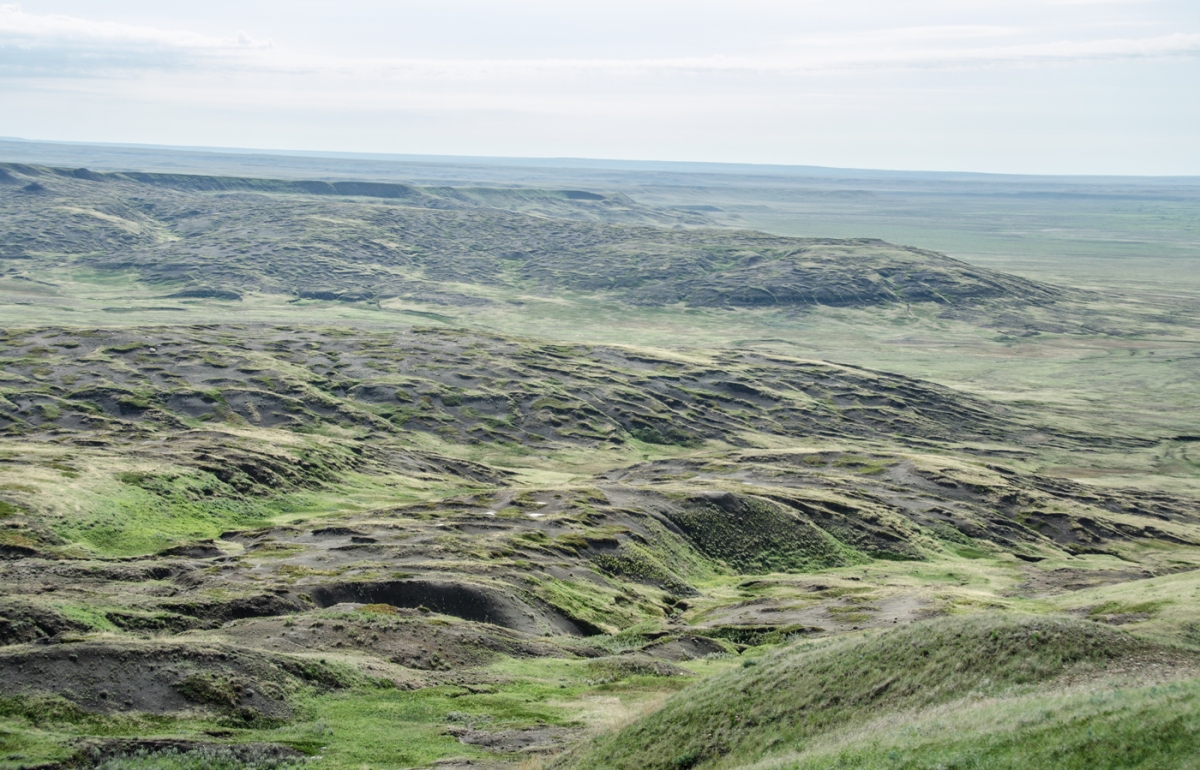
And Saskatchewan welcomes wandering souls looking to lose themselves to endless sky and mysterious lands. The northern reach of the Great Plains, southern Saskatchewan is scoured by ancient glacial floods and swept constantly by wind. Where the land is not broken for crops, dinosaurs sleep in shallow soil beneath the bones of bison and the stones of tipi camps.

FrenchmanValleyHomestead
I could live there. Frenchman Valley, Grasslands National Park, rainbow after a storm.

On a few high plateaus, forests cluster against potential invasion by the surrounding plain. The Frenchman River bends upon itself in a tight ribbon, winding through dry country on its way to meet the Milk and the Missouri.

GrasslandsNationalPark
A thousand miles from my house, the Frenchman River winds through a windswept, peaceful landscape.

After storms roll over the land, emerging sunlight light illuminates the rivulets of long-evaporated torrents. After the wind and lightning, sometimes stinging hail, you can step into the low sun and let grief rise on the wind and draw into the retreating clouds.

EastBlockStormLest you think I wallow in drama, know that I am damn good at putting on a face and going through the motions. I made it through college finals two weeks after my mother was killed. I lent a shoulder and an ear to anyone who needed it when a friend shot herself. I’m a pro. I don’t cry.

And I know how to occupy myself while the worst of the hurt fades.

TriceratopsVertebrae
Need perspective on how trivial your life and cares are? Hold a 65+ million year old fossil.

So it made perfect sense to return to Saskatchewan when a budding Parks Canada paleontologist told me that Grasslands National Park hosts a fossil hunting week in August.  Hunt for dinosaur fossils? Sure, never done that. Never met a live paleontologist.  Hang with the visitors and locals who come for barbecue and music on Saturday? Perfect. I could have fun playing science tourist, put on a face, and forget.

Badlandsriders1
Familiar beefy butts of ranching horses.

Then my mask got knocked a little sideways when the horses started arriving for the Saturday wagon rides.  These are tourist rides. Not long rides, but long enough to make you wonder how the backs of westward-bound pioneers did not break as their wagons rumbled across on the prairie. At the turnaround point, a young interpreter gives a short talk about grasslands. Other local folk bring their horses and ride along.

A rancher with one arm packed in a sling rode a white horse. No, they don’t need shoes here, she answered.  It’s dry enough that their feet don’t go soft and sag, get bruised by rocks and then abcess. And shoes would be terrible fire hazard, with metal spraying sparks from rocks. Of course, I said. She knew what rain rot is, and why our West Coast horses wear blankets when the skies cry all winter.

BadlandsWagonRides
Left to right, a Clydesdale, Percheron, the dun horse, and a good ol’ fashioned bay Quarterhorse. Oh, and really uncomfortable people on a wagon.  There is a reason pioneers were often seen walking beside wagons.

Then there was the dun horse.  I know what dun is: a gene that dilutes the hair color but leaves a pattern of dark hair in a dorsal stripe and ear tips. Tail and legs can be dark, with a “primitive” zebra pattern on the lower legs. I know this from books, but I’d never met one. It’s a different color, subtle, maybe not flashy enough for some of the more chrome-conscious horse folks I’ve known.

BadlandsDunHorse
The dun horse on right- you can see the leg striping.  I forgot to ask why everyone cuts tails short- we spend a lot of time and money on tail bags to make them long. Lots of folks here talked about riding rodeo, where long tails could be a problem.

I asked Mr. Norris if he was raising his horses, but no, he said they were bought. The family had given up on horses and used ATVs. He still rode. He asked me if I had horses.

“No, lost the last one. Likely bad colic, couldn’t do anything by the time I found him. You know how it goes.” I looked away at the hills.

“I’m so sorry,” he said.

We got back from the short, joint-wracking ride with time to spare before the barbecue. I sat on the porch of my rental tent cabin and watched the wagons and riders leave again. After they returned, a jackrabbit thought triggered me to grab my camera and go down to the gathering place.  I found Mr. Norris and his dun horse.

“Do you mind if I take a photo or two of your horse?” I asked. “I do some art, and I’d like to sketch your horse.  I’ve never seen a dun before.”

I couldn’t tell him I lacked the heart to put my own to paper or canvas.

He helped me get the horse’s attention, because a horse will always back its ears up and lay them flat when it sees a camera.  They’re not like kids today, who spring into a pose when a lens appears. It’s beneath horses to clown for cameras.

Then Mr. Norris handed me a rein and just said, “Here, hang on to this.” He walked away.

DunHorseSketch
Study of the patient and helpful dun horse.

I wouldn’t get on someone else’s horse unless expressly invited, but I wondered anyway. Instead, I did post duty and held the horse, carrying out what even the most outwardly polite, well trained horse appreciates: ear scratching.

“Getting on that widow maker?” asked a wagon driver.

I smiled and rubbed the horse’s neck, watching for the eyelid droop that signals a polite horse is grateful.

When Mr. Norris came back, I handed the reins back and thanked him.

He swung up into the saddle for the next ride along and said, “You know what Winston Churchill said, right? The outside of a horse is good for the inside of a man. Or in your case, a woman.”

BadlandsPercheronTrain.jpg
You can see the park fire danger sign behind these Percherons- level at “extreme”. There is a reason these big guys aren’t wearing shoes!

And it finally stopped. The bleeding inside, the catholic guilt. Something closed up, something quieted down. Without meaning to, Mr. Norris and his dun horse rode off with my ghosts and buried them somewhere in the sunburnt grass, the dusty ancient floodway, lying out there with the dinosaurs and the bison bones.

I went to the barbecue, and sat peaceful for the paleontology talk and music by local folk. It was like being back in small town Midwest again, only with science.

When I drove into my yard a few days later, the barn stood peeling in the sun. It was just a messy, neglected building needing painting and a good cleanout. Barn swallows, garter snakes, and bats ruled it all summer. Mud nests bulged from rafters. Occasional domes of guano ate at the concrete aggregate in the aisle. Feathers drifted in puffs of breeze.

Dusty water buckets and empty brush bins leaned unsteady in crooked stacks. The tarps still laid balled up on the floor from that last numb run to the dump with blankets and halters.

BarnSnakes

It was just a barn again. Labor Day was coming. I could start cleaning it then.

I closed the doors.

PrairieSunset

Living on our leavings

Coyotes are survivors with jackal-like smarts and extreme adaptability. And they’ve learned to work with human behavior.

We often think of humans as the eternal enemy of all wildlife. It’s natural to go there. Right now, we are causing the biggest mass extinction since the meteorite that tipped the dominoes, ultimately killing the dinosaurs and letting mammals prevail.

But some wildlife adapts to us and our behavior. A contractor on one of my projects says that gunfire is a dinner bell for grizzlies in Wyoming. The bears learn to associate shots with gut piles left behind by hunters field dressing game. This has caused bear-human conflict when the grizzly doesn’t wait for the hunter to finish processing game.

BrothersDrinking
These grizzlies outside Grand Teton are taking a sip after snacking on the remains of a hunter-killed moose.

I see wildlife adaptability every time I rent a tractor and mow my fields. I’m renting because it’s cheaper than owning for the amount I mow, and I don’t want to get stuck hauling out a tractor if it floods. I rent just often enough to be cost-effective and to keep the grass from becoming too long to tackle.  In between mowings, it grows thigh-high and shelters a population of rodents and insects.

RedTailPair
I’m taking off- I see the voles leaping through the grass!

Many raptors follow my tractor, for good reason. The rumbling and vibration of the machinery sends mice and voles fleeing through the grass, where they become easy prey.  Those that don’t survive become dinner for scavengers.

RedTailPair2
A pair of hawks sits on an installed perch watching me mow.

RedTailHawk07072018

Coyotes also figured out how to work around and with humans and our machinery. Canis latrans follows humans where ever we go, living off our leavings. They pursue our scraps and the animals atracted to our waste and the table we set for birds and pets. Coyotes have walked in our wagon tracks and footsteps, across trails and highways, to occupy North and Central America.  As we exterminated their enemies, especially wolves, their populations grew and their territory expanded. They grew bolder.

Coyotes evolved away from the jackal lineage about 800,000 years ago. Today, they live across the continent, and not just in rural landscapes. They defy our attempts to exterminate them. They prowl cities and business parks. They have been sighted in New York’s Central Park. They aren’t picky eaters:  insects, fruit, garbage, rodents, anything they can find. They may offer free rat control in large cities.

If you are on Nextdoor in my area, or walking our roads, you will see lots of “lost cat” notices.  Outdoor cats in our area can fall victim to eagles, dogs, and coyotes; unlike the first two predators, coyotes rarely leave a trace behind.

CatSkull
I found this cat skull partially buried in the dirt when I was weeding a hedgerow.  A feral cat organization was releasing animals around us a few years ago. They would survive a few days, maybe a week before the coyotes or eagles got them.

Despite the fact that the U.S. government and property owners annihilate a half million of them a year, they are not at risk of extinction.  They have figured us out.

IMG_1291
Private property owners in the West seem to take delight in displaying dead coyotes.  They may in fact be trying to scare other coyotes away. This photo is from Montana.

After grey wolves were re-introduced in Yellowstone National Park, coyote populations dropped by half. They abandoned the apex predator behavior they developed when wolves were absent. Sure, they might sneak a bite of a wolf or grizzly dinner, but they know to hightail it when the owner takes notice.

YellowstoneCoyote
This coyote in Yellowstone National Park stole as much elk meat as possible while the wolves that killed it were napping.

My corner of the Snohomish River Valley had a stable coyote pack for a long time. They would yip and howl in winter far back in the fields.  I would see them occasionally. Once in awhile, they would nab something from my yard at night and launch a raucous coyote party.

CoyoteWeb
As my grass gets longer in the summer, coyotes find cool bedding spots. I spotted this one going out to the compost pile.

Then my hobby-farmer neighbor turned sheep out on his land without adequate protection from predators.  His lambs got nabbed by coyotes, but instead of enclosing them, he went on a rampage after the coyotes with a gun the law says he couldn’t own.

He eventually gave up on the sheep like he gave up on everything. He killed the goats. A local butcher field dressed most of the pigs one day as I was driving home from work. the chickens vanished, most likely killed by eagles. Weeds have taken over and the few remaining animals roam unmanaged. They would be everywhere if he had not installed mesh fencing. Animal Services forced him to downsize and confine wayward cows that triggered too many complaints of property damage.

CowsIBlockedWithFenceRepaire March 15
Can’t blame the cows; going hungry at the end of a long winter, they will do whatever they can to get at food. The fencing basically starved them while changing travel patterns for coyotes.

A year after the revenge killings for lamb nabbing, the rabbit population exploded. Rabbits frolicked in my driveway and destroyed my garden and landscaping. The coyote pack was gone, and the few animals around couldn’t navigate the mesh maze my neighbor installed.

Rabbit
These rabbits are not native to the West, and left unchecked, they devour anything green.

Hope returned in June 2016, in the form of scat with cherries and occasional hair on the road and in my horses’ paddocks.  I finally caught sight of a young coyote as I was  mowing thigh high grass.

CoyoteNotSure
This young pup is on her own early.  In the morning, she would flee when she saw me.

At first wary, this young coyote figured out after several hours that the tractor meant food, and by evening was following at a safe distance.  I can’t imagine how the scrawny little thing stuffed so many rodents down her gullet.  She was still at it after the tractor got turned off at sunset, stalking the grass for confused voles.

SkinnyCoyote
Not a great picture, but you get the idea how young and scrawny this coyote is.  Most pups don’t survive their first year.

CoyoteThinkingOnIt
She seems to have figured out that the tractor means food.

CoyoteVole
Success- chewing on a vole

CoyoteGotOne
She got braver as the evening wore on, even though her belly started to look round with the feast.

Most coyotes aren’t brave enough to follow the tractor like that, but they quickly learn that the sound means easy food, like the sound of gunfire to grizzlies. Every time I mow, they show up sooner or later. This year as usual, a young coyote showed up after a day of mowing to work the fields for voles exposed by the short grass.

Coyote1
This coyote looks like it is winking. I could see both eyes open in other photos.

The coyote was young, and very wary; the tractor was fine just as long as it didn’t stop. I wasn’t going to interfere with its job.  Coyotes are here out West because they adapted to us and our ways. They thrive because we removed their enemies and we waste so much. These coyotes, like their ancestors, have learned to maneuver around us in the shadows, to use our paths and roads, to live on our leavings.

Coyote2


For more information on coyotes, read Dan Flores’ Coyote America: A Natural and Supernatural History, Basic Books.  This National Geographic article features history, statistics, and an interview with Dan.

02coyote-america.adapt.590.1