Hay River Day 3: Exploring ancient waterways

Contemplating Deep Time and life as a chimera

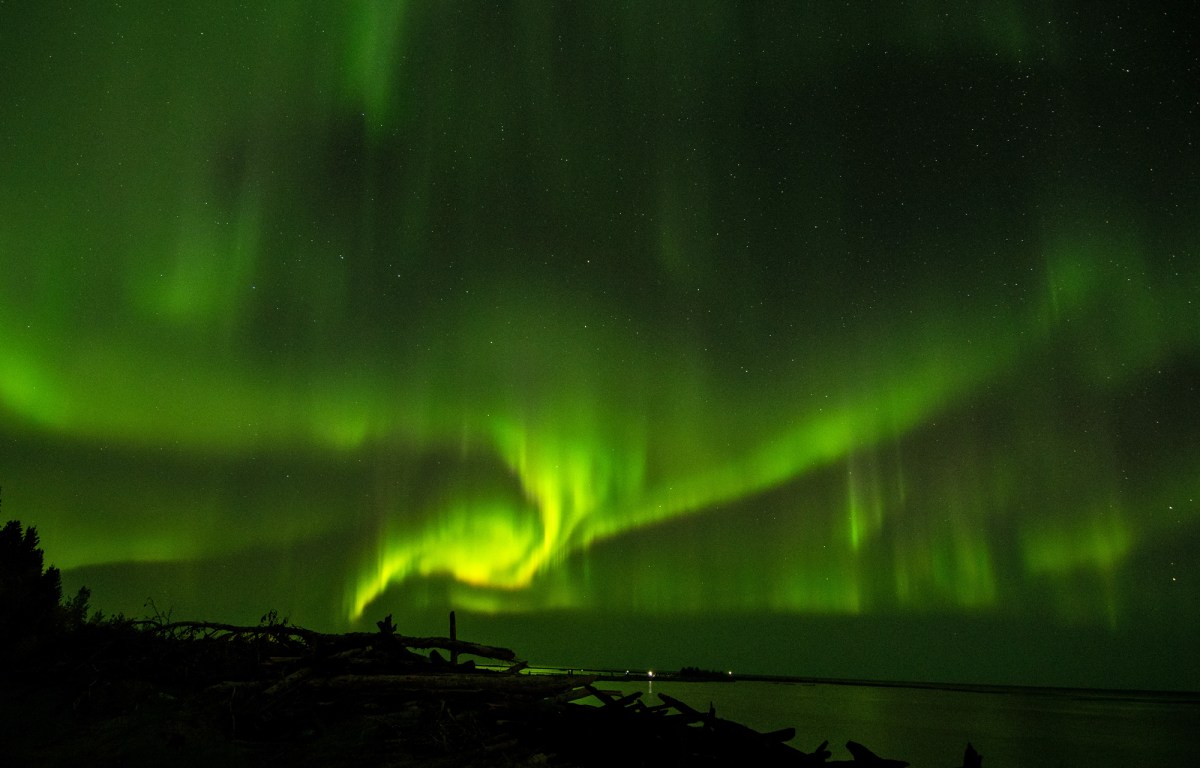
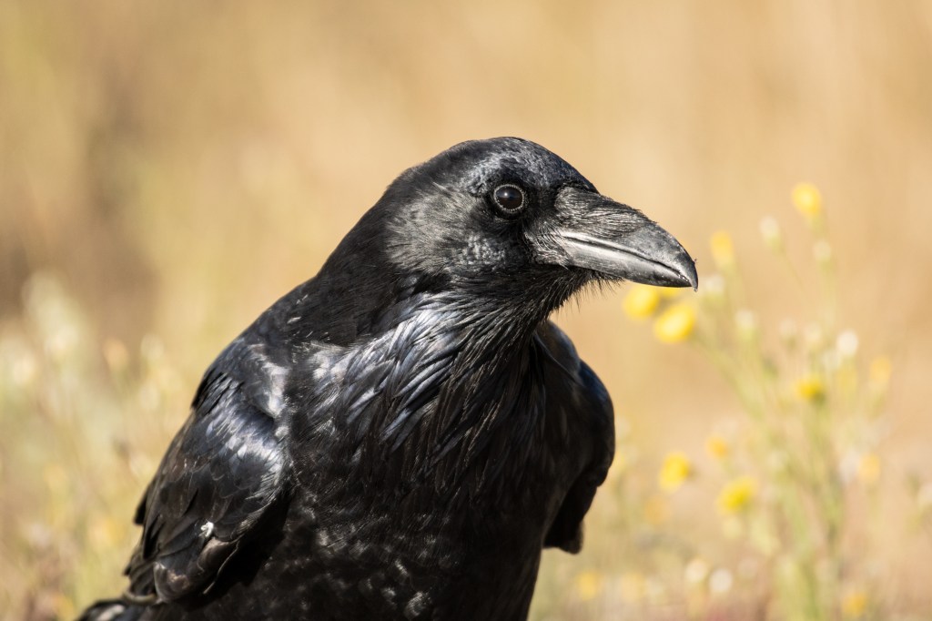
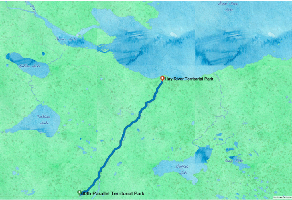
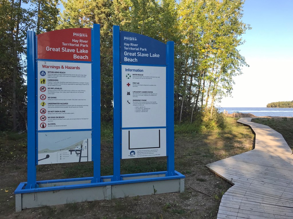
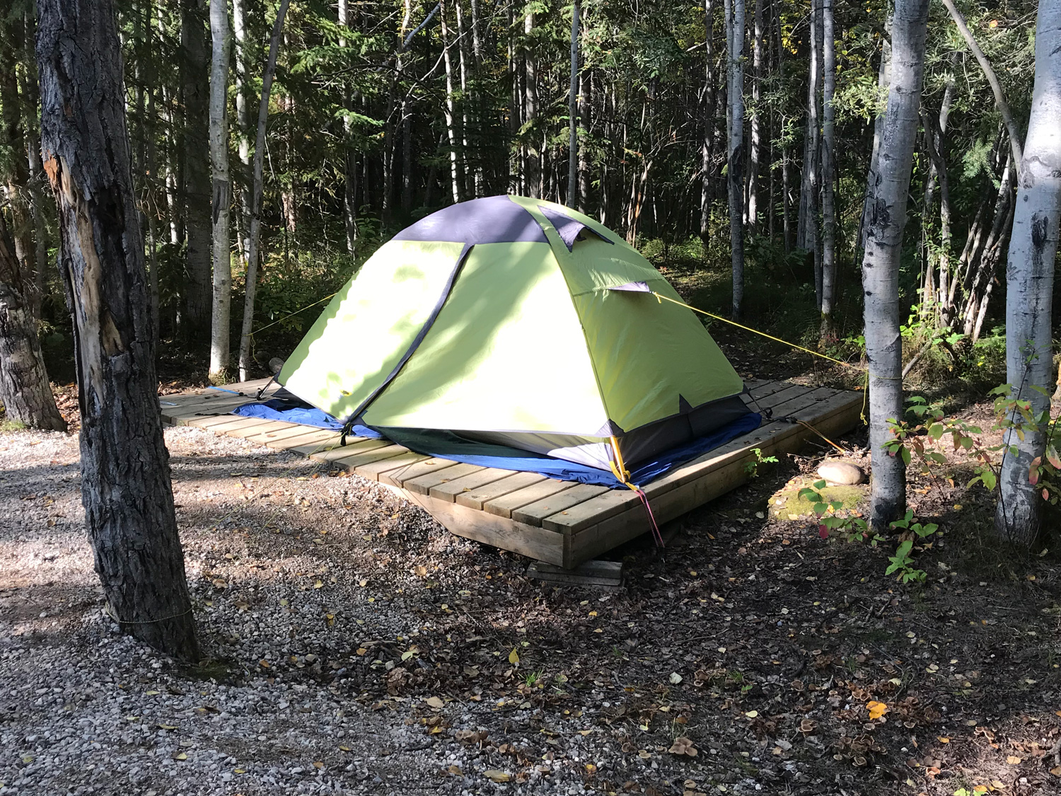
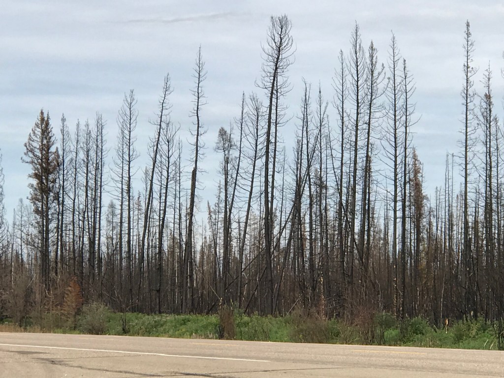
Monday dawned clear, an invitation to explore. The sun rose on a chilly and serene morning as I walked the shores of Great Slave Lake. After a late night watching the aurora, rolling out of a warm sleeping bag to catch the sunrise seemed like a stretch. But I had planned a day following water. Strolling the beach by the campground with a cup of coffee and a camera seemed like a good start.

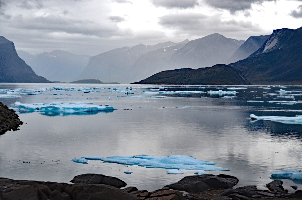
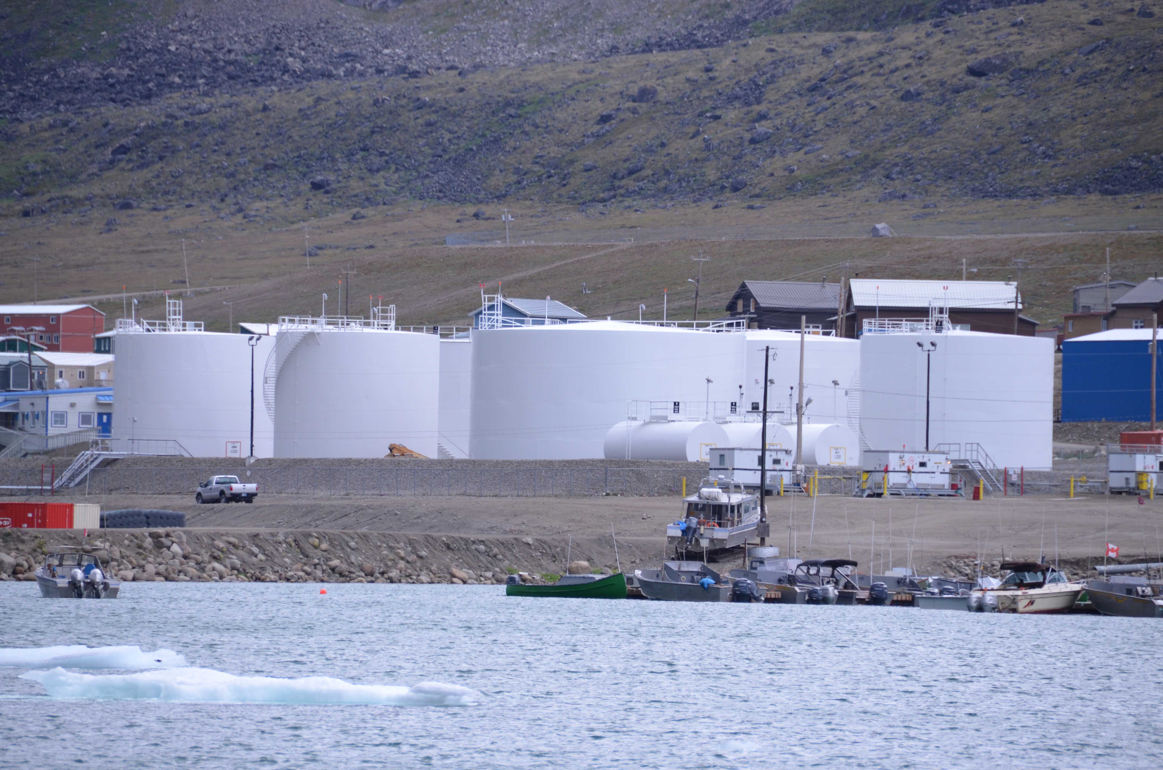
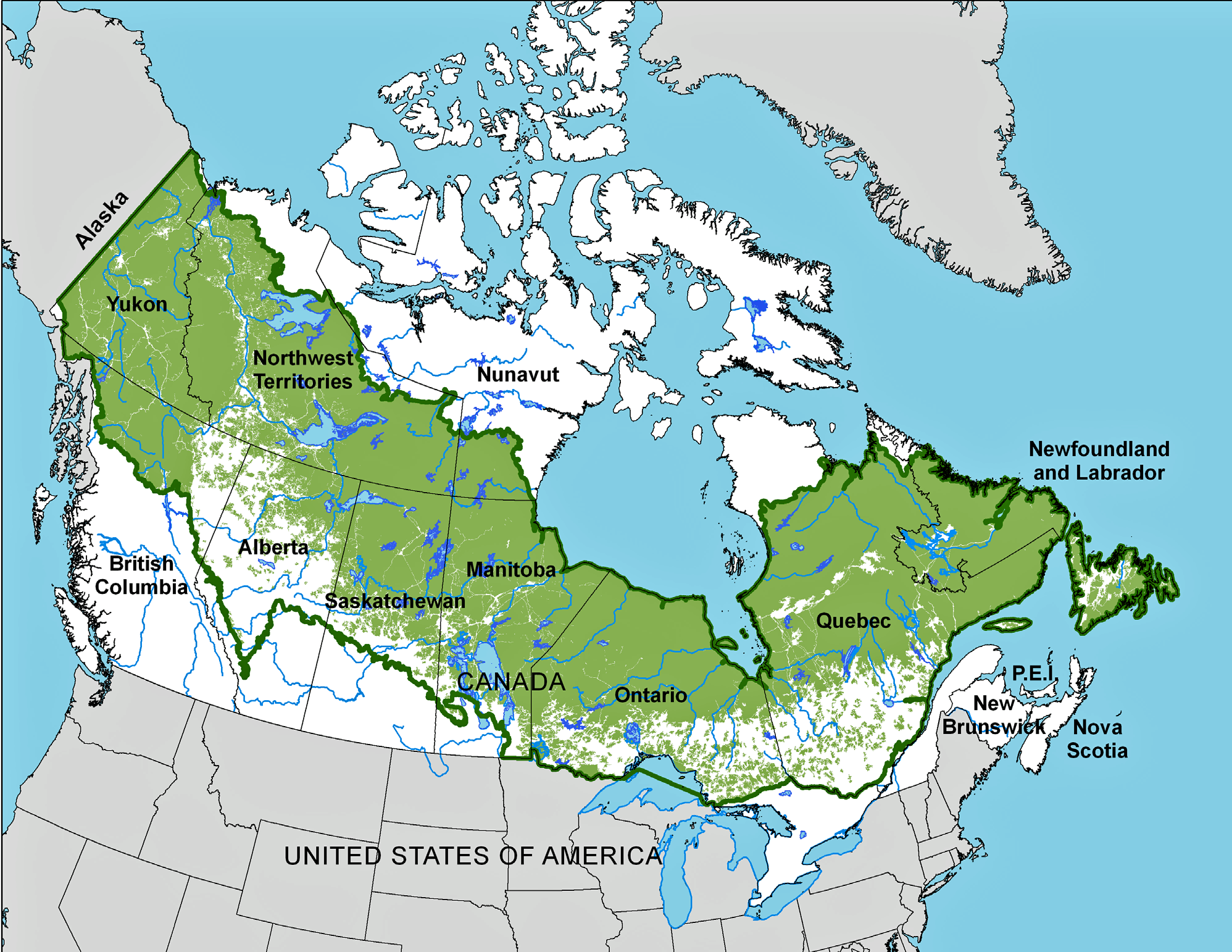
You have to stand on the shores of the Great Slave to feel its draw. North America’s deepest lake stretches across the horizon like the ocean, and back in time to the last ice age.

The beach by Hay River Campground curves, leading to a spit where seagulls nest. Morning light turned the sands to bronze.

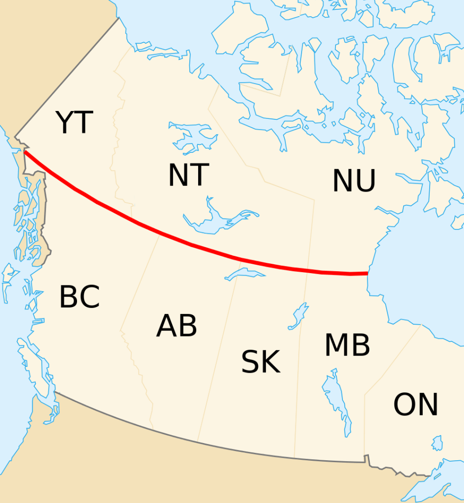
An arc of lakes from Great Bear Lake to the Great Lakes tells the story of the Ice Age that started about 2.5 million years ago and ended only recently. The Laurentide Ice Sheet covered northeastern North America, millions of square miles (or kms) shaping the landscape. The Laurentide butted up against the “smaller” Cordilleran Ice Sheet that covered almost a million square miles in the west.

In the last glacial maximum, from about 95,000-20,000 years ago, the Laurentide Ice Sheet scraped the basins of North America’s various Great Lakes, including the Slave.

Jacques Descloitres, MODIS Land Rapid Response Team, NASA/GSFC [Public domain]

The western boundary is marked by a change in geology even today. The Ice Sheet scraped away the surface to some of the oldest known rocks on the earth’s surface, shown in shades of orange and red below (along the line that cuts the Great Slave Lake in two, if you are color vision-impaired).

https://pubs.usgs.gov/imap/i2781/i2781_c_med.pdf

Those surfaces include stromatolites from about Precambrian times 2.5 billion years ago. Stromatolites are rare, appearing in Western Australia and as fossils in a few other places, including Northwest Territories. They are evidence of the beginnings of life, rock-like mounds built by lime-secreting cyanobacteria and trapped sediment. If you are not appropriately grateful, know that cyanobacteria were the first organisms to create an atmosphere rich enough in oxygen to support life as we know it.

Artist Tim Bertelink depicts a time long ago when stromatolites formed. You see the moon much closer to the earth than it is today, and flaming space debris plummeting through the Earth’s thin atmosphere. Stromatolits are layered in the foreground and mounded in the water. Tim Bertelink [CC BY-SA 4.0 (https://creativecommons.org/licenses/by-sa/4.0)%5D

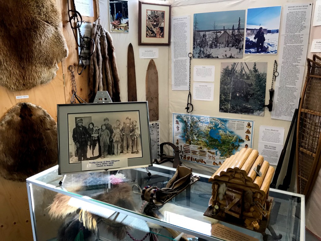
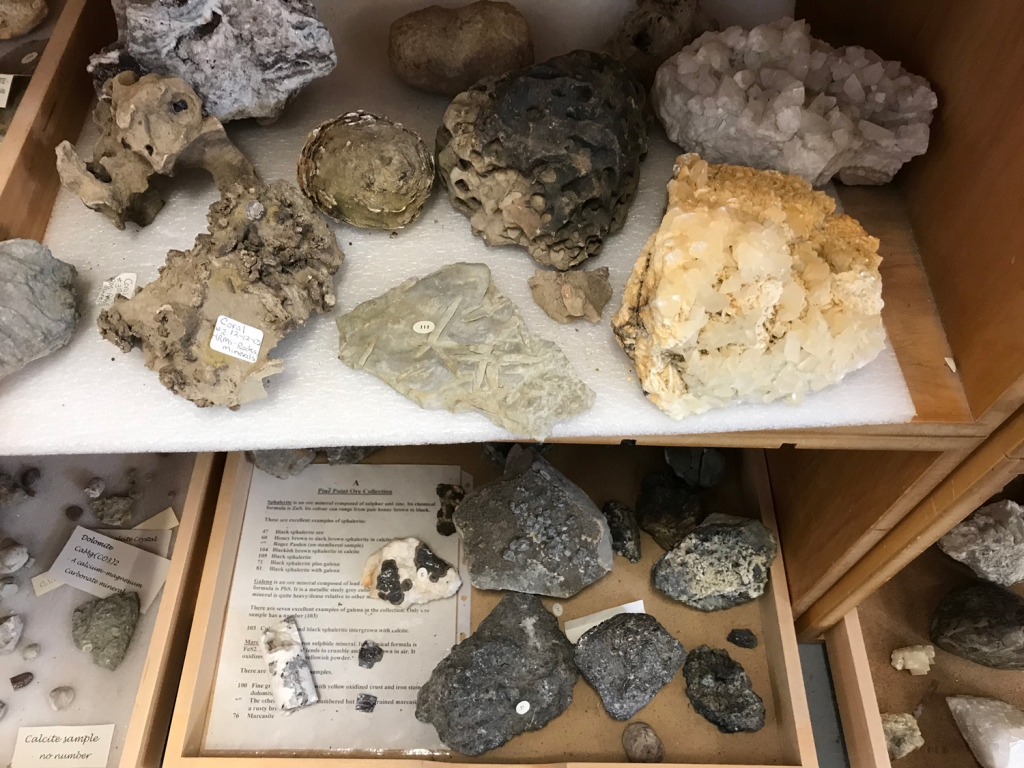
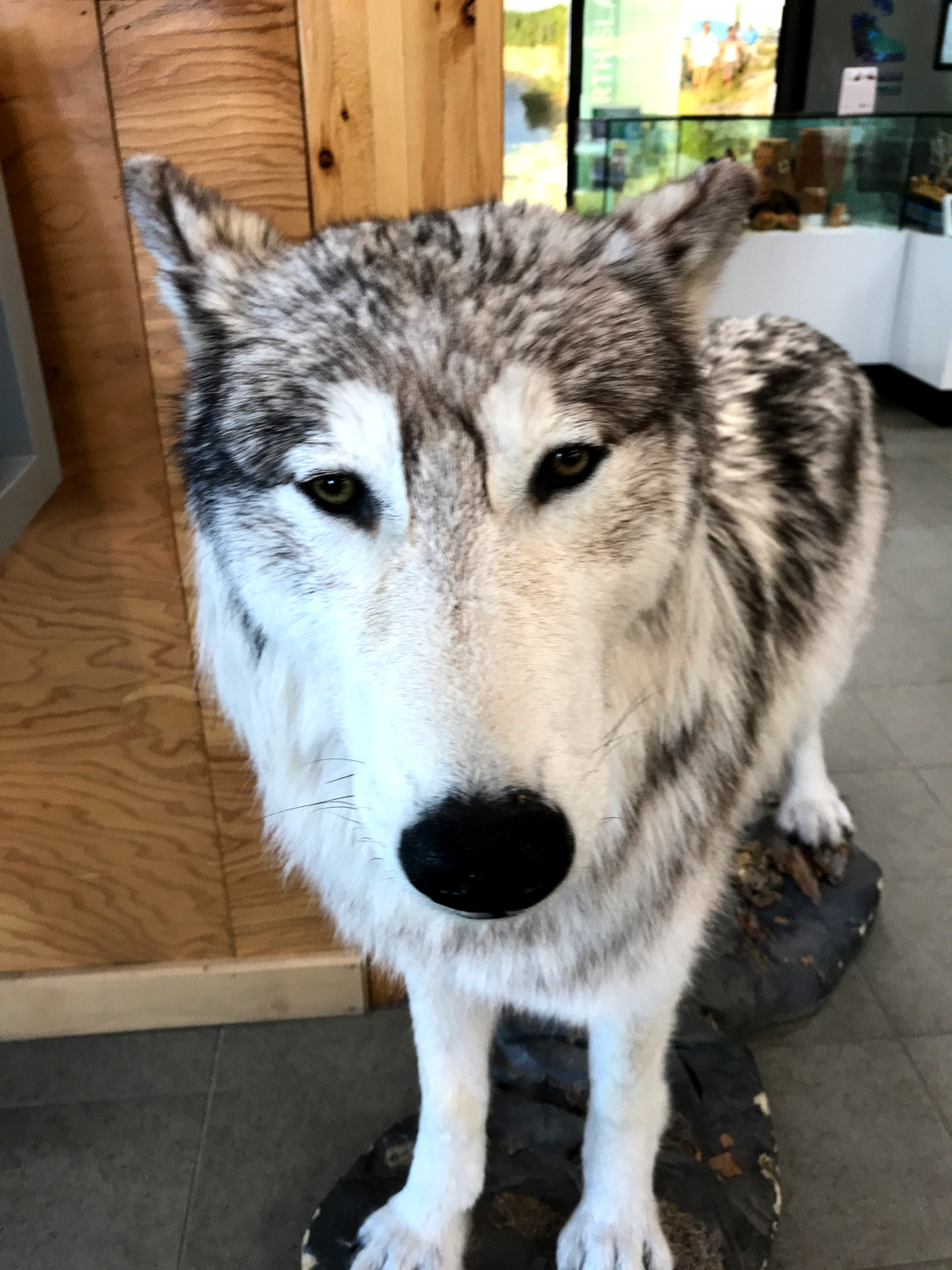
The Hay River Visitor Centre has a display of stromatolites that I will examine more closely on my return visit next year. This time, I barely registered that I stood on the floor of ancient tropical seas, transported back to Deep Time.

Lands west of Great Slave Lake feature relatively younger rock than Archean lands to the east. In exposed areas, the western surface is a modest 358-419 million years-ish, the remains of the Devonian period. This area is shown in blue on the geologic map above.

We call the Devonian period the Age of Fishes, when water covered the planet and complex reefs hosted diverse and sometimes monstrous-looking leviathans.

Dunkleosteus is renowned as the most fearsome of fishes, with armored plates and bone-mashing teeth. This fossil reconstruction shows the massive plates on its head and teeth.
Dunkleosteus is the most fearsome and legendary of Devonian fishes, armored and three times the size of a modern Great White Shark, with bone-crushing teeth. Photo from Royal Tyrell Museum, Van der Vieren.

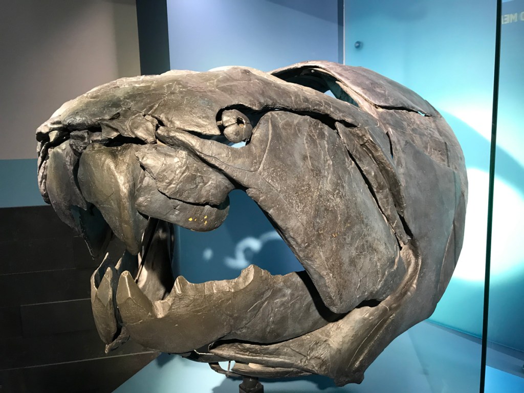
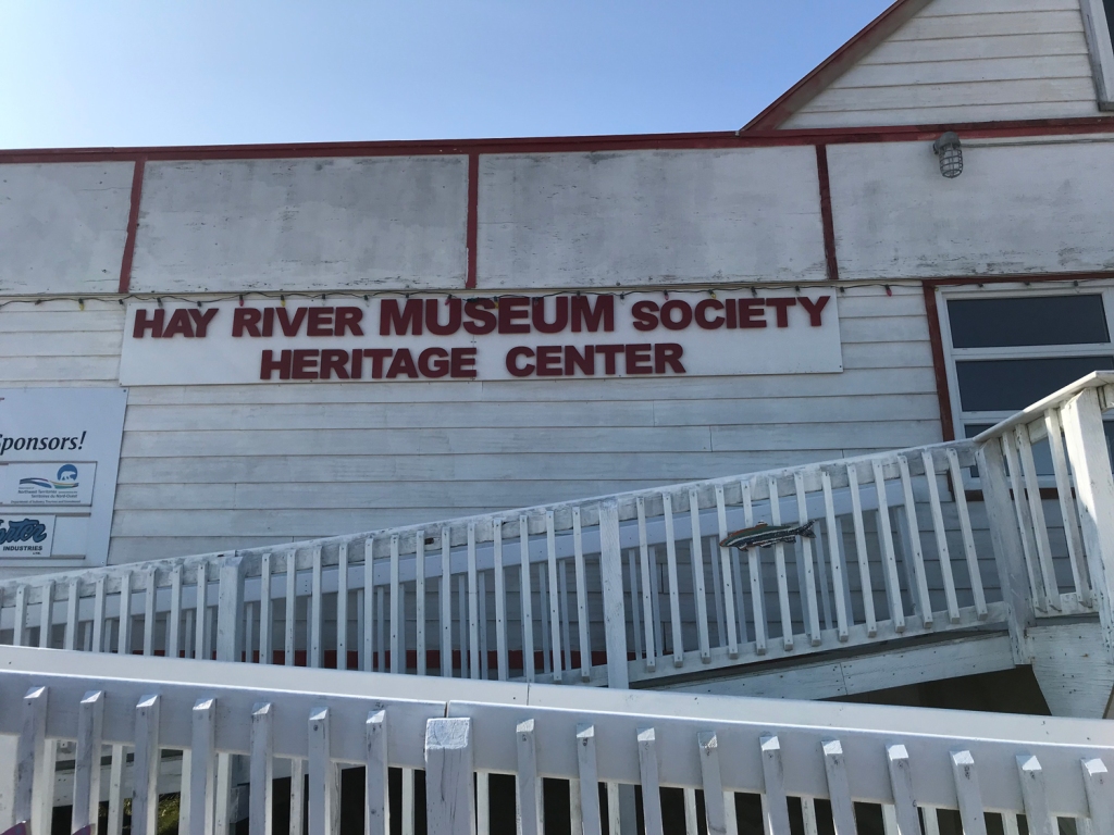
I would discover evidence of other ancient fish at the Hay River Visitor Centre. The Visitor Centre is open during the week in off-season, so I had to skip it when I arrived on a Saturday. I’m going to tell you to plan your trip to arrive there first. You need to get local travel tips, history, and environmental issues from Peter Magill. You should peruse the exhibits and local artisan work for sale.

When a large family from Yellowknife came in to the Centre, I turned away from brochures and gifts to investigate exhibits. I discovered that the waterfall route I had visited on my Sunday drive held a giant secret.

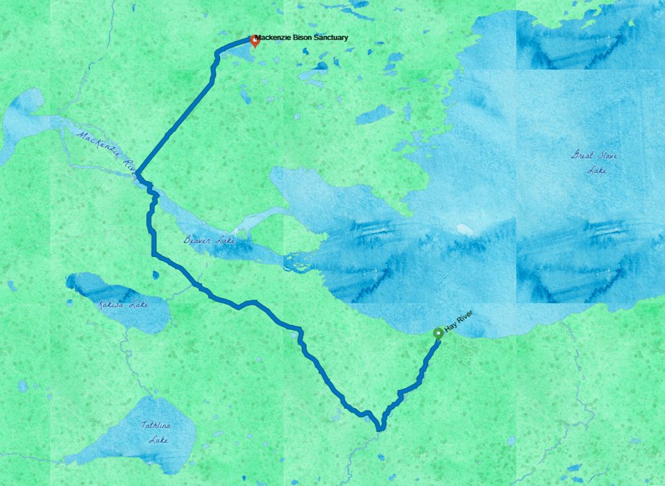
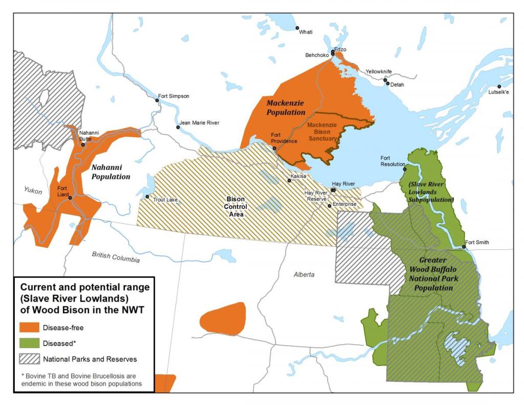
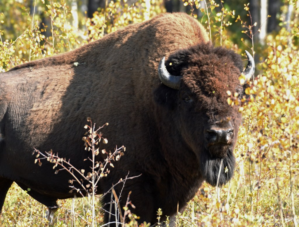
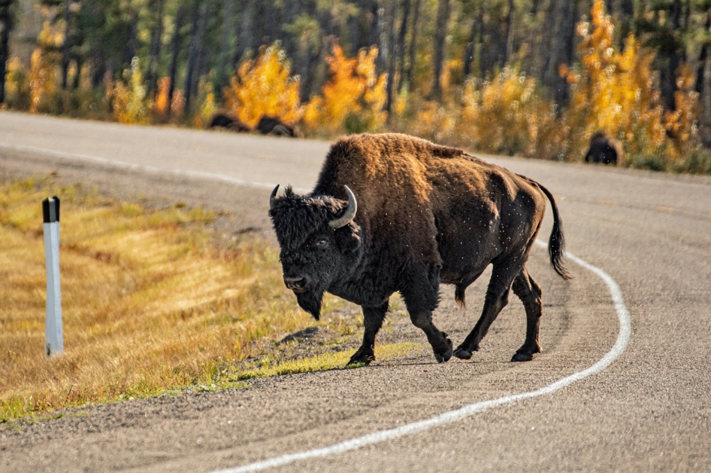
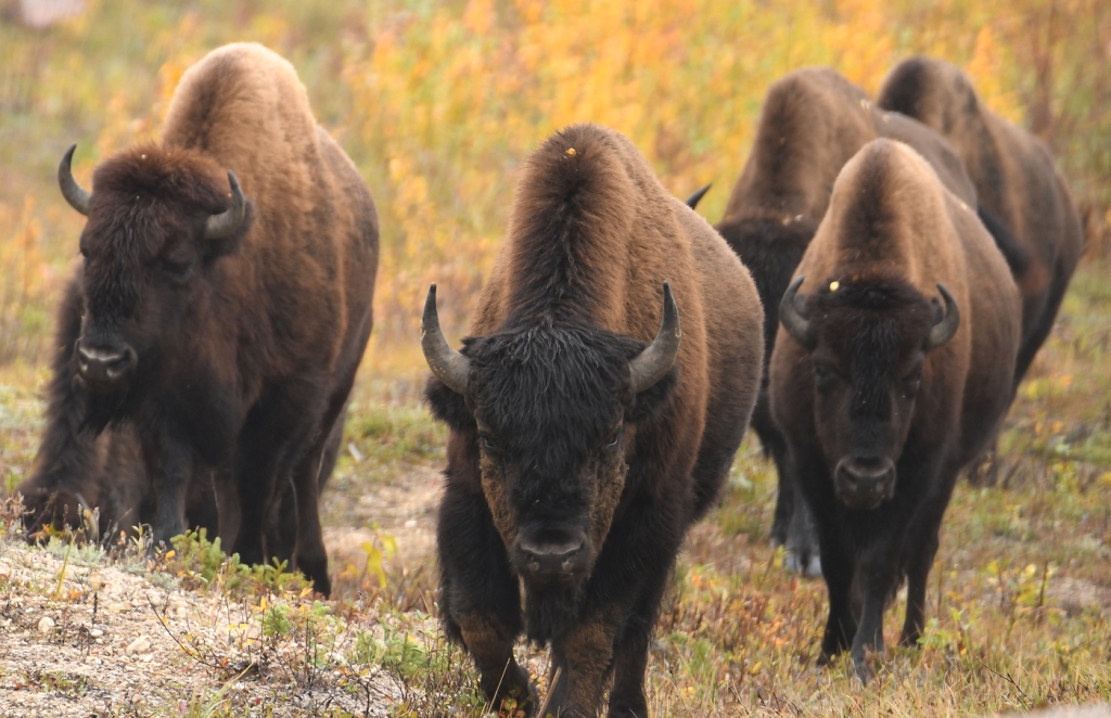
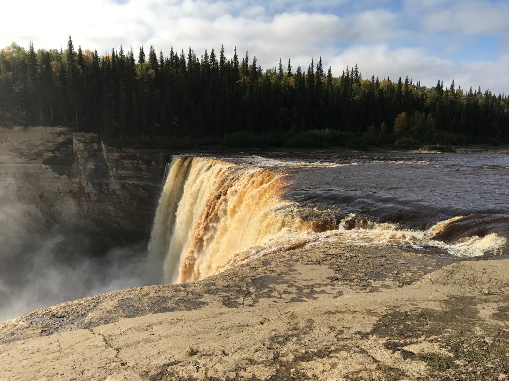
Full disclosure: I stopped at the waterfalls on the route to Mackenzie Bison Sanctuary because they are a tourist attraction. I am not one of those people who finds spiritual serenity in falling water. Instead, I sit at waterfalls contemplating natural history, geological forces and hydraulics. I find them fascinating as a force of nature, not of spirit. I know that peoples from time immemorial see and hear more than I can. I’ve given up on the divine where waterfalls are concerned.

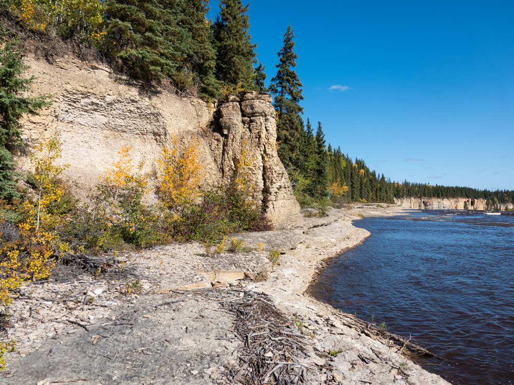
The waterfalls are well worth your visit no matter what you see in them. In mid-September, I had them to myself. Perhaps because I wasn’t feeling well, I enjoyed just sitting in the warm sun and watching water flow over rock shelves sculpted by ancient ice. Lady Evelyn Falls was perhaps the loveliest of the three with a gentle arc sweeping from bank to bank. Alexandra was the most dramatic. Louise Falls featured the most interesting formation, a shelf of blocks.

What I missed during my Sunday waterfall drop-ins were fossilized trackways from Sarcopterygians, the first fish to set lobed fin on land.

This exhibit in the Hay River Visitor Centre shows a fossil trackway upstream from Alexandra Falls.

Casts of individual tracks sit on the floor. I knelt down and felt them with my fingertips. I imagined a massive lobe-finned fish, the first tetrapod, hauling its huge body from a drying pool and moving slowly across the land to find more water.

Of course, I had to go and see the trackway. I now felt well enough to make the hike between Alexandra and Louise Falls. I could make it a day. I had food for lunch in the car. After talking with Peter awhile and buying local gifts for friends, I headed out.

Alexandra Falls is easy to reach from the road. There is a parking lot I walked the trail to the river, but instead of turning downstream to the falls, I walked upstream. The bank and trackways erode every spring with battering by the Hay River. But the tracks from the display are still there. Further upstream I found more tracks, and fossil shells embedded in limestone.

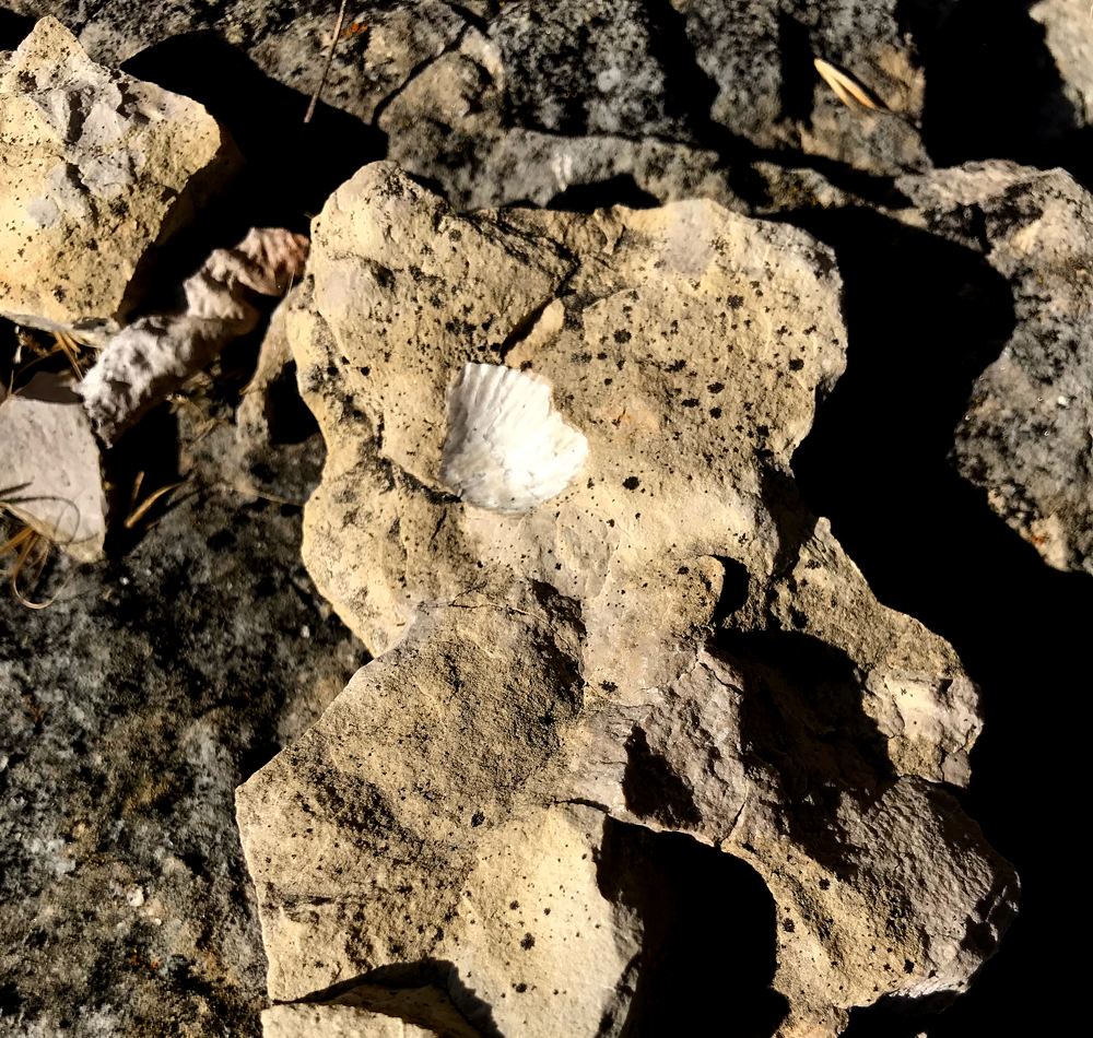
I brushed fine debris from the depressions as I sat by the finprints drinking water-primordial, life-giving water. Water that beckoned fish to grow primordial hands and crawl onto the land.

I sat in the sun struggling to comprehend time. I always think of North America’s West Coast as young compared to the East, where old homes are a century older than my area. This all looks adolescent compared to parts of Europe, where crumbling stone tells of life a thousand years back. But this is age as measured by human occupation, not real time.

The Hay River cuts into rock laid down in Deep Time. View from river bank at Alexandra Falls, looking downstream.

The rock I sat on bore traces of fish that lived almost 400 million years ago. I felt like dust- or the dust mites that appear only under electron microscope. We are really nothing in the face of Deep Time. A throwaway moment in the history of life. We seem so large and loud and destructive- but we are meaningless and small on a geologic scale.

We are, in fact, a chimera of ancient life. I sat there with my mess of flawed DNA that includes junk sequences from earlier beings and ghosts left behind by viruses. My body hosts microscopic flora, early life forms. Friendly flora help me digest my food and protect me from pathogens. Animal studies say that I would die in a sterile environment.

I sat in the thin fall sunlight with my hands resting in those fossil tracks and simply dissolved. What it meant to be human, to be me, vanished in colored droplets rising with the mist from the falls.

This realization might frighten or depress some people. I was glad I didn’t have a travel companion at that point.

Personally, I found this liberating. Soothing. All those to-dos and must-dos, the fears and hurt and failures. All the small successes that seemed so hard won. The looming questions about becoming an old person with an irritable immune system in a country threatening to cancel health care.

Nothing mattered, not really. Not in Earth’s impassive regard. The sheer act of being alive and touching deep time at that moment was more than a miracle. I could live in this precious moment experiencing dissolution and absolution. I could relax.


There are living Sarcopterygians, remnants of Deep Time still swimming in today’s oceans. The coelacanth, a Lazarus fish thought to be extinct 66 million years ago, was rediscovered off the east coast of South Africa in 1938. I learned about these ghosts of an unimaginable time in grade school. I loved that the world was so much larger and older than me, that there were mysteries to be discovered in my fleeting time on earth.

I love that feeling still. That is why I travel to places like this. That is also why I will return- to feel small and amazed once again. Next time, I will add a visit to Sambaa Deh Falls Territorial Park, where ancient coral tumbles down the river from the falls.

This reconstruction shows a sarcopterygian propelling itself on the surface as it leaves the water. The massive lobed fins brace the upper body of the fish.

I walked the trail between Alexandra and Louise Falls and back, reading every interpretive sign along the way. The signs tell the journey of young Dene people on a portage past the barriers of the Twin Falls.

When you reach Tucho, the elders of all clans in the region will gather to hold ceremonies, celebrate, and give thanks. Every elder there will be called upon to use special healing gifts. There will be many new stories to tell and legends to retell to educate the young.

Interpretive sign, Twin Falls Gorge trail.

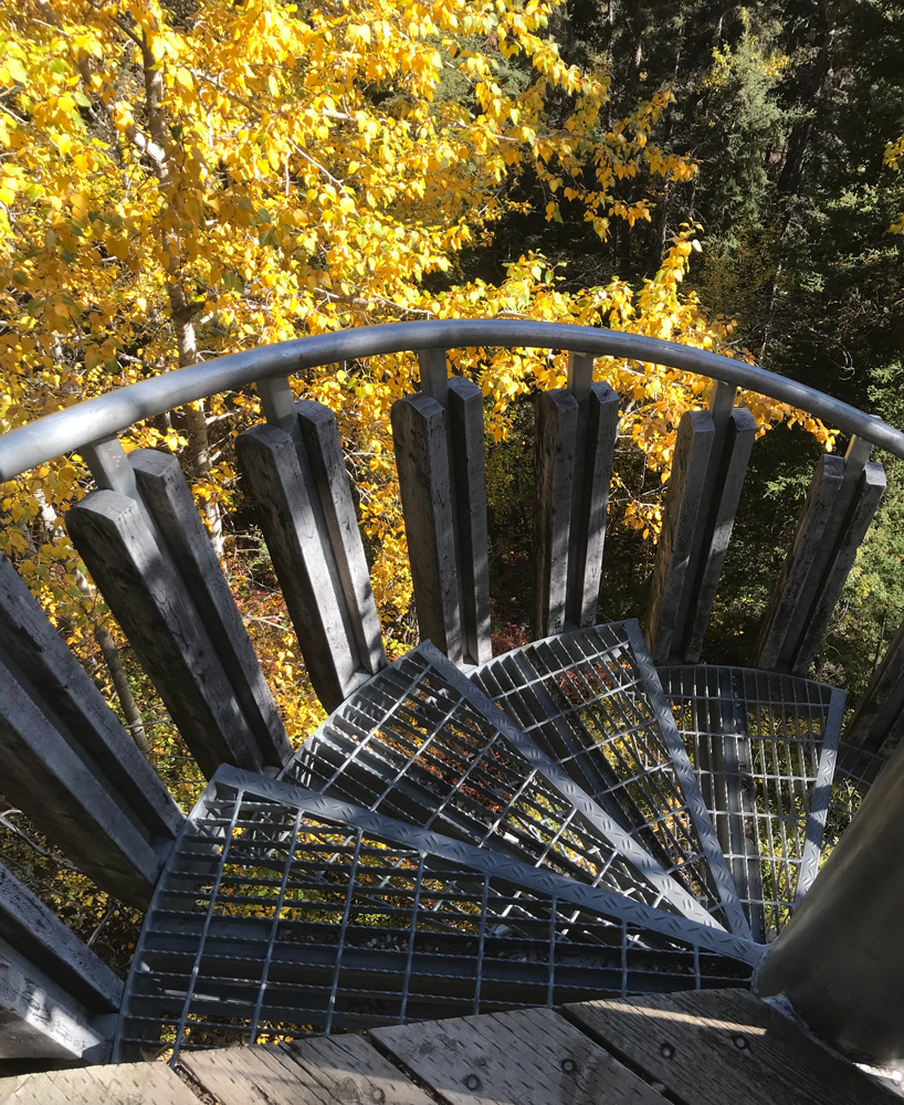
The restored portage trail is well-maintained and used heavily by modern life, including beavers, black bears, and likely other furtive creatures. A sturdy spiral stairway safely transports hikers from the trail to an overlook at Louise Falls. I have no idea how First Peoples made this trek, but I do know they would be more fit, agile, and adept at cross-country navigation than most of us modern folk.

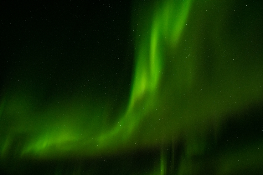
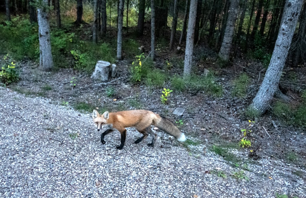
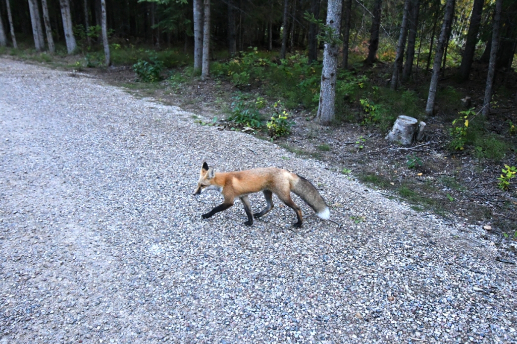
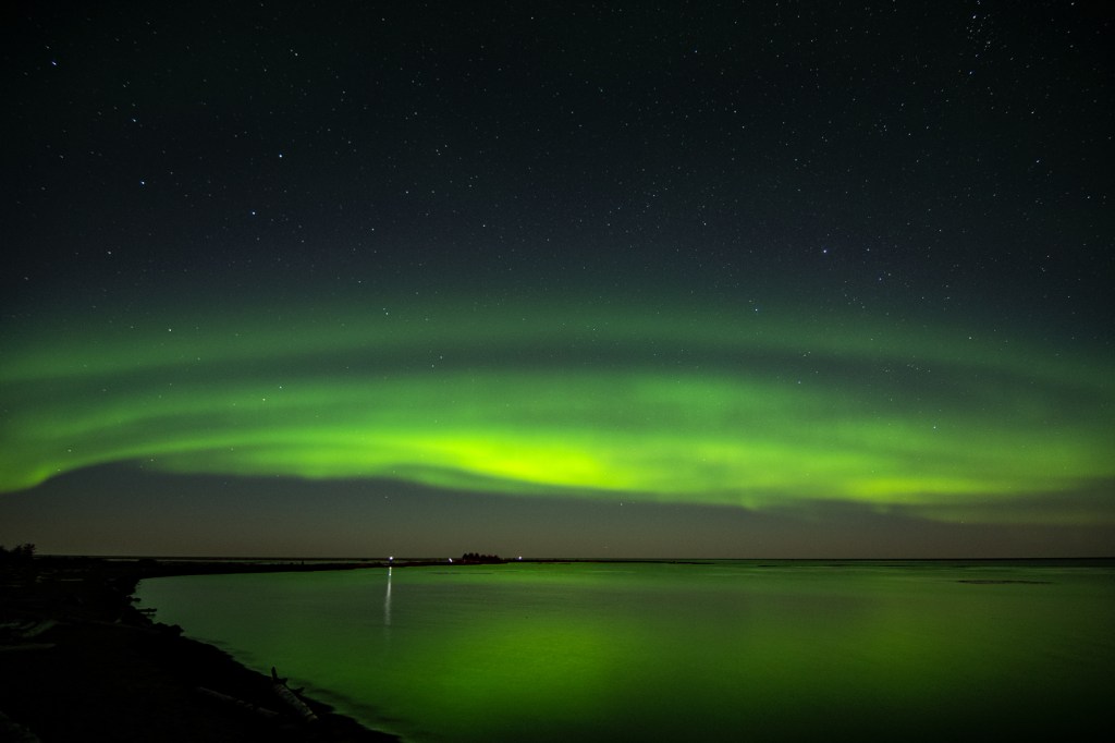
I had one last night to spend at Hay River Territorial Park. One late night to brave the sneaky foxes and creep down to the beach to try my hand at photographing the aurora. The Northern Lights were softer, greener, and the light show more brief. I was still entranced. I had spent the day becoming so small and insignificant. I could be one of those atoms in the sky, struck by charged particles from the sun, emitting light on humanity as I calmed.


For an easy, fun look at Deep Time, watch this PBS video.

References

Spectacular NWT- 19 reasons to see Great Slave Lake. https://spectacularnwt.com/story/19-reasons-to-see-great-slave-lake-now

What causes the aurora borealis, by EarthSky. https://earthsky.org/earth/what-causes-the-aurora-borealis-or-northern-lights

Twin Falls Gorge Territorial Park and Waterfall Routes. https://www.nwtparks.ca/explore/waterfalls-route

Hay River to Mackenzie Bison Sanctuary

A troubled day watching wildlife on land and lights in the night sky.

A watercolor map shows Great Slave Lake in Blue on the upper right, with a blue route line from Hay River, on the shore, northwest to cross the Mackenzie River, and then across to the Bison Sanctuary.
I took advantage of a sick day to travel to a protected area for wood buffalo.

When you are a 4 day drive from home, it’s not a wise idea to become ill. I knew it was a possibility, and had really worried about the potential for decent medical care in a remote area. When I woke up sick on a Sunday morning, I knew I would need to get help that day. The bacterial infection that started with a tick bite in June was back with a vengeance. I sat feverish and in pain in a dark tent Googling medical care services by the glaring light of my cell phone. On a Sunday, my only option was Hay River Emergency.

I lay back waiting for dawn and wondering what would happen if they could not help me. Would I need to leave my car behind and take an emergency flight home? I felt foolish- why hadn’t I ditched my plans? Why didn’t I just stay home and hunker down? I thought of the coworker who sustained a strained back muscle just as her husband and kids left for a 2 week vacation in Glacier National Park. She stayed home in a dark house, miserable, to recover.

I need not have worried. The hospital was bright, up to date, and the staff friendly and professional. The doctor was as befuddled by my own when I showed him the lab results on the bacterium. They had not posted the sensitivity, so he did some research and guessed. They gave me antibiotic in the hospital and a prescription for more.

This photo shows yellow chairs and a grey couch in front of a window in a hospital exam room.
It’s an odd trip that includes photos of the emergency rooms and urgent care facilities you visited. If i had family or friends with, they could have accompanied me to this spacious exam room.

The bill came to $275 USD, which I could easily pay out of pocket. Most copays in the U.S. would be higher. I felt guilty as I watched a dark-skinned woman strolling and smoking outside, a bag and dripline peeking from under her jacket. She would have health care, I thought, but any extra expense would be a burden.

I needed to take it easy while the antibiotic kicked in, so I decided to drive to Mackenzie Bison Sanctuary. The sanctuary is a few hours’ travel toward Yellowknife, but scenic and lonely. It is best to fuel before going. I filled after crossing the Mackenzie River and paid dearly for it, more than I would at Hay River.

The Deh Cho Bridge rises above the river, a gentle arc with two braces that anchor stay cables supporting the span.
The Deh Cho Bridge, designed by Infinity Engineers, features two support structures for stay cables that support the structure.

The day turned to sun as I drove. I crossed the Deh Cho Bridge, spanning 1.1 km across the Mackenzie River. The bridge is a technically challenging and expensive infrastructure solution. The bridge project struggled through redesign, a bankrupt contractor, cost overruns for materials, and weather. Finally it opened in 2012, replacing a summer ferry and winter ice roads as a way across the Deh Cho River.

The river is a natural barrier for bison, and must remain that way to protect them, as you will see. This was apparently an unappealing idea to the bison during the bridge construction project.

Photo by snowceltdog [CC BY 3.0 (https://creativecommons.org/licenses/by/3.0)%5D

Bison grates prevent the animals from walking onto the bridge on either side. They can’t be prevented from swimming, and bison managers have observed bison tip-toeing across grates in the past. If nature and man-made barriers fail, there is always the high powered rifle.

This sign in English and French lets you know that you are driving into the Mackenzie Bison Sanctuary.

After the last Ice Age ended, about 11,700 years ago, bison had spread across habitable parts of North America. Bison evolved rapidly along with a changing climate. Ancient steppe bison gave rise to our modern bison and ultimately faded away. Plains bison were far more numerous than wood bison, though accurate population numbers will never be known.

If you see wood buffalo today, you are seeing ghosts. While all bison were decimated by overhunting during the development of the railroad, wood bison may have been lost to interbreeding. A seminal decision by managers of long-gone Buffalo National Park resulted in the transport of 6,600 plains bison to Wood Buffalo National Park. The animals hybridized and the plains bison transferred diseases from cattle into the Wood Buffalo herds.

Here is author Jennifer Brower talking about the park in a 2008 trailer by Athabasca University Press. Her book, Lost Tracks: Buffalo National Park, 1909-1939, is available from AUP as a book and free PDF download.

An apparently miraculous discovery of 200 isolated animals in WBNP mid-century led wildlife managers to hope that “pure” wood bison could be saved. Of 200 animals, only 23 survived the trip out of WBNP to establish the Mackenzie herd. The travails of transport and an anthrax outbreak decimated the herd.

Map of BC, Alberta, and Northwest Territories, showing diseased and disease free populations, with national parks and reserves marked.
This map shows the 2014 range of bison in northern BC and Alberta and Northwest Territories.

While some populations appear to be disease-free today, it is not clear whether they are genetically distinct enough to call “pure”.

The two bison bulls below are from Northwest Territories: the bison in the upper photo is from Mackenzie herd and the photo below shows a bull from Wood Buffalo National Park. Both have a forward thrust shoulder, abbreviated hair on their heads, and other features of wood bison.

But the bull on the top has indistinct pelage on its abdomen while the bull on bottom has more of a woolly “vest” and bare thermal window like plains bison. Both these bison were photographed within days of each other, so changing seasons doesn’t explain the difference.

Later I learned that the MacKenzie Sanctuary bison herds were subject to anthrax outbreaks in the same season that Wood Buffalo deaths hit the news. The animals tend to use the road verges to get away from insect-thick forests in the summer, and stricken animals died there. Wildlife officers were forced to burn the carcasses in the ditch to contain the spread to other animals.

Historic management practices may have muddied the genetic lines between woods and plains bison, but each has adaptations for different environments.

Great video talking about wood and plains bison in Canada.


Biomechanics may explain differences between wood and plains bison better than DNA at this point. Both wood and plains bison have a pronounced hump that allows them to forage in snow for food. But wood bison may not reach the speeds that plains bison needed to achieve to outrun long-gone predators. A woollier abdomen may protect wood bison from scraping by twigs or bites in the insect-rich boreal forest, while the plains bison’s bare thermal window may be critical to managing body temperature during hot prairie summers.


I saw no sign of wood buffalo on the way north, but instead, vari-colored forest and muskeg spinning by beneath a bright sky. I turned around in late afternoon, and woodland ghosts appeared.

First a few bulls emerged from the trees, then cows and a calf or two. Looking across stunted trees, I saw animals resting away from the road. With no traffic, I could stop and examine them through binoculars. They looked different from plains bison, with more abbreviated bouffs and steeper humps set farther forward. Were they really different? Did it really matter?

A wood buffalo bull walks across a curving highway, with golden leaved fall trees bright in sunlight behind it.

North America’s First Peoples viewed family and community in a more fluid way than settlers. Family units were not identified only by father’s name. Family consisted of a long list of ancestors on both sides of the family presented with their unique stories as part of a person’s introduction. People could become part of a community if they contributed to that community.

This animal looks very distinct from plains bison, with short hair mostly piled behind its horns, a steep rise to the forward hump behind, and a different shaped face.

Perhaps biological necessity fostered a more tolerant culture, perhaps. As smaller populations, they would need to maintain a fluid culture, welcoming outsiders to avoid inter-family reproduction.

From an indigenous perspective, a buffalo with combination of wood and plains bison genes is a buffalo. Even if the wood buffalo is an ecotype instead of a subspecies, it is a buffalo. But our endangered species laws carry Western European bias toward genetic purity, and a hybrid isn’t necessarily valued or protected. The more refined genetic analysis becomes, the more hair-splitting about genetic purity occurs.

A group of bison approach the camera, with a dark faced bull in the front.

I watched the wood buffalo move in a stately parade just like buffalo do, in a vastly different environment from their prairie cousins. Poplar and birch, tamarack and spruce- there was nothing like  grassy plains here. Their massive brown bodies carried a heavy history slowly into the woods, disappearing like ghosts bearing infinite knowledge of earth and sorrow.

At Mackenzie, the raven lives with bison just as on the plains. These long-lived, intelligent birds have a place in story for peoples of the north. Their lustrous black color is a result of being tricked by either ducks or owls. They have medicine power and wisdom, but can get mad when fooled. I imagined they were looking at me quizzically, wondering why on earth I traveled this far with an uncertain health status. But really, they may have been sizing me up for handouts.

A shiny black raven glances at the camera with its head tilted as if listening.

Nightfall offered another opportunity to try my hand at photographing the Northern lights. I felt better after downing a gallon of water and a couple of light meals. I ate soup for dinner and sat with a cup of cocoa and marshmallows at the picnic table at my site.

In the falling light, shadows flitted through the woods. Suddenly, a fox appeared across from me, standing on its hind legs with front paws on the table. It looked at me with a Picasso face: a face made of two triangles joined at the base above its eyes, with triangular ears and eyes.

Still staring intently at me, it dipped its nose into the marshmallows floating on my cocoa. I exclaimed in surprise, causing it to spring away from the table. A dab of marshmallow whitened its nose. It stood and slowly licked off the marshamallow on its nose for a moment. I thought it looked resentfully at me, but maybe I imagined that. It disappeared into the forest.

A sketch of a fox propped by its front feet on a picnic table, over a mug of steaming cocoa with marshmallows.
The fox was too stealthy and quick for a photo, so here is a sketch reconstructing the culprit at the scene of the crime.

I crawled into the tent, leaving my shoes outside under the fly. I set my phone alarm for 11, then tried my best to sleep. I pondered just turning off the alarm and getting some rest, but I had come this far hoping to see the northern lights once again. I could sleep tomorrow if need be.

A lime green and blue tent is tied down on a wooden platform among a stand of trees with white bark.
This tent pad was apparently set up in the fox patrol zone.

A rustle behind my head caught my attention. Then, a swift, light pounce and two paws landed on the tent and my head. I hollered and hit the tent wall.

I got up before the alarm, not rested, and went to pull my shoes on. I couldn’t find one shoe, so I shone a light across the site. The shoe lay on its side in the middle of the site.

Darn foxes.

Bundled in fleece and a parka, I walked to the beach in the dark and set up my gear. A group of people say by a fire nearby, and I could see the shadows of lone photographers on the dark beach.

I wasn’t very good at this the first time as I hadn’t anticipated the difficulty of focusing on manual wearing glasses that wanted to fog up. But the aurora worked with me, shimmering in green and purple and red. I experimented with shutter times, not sure of exposure, counting “one-one-thousand, two-one-thousand” under my breath.

Soft waves washed the shore. Fire snapped and cracked and murmuring voices floated from the dark forms huddled around the embers. The crisp air cooled my cheeks, unnaturally warmed by my body’s attempts to burn out the infection.

In the firelight, foxes skirted by, half watching for opportunity, a gap in surveillance. I heard a French accent say, “See, the foxes. They are here.” The photographer was walking past me in the dark. He waved at the lights, which had softened. “It is over,” he said. “The light show is done.”

A Japanese photographer I recognized from camp had just set up his tripod. He paused and looked at the sky over the lake.

I shrugged. “It’s still good practice,” I said. “The stars are out here. We never see them at home because of city lights.”

The Frenchman shrugged back and walked away with his gear.

After he left, the lights arced across the sky, reflected in the waters of the Great Slave Lake. The Japanese photographer and I stayed awhile. My photos displayed marginal focus over time, possibly due to fumbling with gloved hands in the dark.

A green light curtain extends upward and to the right in the photo.
I lost focus fussing with my camera over time, but really, it was all about the experience.

Since the forecasts for weather and aurora were good for the next night, I pulled up stakes and walked back to my campsite, rewarded for having at least tried.

When I returned to my tent, I pulled my shoes off a noticed a wet spot on my sock. Puzzled, I shone a flashlight in my shoe. I found flattened fox poop in the heel. The fecal pancake left a brown stain on my shoe liner when I dumped it out away from the tent. I carefully removed my socks, turning the stained spot inside, cleaned my foot, and put on a fresh pair for the night.

A blue Keen trail running shoe with the sole out sits on the wooden tent platform. The sole has a brown stain on the heel from fox poop.

The furred sprites had wreaked revenge on me. I was mad at them, but intrigued. Little mischievous magicians of the forest, they were still wild spirits despite obvious handouts. As I dropped off to sleep, I saw that face of triangles and diamond-sharp eyes staring at me over a cup of cocoa.

Darn foxes.

A fox steps across a gravel path with trees running alongside it.
A fox checks me quickly in passing to see if I’m offering a handout.

References

Bison Bellows: Plains and Wood Bison: What’s the Difference? National Park Service. https://www.nps.gov/articles/bison-bellows-2-25-16.htm

Genetic analyses of wild bison in Canada: implications for recovery and disease management. 2016, Journal of Mammalogy, Oxford University Press. https://academic.oup.com/jmammal/article/97/6/1525/2628020

Northwest Territories Species at Risk (map of wood bison populations): https://www.nwtspeciesatrisk.ca/species/wood-bison

Lost Tracks, Bower, Jennifer. Athabasca University Press, 2008, available online.

Chapter 4: Hay River, NWT, Day 1

I arrived at Hay River only to find a connection to another northern destination I visited not too long ago.

The next leg of my journey unexpectedly closed a loop on a trip I took to Baffin Island in 2015. The 2-hour run from 60th Parallel Territorial Park to Hay River made for a short driving day and an opportunity to explore. At Hay River, I found a place connected by water to the remote lands I trekked not too long ago.

Watercolor map of the route from the 60th Parallel to Hay River. Background is bright green and waters are washes of blue.
The short run from the 60th Parallel to Hay River takes you past wetlands and forests.

I do appreciate journeys alone to explore and reflect. But when I spend too much time submerged in memories, I feel like an Inuit orhpan standing on cracked arctic ice above waters full of lurking beings with dubious intent. The Qalupalik might crawl out of the water, shove me into its amauti, and slip back under the ice. I might fall into the cold, dark sea and get tangled in Nuliajuk’s hair forever.

So it is nice to come up for air once in awhile. Mystified? Check videos at the end of this story.


I traveled to the 60th Parallel and Hay River via the MacKenzie Highway. Highway construction was started in the late 1930’s, delayed by World War II, and continued after the war ended. The road reached Hay River in 1949.

There are few roads in this area, but they are invaluable for residents and resource extraction. Road building is an adventure here: bridges must span wild rivers to replace ferries and ice roads, and fuel for construction equipment is expensive.

Along the roadside varicolored wetlands increased in forest breaks. Some areas looked like muskeg with scrawny aspens and stunted spruce leaning precariously over treacherously soggy ground. I saw tamarack turning yellow along the roadside. Beaver dams were large, and if this eagle is any clue, good hunting grounds.

A bald eagle sits on top of the dome of a beaver lodge, made of mud and sticks.
An eagle hunts atop a massive beaver dam in a flooded wetland.

At one point, I saw an animal walking the roadside, and as I came upon it, a person. A woman in full bush gear and mosquito netting was walking a cow. I thought I might have been on the road way too long for sanity, but I discovered the source of this apparent mirage later that day.


Hay River’s history is about resource extraction small and large. The first peoples to occupy the area after the last Ice Age would have come for fish, game, and birds, following the rivers and portaging around falls.

Today, the economy of the Northwest Territories is founded on mining. NWT is rich in diamonds and mineral resources. When I stop at the Hay River Visitor Center and buy gifts a few days later, my bounty is packed into a DeBeers Diamonds reusable bag.

A display of "Our Northern Mines", including a map and photos from each mine.
List of active mines NWT mines from NWT and Nunavut Mining Chamber of Commerce.

Hay River also sees the sealift set off with food and supplies- including furniture and cars- from the Mackenzie River to coastal villages.

I learned that the sealift that serves Baffin Island starts at Hay River. Sealift operations are a lifeline for remote communities, as I saw in 2015. When lingering pack ice prevented the ships from accessing these communities, the federal government set up an emergency ice-breaking operation. The villages were running out of rations and fuel and would have been in trouble if winter set in early.

  • View from a low-flying plane of a sea covered in a mosaic of ice fragments, with a large, rectangular iceberg floating on top.
  • A long, dark blue tanker puffs smoke, with ice chunks across the waterway in front. A mountain disappears into fog behind it.
  • Large white cylindrical tanks rise above the shore where boats are tied at a harbor.

The government of Northwest Territories took over an insolvent sealift operation in 2016, not without some controversy among private marine transport companies. But realiable service is critical since subsistence hunting and fishing is no longer an option for survival.

The NWT government has ambitious goals to increase tourism as an economic contributor. The “Tourism 2020” goal is to increase awareness of the area as a destination and raise tourism income to $207 million/year. The Northwest Territories has a more active tourism campaign with “Spectacular NWT” than my own state does!

Winter has been a big sell for Yellowknife as a destination to see the aurora borealis (northern lights). Locals tell me that plane loads of people arrive from Japan all winter, and hotels are full.

For people like me, wildlife and nature nuts, the ground and forest of NWT holds as many suprises as the night sky, and guess what? There is an autumn aurora season, when summer visitors are gone, and the winter tourists are still at home packing.


I arrived after my short drive on a Saturday, with time and options for activities. I checked in early to the wonderful Hay River Territorial Park campground. This campground had actual campers, many in RV’s. Some looked like seasonal residents. The campground is tidy, with a central, heated washroom/shower room and a laundry. There are more amenities, but the campground manager encouraged me to skip setting up my tent and take advantage of events in Hay River.

An elegant sign installation marks Great Slave Lake Beach at Hay River Territorial Park. A boardwalk runs past the blue sign mounts, leading to the water in the distance.
The Hay River Territorial Campground sits by the Great Slave Lake, with boardwalks, beach walks, and northern lights to be experienced.

First I stopped at the Fisherman’s Wharf for a plate of beer-battered whitefish and chips. It was the last day of the season for the Saturday market, which I had marked at home as a must-do. There were a few vendors for arts and goods, and several for fish and chips. I will bet the wharf is jammed during the summer.

A sign on the side of a metal shed advertises the Saturday Market at Fisherman's Wharf.

I ordered and chatted with the women cooking the fish. Whitefish were declining in the rivers and lakes, they said, and they were not sure about the effects of development and mining on water quality and fish. But fishing was their livelihood in season, and they would continue on until they couldn’t. I could go fishing with an outfitter if I had time, they told me. Maybe next time; this time I would just indulge in their catch.

On top of a table with paper taped on top sits a full plate of beer-battered fish and chips with a healthy dollop of tartar sauce.
Beer battered whitefish is a specialty at the seasonal Saturday market in Hay River. The tartar sauce is for the more mundane fries- the fish was delicious with batter and a light sprinkling of salt.

I ate my fish and chips at a table in the sun and watched a young girl chase seagulls. The day was cool and clear, with the thin fall sun lighting up the boat planters.

I reached Hay River Territorial Park and Fisherman’s Wharf across a bridge that connects New Town with Old Town (maps located here). Old Town, exposed to the surrounding waters, was submerged by the Great Flood of 1963. The entire population was evacuated as ice jams that had held back spring meltwater burst and crushed the town.

View of Old Town in the 1963 flood, from the NWT Archives.

NWT Archives/Bobby Porritt fonds/N-1987-016: 0007

The New Town area was built so that people could move back to safer ground. But some returned to Old Town and stayed on Vale Island, accessible only by boat and winter road. Driving through old town, you can reach the abrupt and unassuming end of the Mackenzie Highway in Hay River. Along the way there is unmarked access to a serene, driftwood-strewn beach where you can sit and gaze across the Great Slave Lake.

A black and white sign marks a graded brown dirt area. The sign says "Temporary Road: use at own risk".

After lunch, I stopped at the Hay River Museum, around the corner from the wharf. I am a huge fan of community museums, and this one did not disappoint. You will never see a place in three dimensions until you will view donated collections listening to stories told by a local volunteer docent.

Entrance to the Hay River Heritage Center, showing a white painted wood ramp for accessibility, white siding, and red lettering.

What popped out as I was coming in was a round wooden sign that said, “ZOO”. The gentleman behind the counter started to laugh when I pointed at it and raised my eyebrows.

“That sign has a story,” he said. It came from one of the oldest buildings in Hay River, a complex of restaurants, hotel, bar, general store, post office, and even pharmacy. The Zoo held a lot of memories but not much structure after 70 years of subarctic weather and heavy use. Apparently people were upset by the loss of the dilapidated complex and felt it should have historic designation. One man got drunk and stole the sign, convinced it would be destroyed. The next day, hung over and embarrassed, he gave it up and here it sits on the porch at the Heritage Center.

If things were different – say, if the buildings did not appear to have survived a riot and look like they could fall down in a stiff breeze – maybe an effort could be made to save them.

Paul Bickford, Hay River Hub, July 2, 2019
A round barrel with carved wooden letters in light grey fixed to the bottom. The letters spell out "zoo".
This sign once welcomed people to a tumble-down complex that still holds memories for people as a social and retail core.

My host was a retired tug captain who plied the Canadian Arctic his entire career. He thought it might be nice to live somewhere warm, so he bought a retirement home in Arizona in a development full of retirees. He hated it so much that he sold the house at a loss and came back to Hay River. “I liked the warm weather in winter,” he said, “but that was about it.”

The museum traced the town’s history from a Hudson’s Bay Company fur trading post to a hub of commercial fishing and finally, a center for shipping and second home to men working the mines. As always, there was a suitcase with gas mask from World War I. There is always a gas mask, a reminder of why international diplomacy is preferable to war.

Ancient fossils were the most surprising find to me. It was starting to dawn on me that I missed something very important when I researched this trip.

  • A booth wall and display case show gear and furs, along with photos, maps, and newspaper articles.
  • A grey/white skull sits atop a wooden display case. View is down on the skull.
  • A very large trout with its mouth agape is mounted on a wooden plaque.
  • A red suitcase contains a "chemox oxygen breathing apparatus" in case of mustard gas attack.
  • Wooden shelves hold minerals and fossils with little cards and sheets describing

The exhibits included a display about indigneous peoples of the area, along with various sashes of the Métis. I got one burning question answered: the origin of the lake’s name. Apparently the Dene people settled in this area were known as the “Slavey people” by the Cree. This is reported to be wishful thinking by the Cree, who enslaved their enemies. Great and Lesser Slave Lakes are named after the Dene.

A simple map of the Northwest Territories showing Dene territory, with divisions for each group of Dene.
Map of historic Dene Territory. These nomadic people harvested game and fish and traveled light.

The museum had clothing donations that likely will inspire some faux-outdoor collection on a runway at some point. If these models could move, they would take selfies and declare themselves Instagram influencers. Because… attitude. And style.

On the wall hung a ceremonial parka designed for the Hay River Centennial Choir. The Centennial Choir heralded 100 years since Queen Victoria ceded “Rupert’s Land” and the “North-West Territories” to Canada. The choir recorded an album, “North of Sixty”, to commemorate the centennial.

  • A white parka like jacket hangs on a wall. The jacket has a fur collar, three stripes across the bottom and lower sleeves, two whales swimming toward each other, and symbolic patches.
  • A simple map shows the land claims in Northern North America of 1867-70
  • A black and white image has information about the choir and recording at the right, and a collage of pictures of indigenous peoples and lands at the left.

My host gave me a collection of photos of the Inuit. “We ran out of the photo collections for the Dene and Cree,” he said. “I hope that’s okay.” I told him I had traveled to Nunavut and that was just fine. He talked of remote villages he visited there as a tug captain based in Hay River. “It was a good job,” he said.

I gather retirement still doesn’t sit well with him. I wonder if it will be the same for me, or maybe I’ll just wander small, remote towns and community museums until I pass on.


My last stop was the Hay River Trade Show, recommended by my new friend at the Museum. The trade show has two components, a community festival and a commercial hall. I paid $2 to visit and dropped into the community room first. There, awards for produce, arts, and crafts sat proudly on tables. Artists and crafts people sold their wares at other tables, and I found an interesting poster on the Northern Farm Training Institute– owner of that cow I saw walking on the roadside.

  • A poster display tells about the Northern Farm Training Institute.
  • A poster with information and pictures sits on a table, with a cucumber and peppers and handouts sitting on the table.
  • A dark green and purple cabbage sits on a plate with a red award ribbon below.
  • Two beaded earrings are pinned to a card with an award ribbon lying underneath.

In the commercial section, shiny trucks and fancy ATV’s were parked around the room. Outdoor clothing hung on racks. I found a wildlife photographer and bought some cards from him, then stopped at the NWT government table. The helpful NWT employee talked me through economy, fishing, and tourism, and gave me a coffee cup, lens cloth, and fish recipe book.

The NWT government does a stunning job promoting the region. My state is wishy washy about this as everything else. We just assume people will flock here. As our largest company stumbles on an oversized airplane that couldn’t, I wonder if we should take a cue from NWT.

A buff colored suede handbag features an intricate floral beadwork pattern on a red felt background.
The Northwest Territories promotes amazing arts and cultural events throughout the region.

Finally, I returned to camp and set up for the night. I was unusually tired, but determined to get up for the aurora, which would be visible after 11:00 p.m. I put my camera in the car, set up for the night sky, and turned in after a cup of cocoa.

On the way back from the bathhouse, I glanced at the mowed play area and saw a fox. It was jaunty and comfortable, play-pouncing and then rolling in the grass. I dashed back for my camera but it vanished into the forest before I returned.

A black-legged red fox heads across a gravel path winding past forest.
The campground foxes were to become part of my Hay River adventure over the next couple of days.

I needn’t have worried about setting an alarm to get up. I had seen a trendy young couple in chic outdoor wear head for the beach with a tripod, camera, and bottle wine before dark. About 11 pm, their car alarm started going off. They weren’t there to turn it off, and grumpy voices started drifting from sites near and far. Finally, a man arrived, did something magical, and the alarm made a sound like a dying duck before falling silent.

I ddin’t dare try to get my camera from my car. What if I set off the panic button on my fob? I walked to the beach in the dark and watched the aurora shimmer across the water. Headlamps on the beach marked photographers. I wondered if I should chance getting my camera and tripod out. But it was cold and I felt heavy and tired. I headed back to camp.

Near the tent, two foxes darted by me, then paused and looked at me. Lithe and curious, they looped around my legs. One sat down, facing me. I faltered, puzzled and unsure what exactly to do, if anything. I wondered if people feeding them. They must have decided I wasn’t worthy, and skimmed across the road into the next camp.

I turned in with the grim feeling that I might be falling sick again.

Below you will find the Inuit stories I referenced above. Enjoy!

The story of Qalupalik, the sea being that kidnaps wayward children.
A beautiful spoken version of the legend of Nuliajuk (Sedna). Nuliajuk’s hair is visible waving in the undercurrent. When she becomes angry, she hides the sea mammals in her hair and roils the water. A shaman must go to visit her and comb out her hair, which she can’t do without fingers.

Chapter 3: Grand Prairie to the 60th Parallel

Finding myself back in a long-forgotten place I once knew

My third day included driving from the Grand Prairie area in Alberta into a new province: Northwest Territories.

As I continued north in Alberta, something felt hauntingly familiar. You worry about this feeling as you get older, wondering if some sort of neurological decline is setting in. It did not really gel for me until I reached the 60th Parallel that I had traveled to a place I already knew.

When I was 12, my mother decided abruptly- as, on a Tuesday- that we would leave the rat race of Chicago and move to northern Minnesota. By Thursday we were back at our apartment packing up. The move might have saved my brother who was going astray with too much opportunity for trouble in the city. It might save both my brothers in a neighborhood where boys were being stalked by a serial killer.

A few years before, my mother had purchased a small cabin at Hovland, Minnesota from some hippies. She had saved everything she could find to buy a tiny place with no running water or electricity. We had spent a few summers there, with family friends tagging along. My grandparents visited once, but stayed in a tourist cabin; our place was too basic. Now we would move for real, to a place that was no place for city folk to spend a winter.

  • Aerial view of rows upon rows of buildings on the left, with a green buffer and the shores of Lake Michigan on the right.
  • Aerial view of a forested area with some small roads and dispersed buildings, with Lake Superior in the right side of the photo.
  • Aerial view of farm area along a river. My property has a growing green buffer around it.

Our years in Minnesota were no Hallmark holiday special . My mother’s high-risk move didn’t resolve as pastoral bliss, with sunbeams radiating from parting clouds at the end of an hour minus commercials. I didn’t transform into a young Rachel Carson, an urban child suddenly enthralled with nature. I never even realized I was standing in the largest biome on the planet, the boreal forest.

Way back then, I didn’t know this forest is a huge carbon sink, home for significant wildlife– and being lost to products like toilet paper.

  • Map showing northern segment of North America and the southern tip of Greenland. The boreal forest is colored dark green and extends in a belt across Canada.
  • Map is the same as previous, with a belt of white creeping in at the south end of the belt, signifying loss of forest for farming and development.

Minnesota then was the place I just wanted to leave. In my own words from some years ago:

I sat on the shores of a frozen bay along massive Lake Superior, gazing at the Northern lights shimmering across the sky. I sat huddled in an oversized, ugly snowsuit, sorel boots, wool hat, and lined wool mittens.  I was as lonely and bent toward the future as any teenager stranded in a foreign and isolated place. I wanted to be far away from trailers, cabins and shacks. I wanted to breathe without the smell of propane heaters in ice fishing huts, and the choking fumes of diesel, gas and oil that ran buzzing chainsaws, growling logging skidders, and screaming snowmobiles. I wanted to run from a strange world of drunkenness and teen pregnancy and domestic violence punctuated seasonally by the puzzled eyes of well-appointed city tourists seeking natural beauty.

Aurora over Lake Superior, 2016. RomanKahler [CC BY-SA 4.0 (https://creativecommons.org/licenses/by-sa/4.0)%5D

If I could dissolve into light, I imagined, I could rise to the sky like the Northern lights and catch a ride on stratospheric winds to some faraway place where my mind’s eye could already see sunlight and hear laughing, chatter, music.


We lived in a land divided, with white folk living in Grand Marais at the foot of the Boundary Waters Canoe Area and the Grand Portage band of Chippewa Indians on remnants of their former lands by the Pigeon River. Well-intentioned city dwellers streamed in to escape their rat race, bringing their culture with: they started community theaters, reading groups, and artisan shops. Tourists flooded in during the summer to visit Isle Royale, and to cross-country ski in the winter.

The rest of the year, local people were left facing each other and facing off. Nurses from the Grand Marais hospital were caught gossiping about their patients at the Blue Water Cafe. People gossiped about my mother, a single white parent living on the rez with her kids. I learned about domestic violence, alcoholism, and suicide from my classmates. I learned about turning in and eating your young from adults.

The reservation kids were slowly banished from school in Grand Marais. They would slump in the back seats in class, then slowly disappear. It wasn’t their fault. Palpable disapproval washed over them as they sat there. I could feel it sweep past and watch them turn away. We got scorned as children of a single parent, but my skin color exempted me from the worst of it. Maybe they thought we could be saved.

I spent a lot of time outdoors when I wasn’t reading or teaching myself to draw. I spent a lot of time alone. I was miserable but determined to get by. I got treed by rutting bull moose before an elder helped me understand that where wolves follow the trail moose stay away. I figured out how to deliver trash to the dump without ending up with a black bear cub in the truck. I learned to ski and fish, to skin a deer. I planted trees and worked at the local resort for money. I watched northern lights.

Bull moose are nothing to mess with. Here is a fine bull looking for someone to beat up or mate with in Minnesota’s Superior National Forest. USDA Forest Service [Public domain], from Wikimedia Commons.

The natural experience shaped me into the person I am today while the human experience left me focused on one thing: getting an education and getting out. I finally did, returning once when my mother was killed by drunk-driving teenagers and then when my brothers threw their share of her ashes into Lake Superior from the Hovland Dock.

The noise, glare, and claustrophobia of city life never suited me after that. Decades later, I bought the only house I’ve owned in river flood plain, where only a few crazy folk like me would chance it. I have spent almost two decades planting a green barrier with only wildlife and few trusted people welcome.

  • A rusty yellow cedar waxwing with black mask and beak faces left. On its head feathers rests a fragment of plant fluff, sparkling against a blue sky.
  • An adult bald eagle is flying toward a small tree with its wings spread and talons dropped for landing.
  • A flicker with red streak below its cheek looks back over its shoulder. It is standing on a rough grey surface.
  • A dark garter snake is curled up with face pointed right, eye focused on the viewer.
  • A male duck with a striking square crown flaps its wings to stand up on the water.
  • A group of white swans are feeding among brown corn stubble while one spreads its wings over them.
  • A dark hawk with striking red tail looks into the distance from its perch on a grey post.

But even in a farm with no farm lights, I will never watch the northern lights dance. A dome of artificial light from exploding communities around me obscures the night sky. We can never escape the light or the noise here.

Now here I was driving north, not fully aware I was heading to a place I already knew, a place that shaped who I am. In northern Alberta, I traveled through boreal forest, complete with moose, wolves, and bears, and northern lights. The difference this time was a lifetime of experience and real longing to be there, eyes wide open and ears listening for the call of birds and animals moving through the woods.

View from below of a dark golden eagle flying toward the right of the viewer.
A golden eagle cruises over the boreal forest hunting prey along AB 35.

The drive from Saskatoon Island Provincial Park to the 60th Parallel made for a long but interesting day. I headed northeast from Grand Prairie toward Peace River and eventually, north on AB 35.

Alberta’s roads are generally like Roman Great Ways. Vital links to resource-rich areas, they are wide, paved, and easy to drive. Hundreds of kilometers are treeless and mowed on each side to keep wildfire from jumping the road. Later in the trip, I talked to an Alberta rancher who harvested hay from the right-of-way.

Besides conferring some wildfire deterrence, the mowed areas provide great sightlines for wildlife. Ravens look as large as calves. It seems like Montana might benefit from this approach to avoid the slaughter that occurs spring and fall on their highways.

The drive changed character as I approached Dunvegan, Alberta on Hwy 2. I started to descend to the Peace River, with some warning of unstable geology.

An orange and black striped barricade blocks people from a broken part of the road.
A barricade prevents people who pull over for photos from ending up in a sinkhole.

The road is crossing the Dunvegan Formation, ancient sea bed with rich gas reserves and notorious instability. A geotechnical report from 1959 warned about conditions as a bridge across the Peace River was considered to replace a ferry system.

Eventually that bridge was built. The Dunvegan bridge, constructed of steel, was completed in 1960 as the longest vehicle suspension bridge in Alberta at 274 m.

Aerial view of Dunvegan bridge, by awmcphee [CC BY-SA 4.0 (https://creativecommons.org/licenses/by-sa/4.0)%5D.

You can take a drive over the bridge and through the scenery in this YouTube video (pardon the puzzling dramatic music- and here I thought I was a little weird about road trips):

Or better yet, stop at Dunvegan Provincial Park for a visit or the night. The park is at the site of historic Fort Dunvegan, a fur trading post. While I’m no more a fan of the fur trade than I am of logging or war, I believe it is important for us to understand that history. The fur trade decimated wildlife and indigenous peoples coerced or forced to support it, and has had ramifications for the environment to today.

  • A grey sign with yellow text and graphic shows a Dunvegan Maple over three curving lines representing the Peace River.
  • An old maple with two main trunks and one broken trunk leaning to the left.
  • A cross and steeple rise above a wooden church building with fir trees as a backdrop.
  • A white statue of the Virgin Mary wearing a crown rises above a pedestal with sign, surrounded by wild rose shrubs.
  • Pink roses in bloom on a dense, yellow-green shrub.
  • A small white building with tidy picket fence stands before a sandy hill.
  • Interpretive signage and a plaque mark a view spot by the Peace River, with the yellow span of the Dunvegan suspension bridge overhead.

Historic Dunvegan District includes not just remnants of the fur trade, but also historic trees. You can touch the bark of Dunvegan Maples brought to the area from Manitoba in the late 1800’s. I wondered how many historic moments include these furrowed trees as silent witnesses in the backdrop.

I could easily spend a full day at Dunvegan, but I know there is one thing I won’t be doing: hiking the hills.


Turning onto Highway 35, I returned to parkway like-conditions alongside the road. I found that mowing is not a guarantee that epic wildfires won’t jump the highway. Increasing heat and drought create potentially explosive conditions for wildfire. All bets are off when a fire starts.

High Level looked like a good stopping point when I first put together my plan in March. But as I traveled through southern Alberta in May 2019, I heard reports that fire had engulfed the area. I decided not to risk it and set my eyes on 60th Parallel Territorial Park as my next stop.

Wildfire at high level.
This image from Wildfire Today, which I wish I had read before leaving.

What I didn’t realize is that the fire chased High Level residents out of town a couple of times, but what really burned was Paddle Prairie. As I drove through this Metis settlement, I saw people clearing burned debris and rebuilding houses. I wondered why Paddle Prairie burned while High Level was spared; some reports say that Paddle Prairie might have been more impacted by unequal distribution of firefighting resources.

Along this burned landscape, I saw people clearing charred remnants of their homes and rebuilding.

The settlers of North America were line drawers. When forced, they used natural features as boundaries. They preferred to slice and dice North America using squares, rectangles, polygons and placed abstract, sometimes arbitrary lines on paper and and on the ground.

The 60th Parallel is one of those lines. It divides the northern and southern provinces of Canada. “North of 60” is sometimes used to describe the provinces that lie closer to the pole, just as “Midwest” describes 12 states in the north-central U.S.

A simple map of Canada's provinces, with a red line marking the 60th parallel, marking a straight border between several provinces.
Bazonka [CC BY-SA 3.0 (https://creativecommons.org/licenses/by-sa/3.0)%5D

In addition to being an abitrary line, the 60th Parallel heralds your entry into a new province. This is marked with great fanfare as you enter Northwest Territories. Despite grey weather threatening rain and creeping tiredness, I felt welcome. I made it.

A large, colorful sign reads "60th Parallel- Welcome to the Northwest Territories". A compass pointing north is included at the right of the sign.

I stopped in the Visitor Center to check into my campsite. As usual, I looked a little silly, conditioned to reserve a spot even though I was traveling in off-season in a lightly traveled area. The woman behind the desk was friendly and funny, with great stories and good travel advice. I believe she was Metis from her stories, but I didn’t know if it was polite to ask.

The number of wildlife mounts increased at visitors centers as I moved northward. This may be due to the increased amount of wildlife you might encounter as a tourist, combined with the number of accidents and conflicts they have because of people. The nice employee gave me wildlife tips along with some tales of mistakes people made over the summer. There was the person who insisted on feeding the fox after she said it wasn’t allowed. And then a couple decided to camp in the backcountry with no preparation for bears. I would find signs of worse as I traveled.

There were few visitors. One couple making dinner in the day use area slept in their van. Another van drove up and stopped. The driver was a man who was all of 4 1/2 feet when I saw him on the ground. His van was modified to let him enjoy roadtripping like everyone else. He asked me if I knew how to pay for a site if the visitor’s center was closed. I told him I didn’t, but he could probably wait until morning. He said he had driven for eight hours and needed to turn in.

There was a potted cactus strapped into the passenger seat of his van.

A green-yellow tent with grey flaps is tied down on a light grey tent platform in a clearing with trees behind.. A matching grey picnic bench sits to the left of the tent along with a fire pit.
Tent platforms are a must in damp forested areas. I carry a ground cloth since most campgrounds don’t have them. 60th parallel was well set up for tent camping.

I set up camp on a chilly night, ate, and turned in after a walk to the river. Just as I snuggled in my bag, the raindrops started to tap on the tent fly, first a few, then rat-a-tat-a-tat. My sleeping bag was cozy and I dropped off to sleep.

Rain fell all night, then stopped at dawn. The sun was rising over the Hay River as I strolled to the lone outhouse, bundled up against the damp chill. The small man was walking with a camera to catch the sunrise. I came back with mine and we nodded hello in passing. We’re all a little different here, I thought. And that’s alright.

Sunrise illuminates the sky below a cloud layer. A wide, flat river winds among forested banks.

I walked down to the river and looked up to see a canoe on the bank. That’s when it hit me. I had come back willingly– even at risk– to a place I once refused to call home.

A deep yellow canoe lies hull upward among green, maroon, and yellow shrubs beneath an aspen forest.